Archive for April, 2020

The Final Day of A Ghost Town a Day feautures Garcia, Colorado and its sister-community Costilla, New Mexico

SoColo9

Garcia is the oldest permanent European settlement in Colorado. Originally called “Plaza de los Mananares” the spot was settled by Hispanic families from Taos County, New Mexico. Adobe plazas with thick, windowless walls protected the early settlers from raids by Ute warriors.

garcia4

garcia3

Located in the far southeast corner of the San Luis Valley just two miles north of the New Mexico border, Garcia was part of the once sprawling network of Rio de Costilla Valley settlements, which at their height in the mid-1800s numbered over 4,000 inhabitants. Today Garcia, and the sleepy village of Costilla across the border in New Mexico are home to roughly 475 people,  1/10th of the regions peak population, and very few of that 475 live in Garcia or Costilla proper, most reside on ranches and farms scattered in the hills nearby.

SoColo10

SoColo7

The histories of Garcia and Costilla are so intermingled that Costilla County, Colorado is named for Costilla, the village in New Mexico- Costilla once being part of Colorado Territory, until a surveying error was discovered in 1869, which gave Costilla back to New Mexico. When Costilla, which pre-dated Garcia by a few years, returned to New Mexico, Garcia became the oldest settlement in Colorado.

garcos3

garcos6

Today Garcia is a collection of homes, many abandoned adobes, and a few occupied. A stunningly beautiful church, and the remains of several adobe plazas. When traveling south out of Garcia, it is hard to tell where Garcia ends, and Costilla, New Mexico begins.

garciachurch1

garciachurch2

SoColo11

slvx11

slvx8


Thanks for visiting my blog!

Please give us a “share” on your social media pages!

Check Out My Book- Order Here!


Day #29 feautures Boston, Colorado

bos19

Boston, at the head of Mayflower Gulch

Boston is an 1890s era mining camp situated at the head of Mayflower Gulch in Summit County.  There are around a half-dozen log cabins in varying states of decay, the sagging ruins of the boarding house, and rusted mining implements scattered around the site. Boston sits in a natural bowl, or ampitheater, and is surrounded by snow capped crags on three sides, making for some great photos. When I visited, there was a dense fog, and I was not able to capture the rocky spires that make a stunning backdrop to the camp.

bos17

bos16

bos10

boscabx6

A cabin along the trail to Boston

bos15

A combination hiking trail/seldom used 4×4 trail leads two miles into the site from a parking lot just off the side of Highway 91 that runs from Copper Mountain to Leadville. It is a popular hiking spot, and it is usually overrun with people on weekends. It is best to visit Boston early in the morning on weekdays to avoid crowds. Unfortunately, easy access also means Boston has suffered heavy vandalism and the trail in to the site is strewn with garbage from unscrupulous hikers who think it is the Forest Service’s job to clean up after them. Some “visitors” have even torn down log cabins at the site and burned the logs in bonfires.

bos5


bos6

bos21

boscabx4

bosw12

Thanks for visiting my blog!

Colorado Ghost Town Photo Book- Order Here!

MyBook

Day # 28 feautures Keota, Colorado

Keota1

The Methodist chrch and water tower at Keota

Keota dates to the 1880 when sisters Mary and Eva Beardsley built a homestead at the spot on the eastern Colorado plains in present-day Weld County. The sisters sold their homestead in 1888 to the Lincoln Land and Cattle Company. A few more farmers and ranchers establsihed roots at the spot.

Keota2

Keota10

When the Colorado-Wyoming spur of the Burlington Railroad passed through Keota in the late-1800s, it allowed the birth of the town- The railroad brought water, which was stored in the huge water tank on the northwest corner of town. The water tank still stands today and is emblazoned with the name “Keota” and can be seen for miles of the flat, open expanse of prairie surrounding the town.

Keota4


keo2

keota2

Keota faded in the middle-20th century, the railroad stopped running through town, and tracks were ripped up in 1975. Most of the town’s residents moved away, the last in 1999. Up until very recently, those who grew up in Keota would return each for a reunion and picnic. At Christmas time each year, an unknown visitor still places a wreath on the door of the old Methodist church.

Keota5

Keota3

Keota today is uninhabited. A few modern homes have been built on the prairie near Keota, but no one resides in the town itself anymore. Weld County has a heavy equipment shed at the site, and oil exploration companies and workers pass through once in a while. A couple of homes, the church, water tower, general store, and some barns and sheds remain at the site.


Thanks for visiting!

Colorado Ghost Town Photo Book- Order Here!

MyBook

COMING SOON!!!

NoColoGHPcover


Day # 27 features Geneva City, Colorado


GC12

Geneva City is one of the most remote ghost towns in the Centennial State located at the headwaters of Geneva Creek in Clear Creek County and sitting in a bowl at timberline. Surrounded by snowcapped year-round, Geneva City can only be reached in the summer months, usually late-July through early-September, outisde of that the narrow, rugged 4×4 trail into the site is covered in snow.

GC24

GC20

GC15

Geneva City is an old-timer- Prospectors first set up camp here after the end of the Civil War in the mid-1860s. Sturdy log cabins were built at the very edge of the pine trees to shelter prospectors from the harsh elements and electrical storms that plague the basin where Geneva City is located.

GC5


GC14GC13

The mountains surrounding Geneva City are rich in iron deposits, and Geneva Creek itself features extremely rare natural iron fens- a geological occurence where iron rich mineral water springs bubble up from the ground and creates rusty colored natural terraces. The high iron content of the Geneva basin area makes metal detecting nearly impossible, and attracts fierce electrical storms.

GC7

GC8

GC11

GC9


Prospectors and miners have worked the rock in Geneva basin for over 100 years, finding small deposits of gold, and largeer depositis of silver, along with the plentiful iron. A smelter was built in the valley far below Geneva City in 1870, and the primitive rfining methods result in the slag from the old smelter still holding about a 10% silver content. The smelter has long since tumbled down, but crumbling red bricks and piles of black slag mark the spot. A sawmill was once operated nearby as well providing support beams and other wood products for the mines of Geneva City.

GC6

GC27

GC18

GC28

The Brittanic Mine was the last mine in operation at Geneva City, and small scale operations were still carried out there into the early-1960s. Geneva City is unique because it never had a year-round population in its entire 100-year history. The winters at the site were just too harsh, and the town too remote to warrant year-round settlement. A number of log cabins, a large saloon/mess hall, a boarding house, and at least one small home, built of milled lumber which still exists, albeit precariously today. Mining remnants can be found all around the Geneva City site, as well as the Brittanic Mine site.

GC26

GC29

GC25

GC22


Thanks For Visiting My Blog!

Please give us a “share” on your social media pages!

Be sure to check out my other ghost town photo blogs!


Colorado Ghost Town Guide- The Foothills Region- Order Here!

mybook2

Colorado Ghost Town Guide- The High Rockies- Order Here!

MyBook3

Ghost Town Photo Book- Order Here!

MyBook


Day # 26 features Modena, Utah

Modena9

Modena was a railroad town born in December of 1899 when tracks from the Utah and Nevada Railroad reached the area. Located west of the iron mines at Iron City, Utah, Modena  grew into an important shipping and supply center, as well as a water stop for the steam engines of the railroad.


Modena3

It is said the town was named after the Chinese cook on the railroad crew who laid the tracks to the site- He would call from his stoves “Mo dinna! Mo dinna!” (More dinner! More dinner!) each evening. Another tale claims the town was named after Modena, Italy. There was also famous mountain man in the Rockies at one time named Manuel Modena. Exactly how Modena was named seems to be lost to time.

Modena6


Modena2

Brigham Lund established a freighting business serving the region, based in Modena, and successful mercantile/hotel in the town.  In 1903 a U.S. government Weather Station was established in the town. By 1905 the Los Angeles and Salt Lake City Railroad routed its line through Modena and brought more commerce to the town.

Modena4

Water tank and pump house for the Utah and Nevada Railroad at Modena


Modena1

Today Modena is largely abandoned or vacant, a few residents remain in the residential section of town, but the old business district is vacant.  The train still passes through Modena, but no longer stops. Brigham Lund’s Merchandise & Hotel building dominates the town site. A false-fronted shop next door to Lund’s Hotel along the dirt main street looks could be a still shot from any “Wild West” movie of the 1950s. Modena sits just a few feet off the railroad tracks, and it must have been quite an experience to be a guest in the hotel when the steam engine came rolling into town, blaring its whistle more than a Century ago.

Modena7

Lund’s Merchandise and Hotel


Modena8


Modena10


Check Out My Book- Order Here!

MyBook

Day # 25 features Twin Lakes, Colorado

day4

Founded in 1865 as a mining camp near two, large, natural lakes at the eastern foot of Independence Pass, the town was initially called “Dayton.”  Around 1878-1879 silver was discovered on the western foot of Independence Pass and the town of Aspen, Colorado was born. Prospectors and merchants, many coming from Leadville, flooded through Dayton on their way up and over the pass to the new boom town of Aspen. Around 1880 the name of Dayton was changed to “Twin Lakes.”

day11

dayton1

twin7

Twin Lakes became a vital supply station on the route between Leadville and Aspen, and the town grew in size. As fortunes were made in the silver mines, wealthy mine owners their families came to Twin Lakes for rest and relaxation in its idyllic setting between snow-capped peaks and the beautiful twin lakes. A lodge called Interlaken was built on an island in one of the lakes, and boats would ferry guests from Twin Lakes to the lodge.  Visitors could fish the lakes for native cutthroat trout, and until around 1900, the much larger yellowfin trout, which was found only in the waters of Twin Lakes, and which is now extinct.

TwinL3

day1

day10

This was once a saloon

day2

dayton2

Original Dayton Hotel built in 1865, now part of the Twin Lakes Historic Park

day12

With the silver market crash of 1893, and the demonitization of precious metals in ensuing years, Twin Lakes faded into shadow of its former glory. The lodge at Interlaken now sits abandoned on its island, getting a few curious fisherman who stop by for a look each year. The town of Twin Lakes itself remains a sleepy community, a cafe and historic hotel dating to the town’s prime remain open in the summer months for tourists. A single gas pump and a fishing tackle shop round out the town’s current services.

TwinL4

twin4

day8

Twin Lakes has a few seasonally occupied homes, and a large number of vacant and abandoned buildings. An historic park free to visit features a number of abandoned buildings to explore, including a two-story log saloon, and an adobe hotel dating to 1865- Remnants of the original town of Dayton. Across the street tucked in the far corner of a tree-lined street behind the cafe and hotel is the old school house, preserved by locals with a fresh coating of white paint with green trim. The best time of year to visit Twin Lakes is in mid-September when the summer tourists have gone home, and the aspen and Gilead trees have turned gold and orange. Twin Lakes is a true beauty among the many small towns of the Rockies.

TwinL2

Twin Lakes school house

day7


day6

Thanks for visiting my blog!  Be sure to check out my other ghost town blogs!

Please give us a “share” on your social media pages

Check Out My Book- Order Here!

MyBook

Day #24 features Grenville, New Mexico

OLYMPUS DIGITAL CAMERA

Grenville, New Mexico dates to the 1880s and was founded as a camp for workers laying the new tracks of the Denver & Fort Worth Railroad, which would eventually be absorbed by the Burlington Railroad.

OLYMPUS DIGITAL CAMERA\OLYMPUS DIGITAL CAMERA

OLYMPUS DIGITAL CAMERA

A town plat was filed in July 1888, several years after the camp had already been established. and a full four months after the last spike in the Denver & Fort Worth line had been driven at the site on March 14, 1888.

OLYMPUS DIGITAL CAMERA

OLYMPUS DIGITAL CAMERA

OLYMPUS DIGITAL CAMERA


OLYMPUS DIGITAL CAMERA

OLYMPUS DIGITAL CAMERA

Grenville, located on the barren high plains of eastern New Mexico 27 miles northwest of Clayton on present-day US-87, was a typical western railtroad town featuring the usual businesses and amenities for railraod travelers.  The town was also a supply and shipping center for nearby ranches and farms, beans being the top producing crop until the Dust Bowl years.  A combination of the Dust Bowl and the end of the railroad era led to the decline of Grenville.

OLYMPUS DIGITAL CAMERA

OLYMPUS DIGITAL CAMERA

OLYMPUS DIGITAL CAMERA

Grenville today is home to a number of abandoned residential dwellings, stores, and a school house which is one of the most photogenic I have come across in my ghost towning adventures. An old restored Texaco station on the edge of town recently housed an antique store, but it too has now closed its doors.

Grv2


Thanks for visiting my blog! Give us a “share” on your social media pages!

Colorado Ghost Town Guide- The High Rockies Order- Order Here!

MyBook3


Day #23 features Lincoln City, Colorado

Rox12

Lincoln City is one of the oldest settlements in Colorado, dating to 1861. A man named Harry Farncomb discovered enormous amounts of gold in the gravels of the creek in French Gulch, in the unusual form of strands and clumps of wire. “Wire gold” as it is known is of fine purity, and most could be used immediately in the minting of coins and manufacturing of jewelry, which made it even more valuable than “regular” gold which normally required some sort of refining. Farncomb knew the source of the wire gold must be the hill above French Gulch, so, even before staking claims, he bought the hillside, and much of the bottom land in French Gulch.

OLYMPUS DIGITAL CAMERA

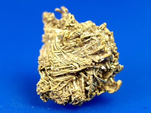
An example of wire gold, similar to that found in French Gulch

lincoln6

When Farncomb began mining operations in French Gulch, and news spread of his discovery of pure wire gold, a mad rush into the gulch followed. Fortune seekers were irate to find that Harry Farncomb already owned all of the land in upper French Gulch and violence ensued.  Gunfights were common between Farncomb and would-be prospectors who felt he had unfairly grabbed the land. Cases were taken to Court, but Farncomb had legally purchased the land, and the prospectors had nothing legal to stand on in their complaints.

lincoln3

lincoln4

Tensions eventually reached a crescendo one day, and a shootout between the warring parties took place in Frenchg Gulch that lasted seven hours! Three prospectors were killed and numerous others were seriously wounded by Farncomb and his allies that day. After the battle, Farncomb agreed to sell parcels of his land in French Gulch, and he was paid handsomely for the rich claims. Today, Farncomb Hill at the head of the gulch bears his name.

lincoln5


The town that sprang up around the claims Farncomb had sold was called “Lincoln City” in honor of President Abraham Lincoln, and as a slight to the nearby town of Breckinridge, which was named after former Vice President John C. Breckinridge, who had recently joined the ranks of the Confederate Army as General, and who would go on to become the Confederate Secretary of War under President Jefferson Davis. The town fathers of  “BreckInridge”Colorado quietly changed the spelling of its name to “BreckEnridge” in 1867 to hide this inconvient truth. (Breckenridge is now a fashionable ski resort and summer recreation spot, and few knows of the town’s controversial name change.)  

John Breckenridge

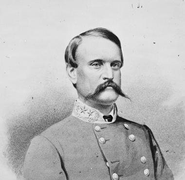
General John C. Breckinridge, Former Vice President of the United States, Confederate Secretary of War, whom “Breckenridge” Colorado was named after, the town fathers altered the spelling in 1867 to hide this fact

lincoln9

Passions were strong in the Civil War days as roughly 40% of the population in Colorado at the time was southern-born, and fights oftne broke out in the mining camps based on regional alliances between northern and southern factions. Such was the case between the townsfolk of Lincoln City, and the people living in Georgia Gulch on the other side of the mountain from them. Bands of drunken men would leave one gulch and appear in the other where fist fights, broken noses, and the occassional gunfight would erupt between the opposing groups. The “war” between Lincoln City and Georgia Gulch carried on for years with no serious loss of life, but plenty of spirited jawing and bruises.

geogulchsecesh

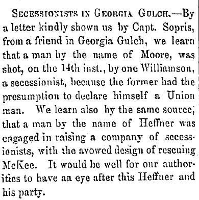
Old newspaper article about the pro-south faction in Georgia Gulch, Colorado near Lincoln City

lincoln2

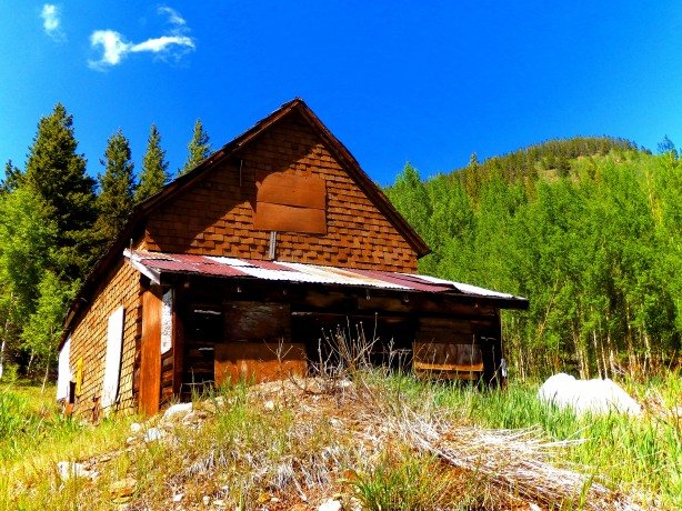
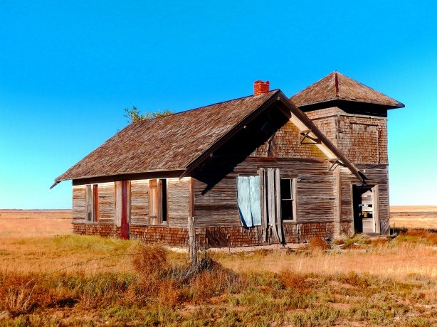
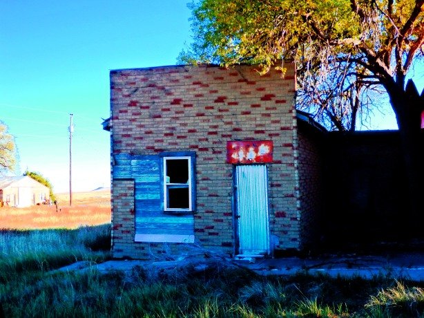
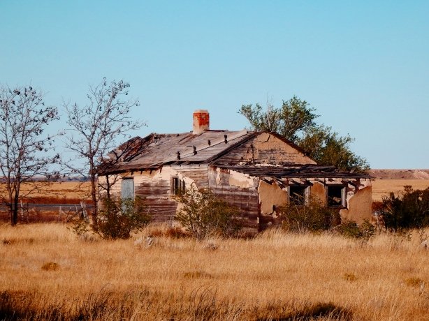
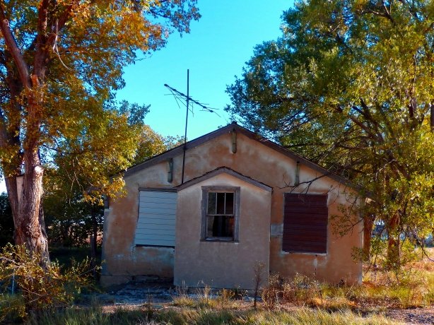
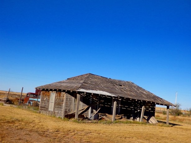
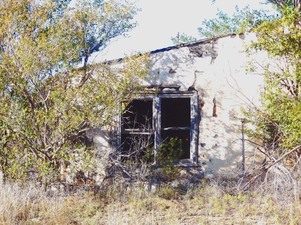
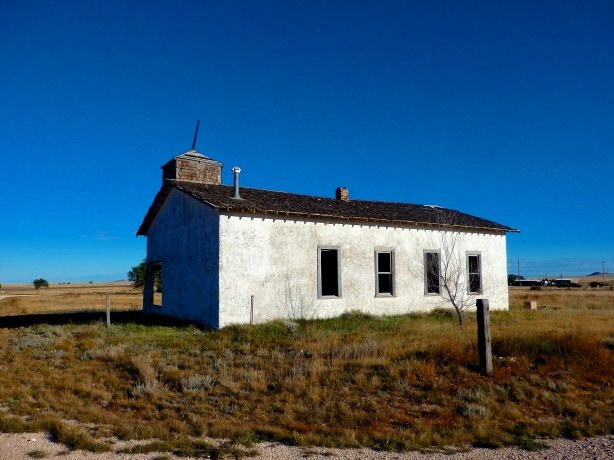
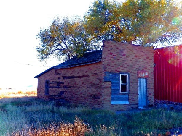
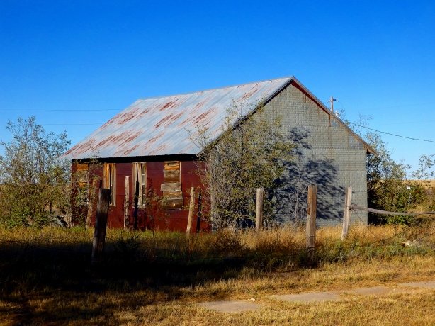
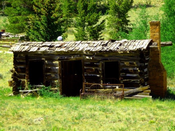
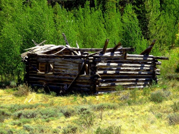
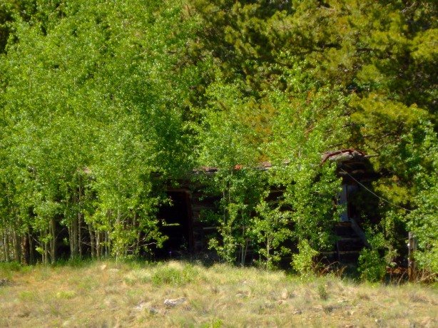
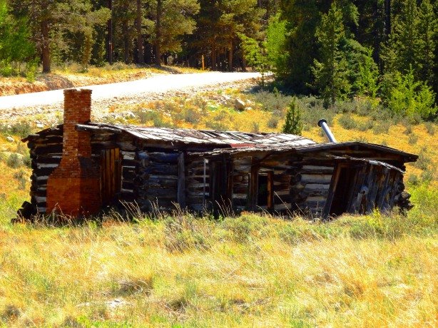
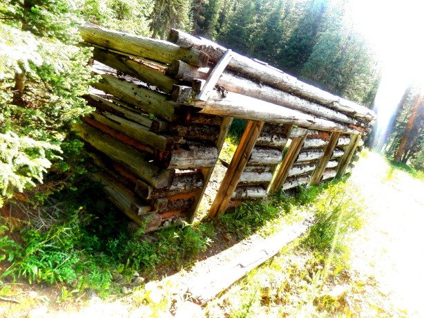
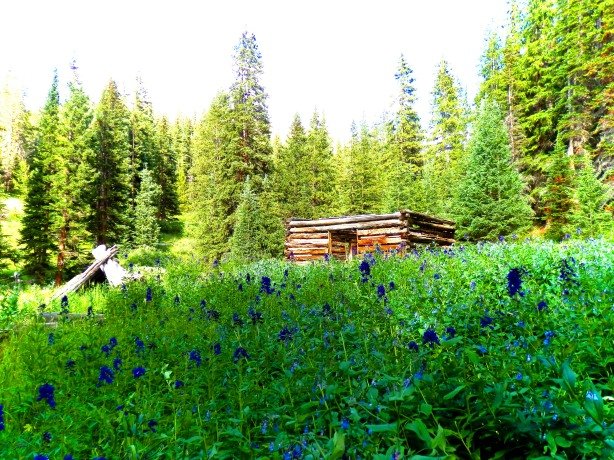
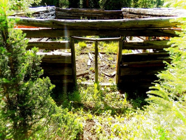
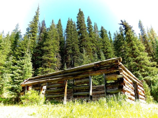
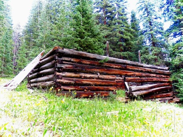
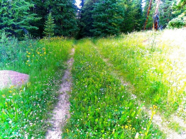
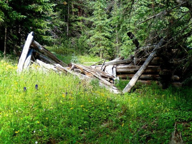
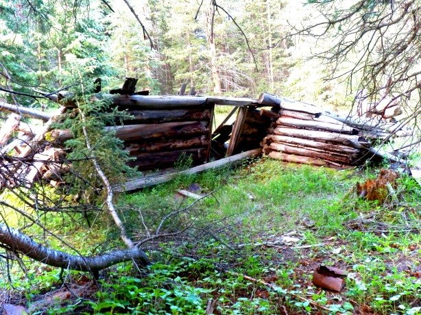
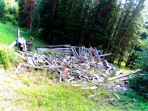
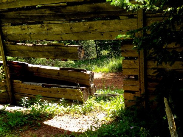
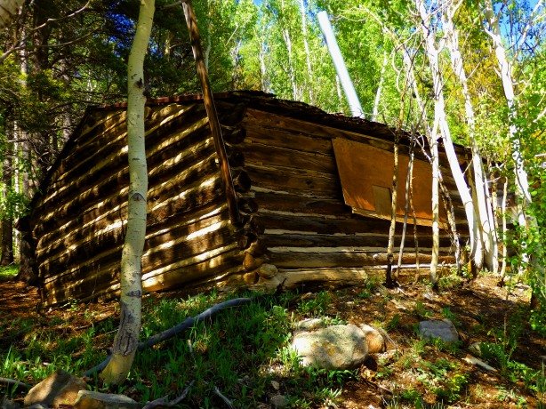
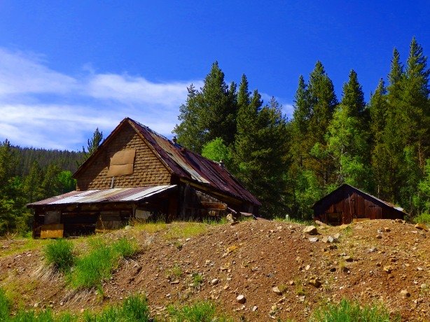
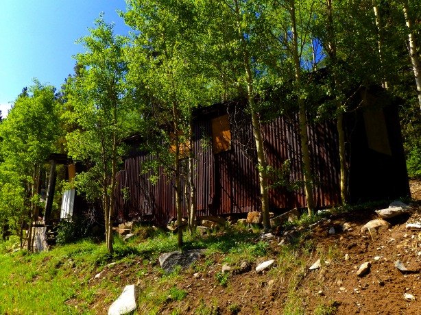
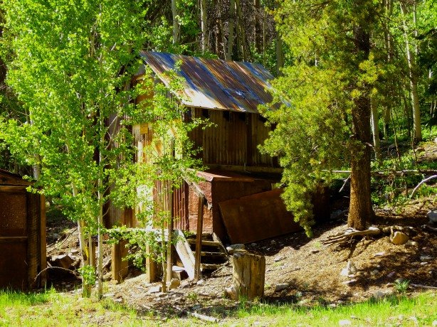
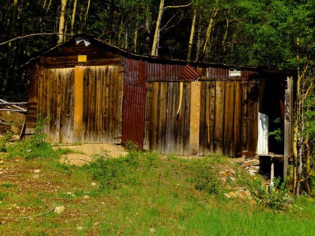
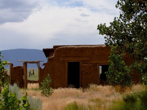
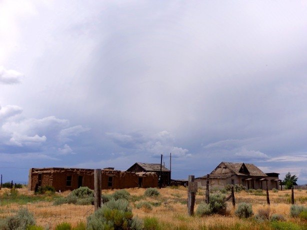
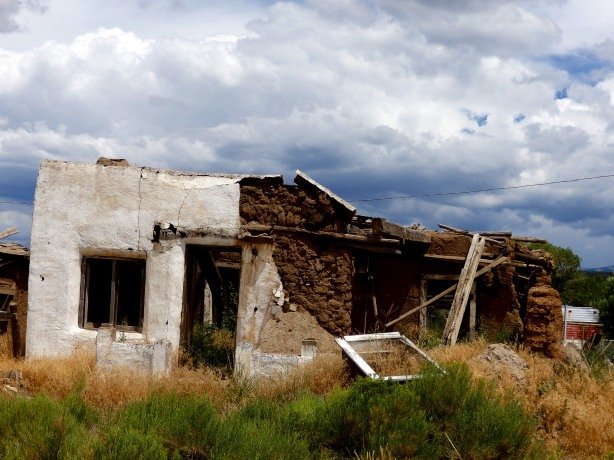
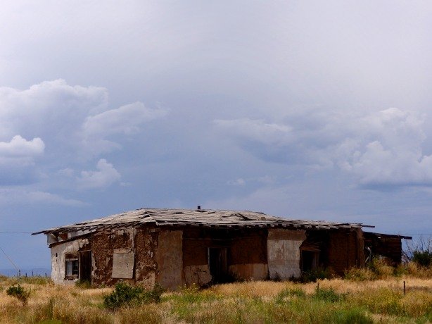
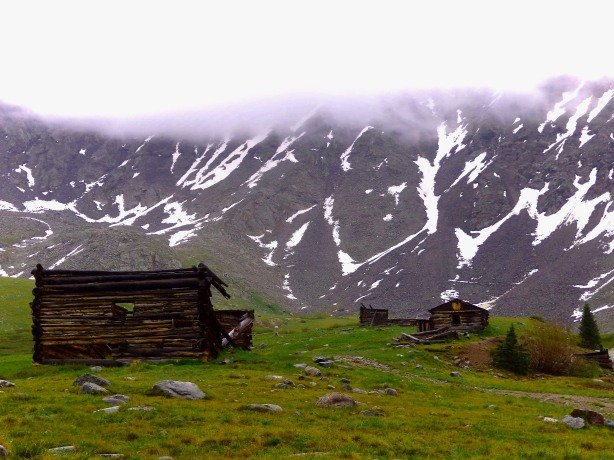
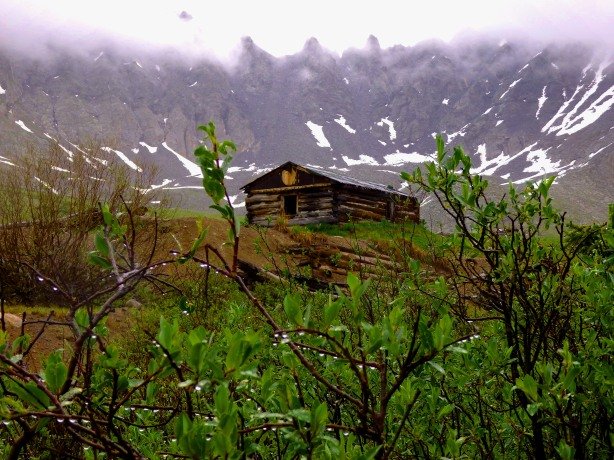
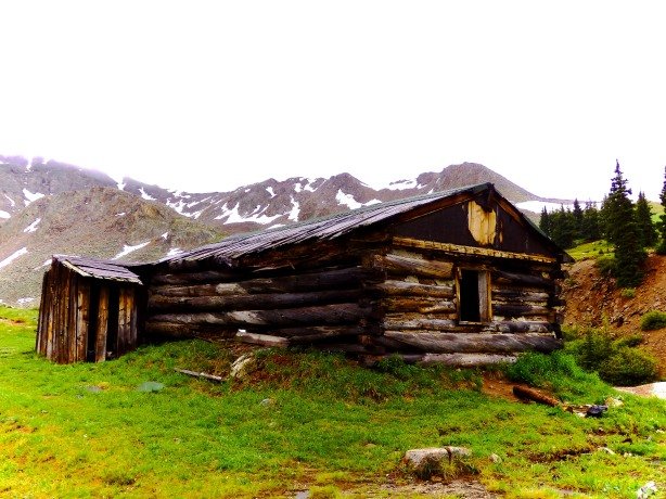
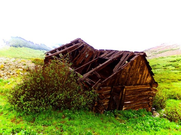
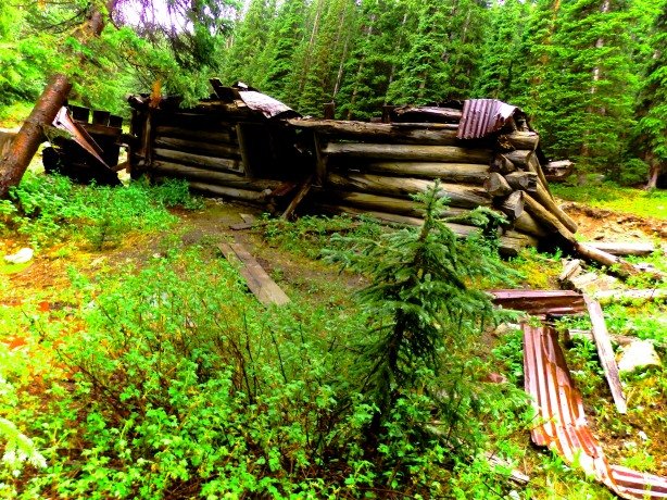
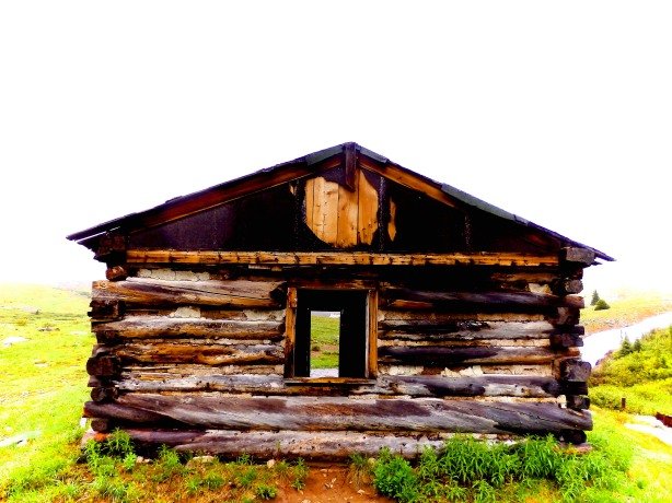
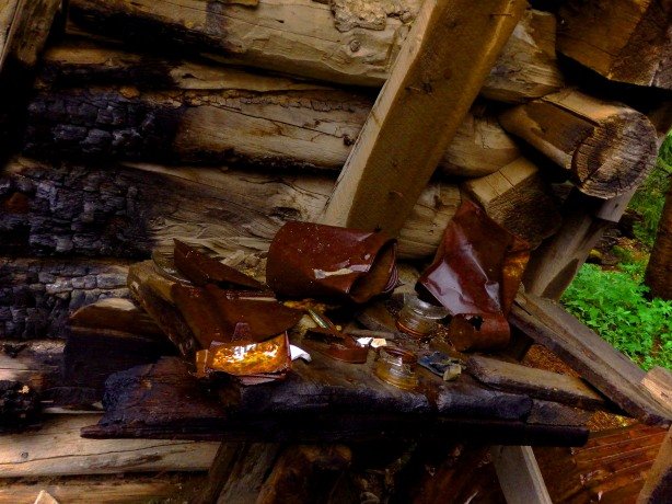
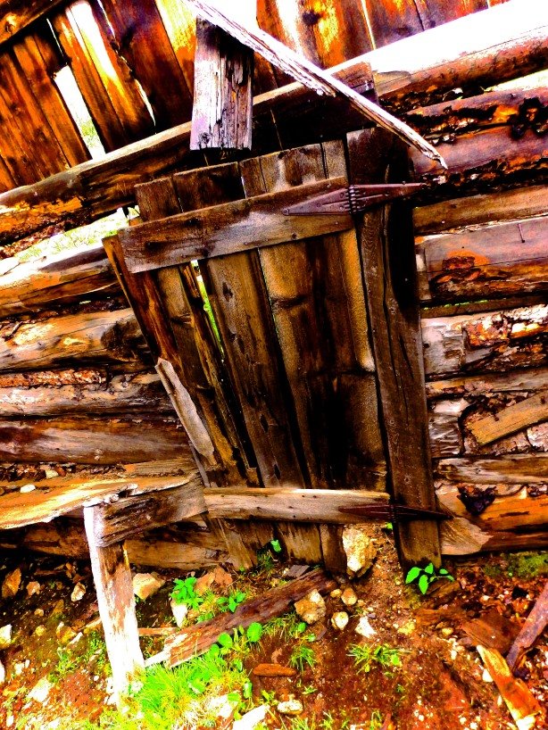
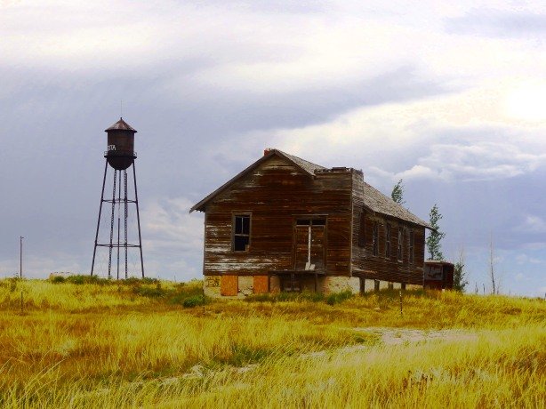
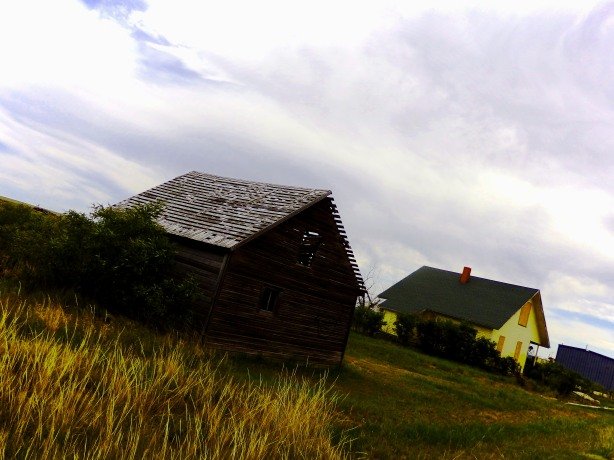
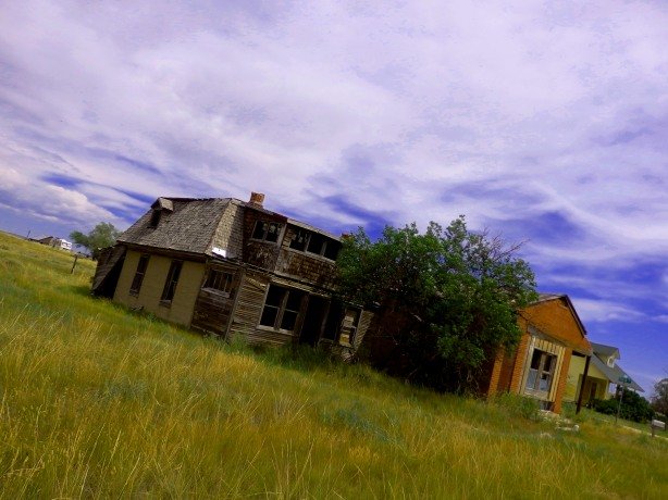
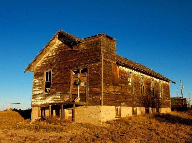
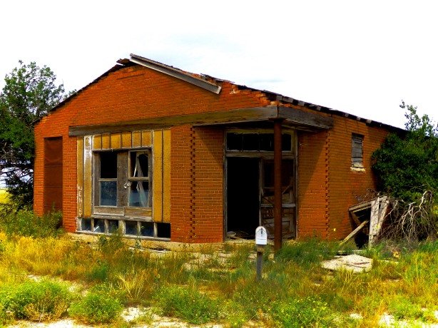
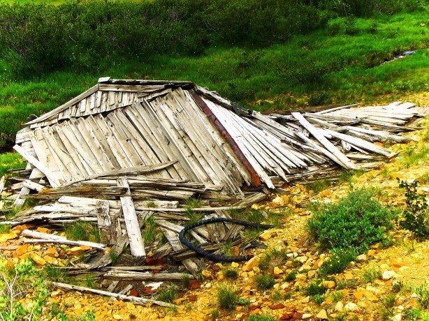
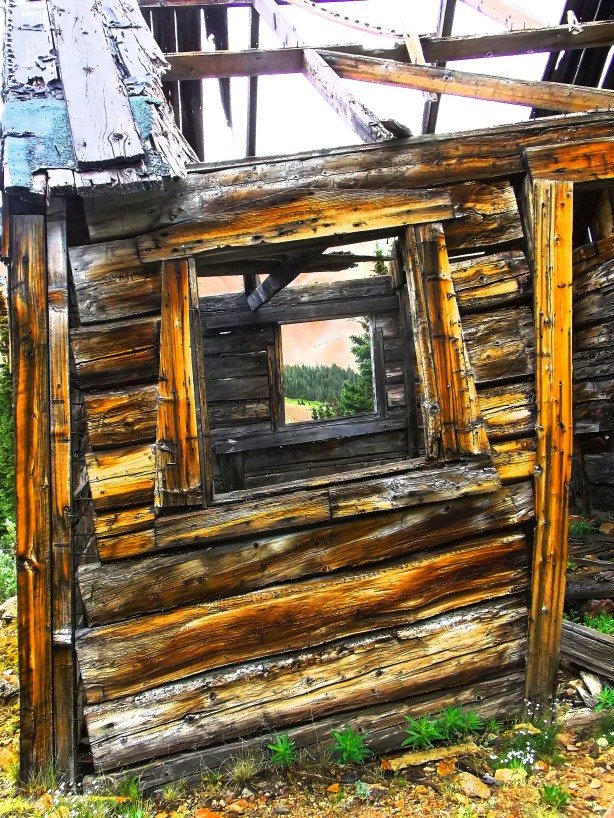
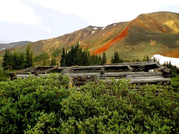
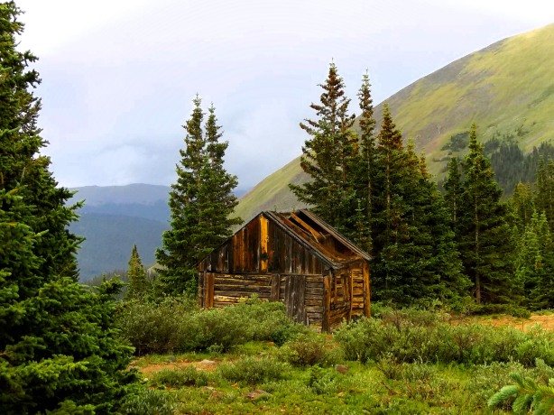
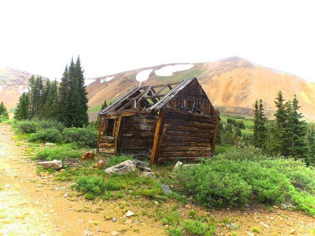
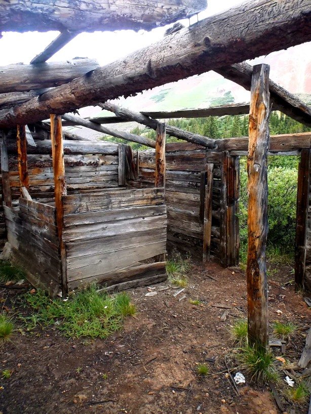
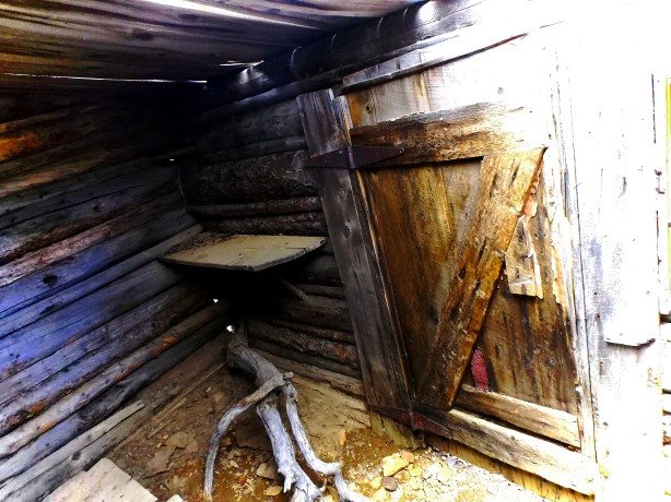
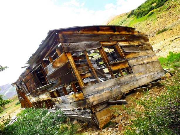
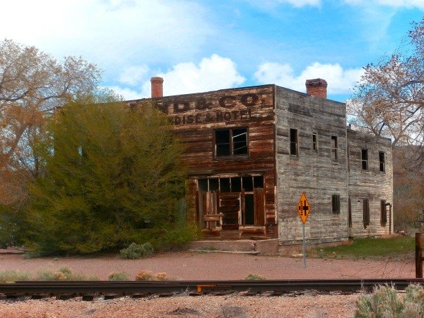
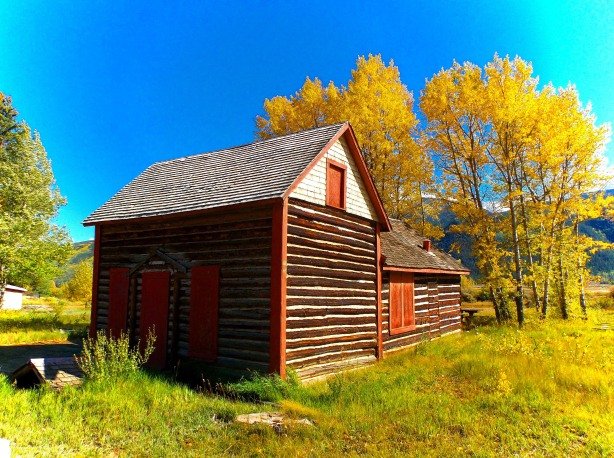
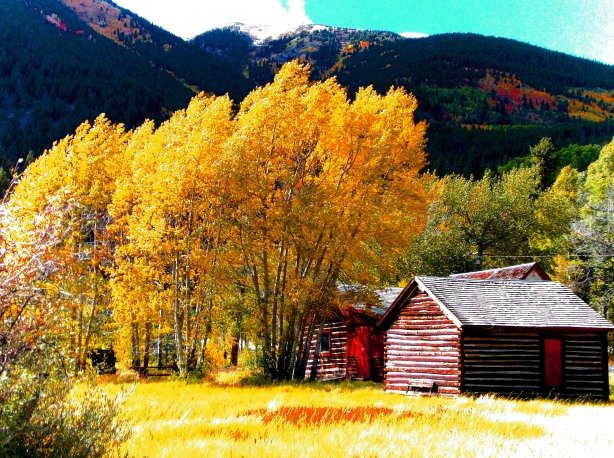
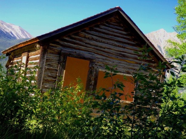
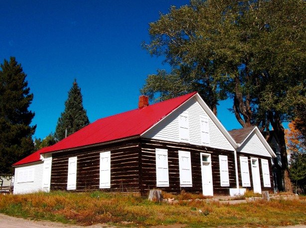
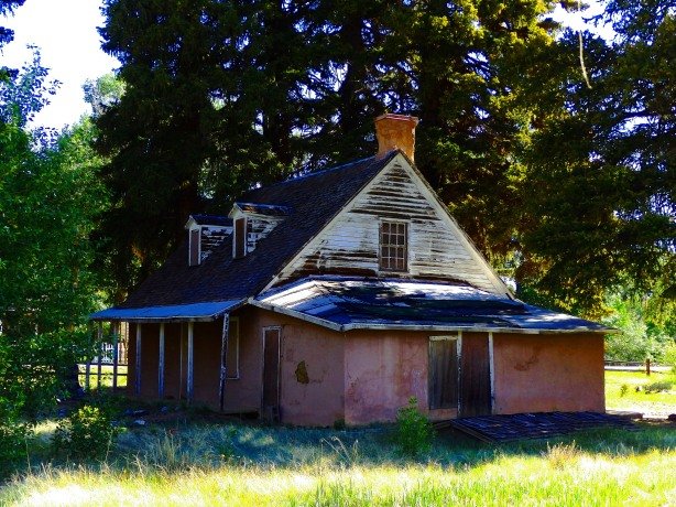
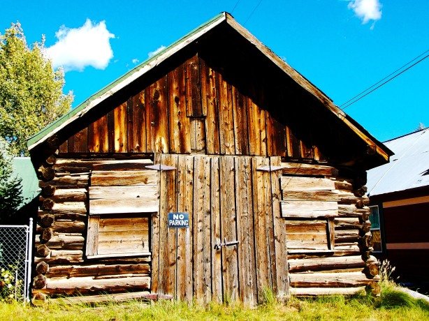
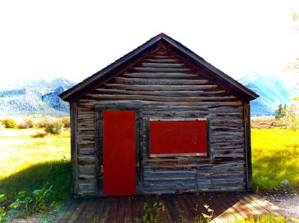
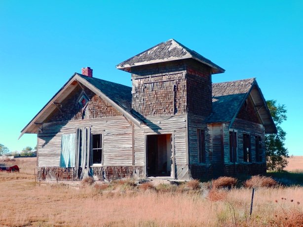
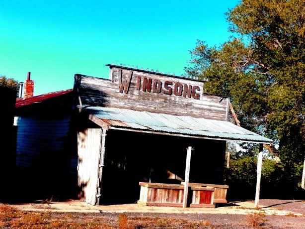
In the 1880s the gold deposits around Lincoln City began to play out, but silver and galena ores were discovered which kept the town alive. Around 250 people called the spot home in the mid-1880s. A smelter was built to process the lower grade ores and the silver now being mined. Dredges were scraping the last of the placer gold from the creek below. Mills crushed hard rock on the hillsides around the town for the last specks of gold to be found. Lincoln City boasted a general store, Post Office, and two hotels. In the decade between 1885 and 1895, Lincoln City all but died, dwindling from 250 residents to only 25.  In the 1940s when ghost towning legend Muriel Sibell Wolle visited, only two old grizzled prospectors remained at Lincoln City.  Today, Lincoln City is no more, it is just a cluster of tin-roofed and tin-sided shacks, some cabins, mining debris, and a lone grave nestled in amog the pine and aspen trees. Modern-day Breceknridge has absorbed the old Lincoln City townsite, and modern luxury homes dot the pines all around the old shacks and cabins. Sadly, some have even called for the removal of the lone grave so they spot can be turned into a parking lot for the mountain bike and hiking trails that begin at the old town site. The future does not look bright for the sparse remnants of one Colorado’s oldest towns.

lincoln11

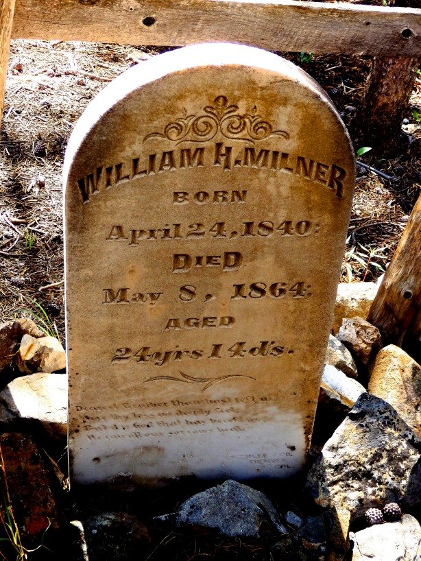
Some have called for the removal of this tombstone dating to 1864 so a parking lot can be built for hiking and biking trails that start near the Lincoln City town site

lincoln7

Thanks for visiting my blog! Guve us a “share” on your social media pages!

Please see my other blogs for more ghost town photos and history!

Colorado Ghost Town Guide- The High Rockies- Click Here!

MyBook3

Colorado Ghost Town Guide- The Foothills – Click Here!

mybook2

Colorado Ghost Town Photo Book- Click Here!

MyBook


Day #22 feautures Holland, Colorado

jun17

Holland, Colorado dates to 1874 when a smelter was built at the site to handle the silver, gold, and iron ores being extracted in the Mosquito Range a short distance to the west. Two theories exist on how the town was named- One claims it was settled by Dutch immigrants from Pennsylvania who named the town “Holland”, but the other, more plausible story is that the smelter was built by two brothers Park and Dwight Holland, and the tiny settlement was named after them.

holland2

Several log cabins were built in a small, circular, meadow around the smelter, and one large, luxurious, two-story home, said to belong to the smelter owners was built in a forested area just south of the main cluster of cabins, near the smelter. A Post Office was opened at Holland in February of 1874, but lasted less than one year, closing in December 1874. The smelter was a failure as well, and was sold at auction to pay off taxes only a year after its construction in 1875.

holland4

Holland remained occupied until around 1890, the inhabitants working in nearby mines, or in the surrounding towns of Alma, Alma Junction, and Park City. In the mid-20th Century Holland, like many Colorado ghost towns, was “rediscovered” and some of the cabins were restored for seasonal use, and newer homes and cabin were built nearby.

holland1

Today around six cabins remain at Holland, some buried deep in the trees require a keen eye to spot. Near the smelter site the brick chimney of the Holland Brothers house remains, obscured by pine trees, but the rest of the house is long gone. An old stage barn  which may date to Holland’s prime can be seen on the northern end of the town site, next to a newer home on private property.  All of the Holland site is privately owned and accordingly posted, but can be viewed from the public road.


Thanks for visiting my blog! If you enjoyed this, please give it a “share” on your social media pages!  Thanks Again for Stopping By!


Check Out My Book- Order Here!

MyBook

COMING SOON!

NoColoGHPcover

Colorado Ghost Town Guide- The Foothills Region

mybook2

Colorado Ghost Town Guide- The High Rockies

MyBook3

Day #21 features Dyersville, Colorado

dy4

In 1880 Father John Dyer, an itinterant Methodist preacher and Colorado legend, along with two other prospectors staked claims on a silver vein near the headwaters of Indiana Creek on the west slope of Boreas Pass near above the town of Breckenridge.  The Warrior’s Mark mine was built on the vein and Father Dyer and his partners built cabins at the site.  Over $10,000 worth of silver ore was hauled out of the Warrior’s Mark in the first six months of operations, and soon the small town of Dyersville sprang up to house the miner’s and their families.

Dyer

Dyersville had a church, where Father John would preach the gospel, a branch of the Breckenridge-based Adamson’s Blue Front clothing store,  a large mess hall, a saloon called the Angel’s Roost, and a school house. Mail was brought to Dyersville via Breckenrdige, but no Post Office was ever established in the town.  The Warrior’s Mark continued to produce until around 1900 when the vein played out, and Dyersville was abandoned.

dy0

dy24

dy9

dy8

dy6

dy25

dy23

For decades Dyersville was lost to time, buried in the dense timber along Indiana Creek, its whereabouts known only to a few old-timers.  Dyersville was “found” again a few decades later, virtually untocuhed since it was abandoned around the turn of the 20th Century.

dy10

dy1

dy2

Today, Dyersville still retains about a dozen log cabins in verious stages of repair, the roofs are gone on all, so it won’t be long until they vanish. In the last five years, vandals have damaged some of the esier to locate cabins at Dyersville. The ruins of the Warrior’s Mark can still be found nearby. Ruts from the old wagon road that once serviced thre town can still be seen cutting through the trees.

dy18

dy12

dy13

You can see where there the mess hall was, broken plates, rusted cans, and bones from meals gone by litter a slope adjacent to the mess hall ruins. Another log building tucked away in the trees has the looks of the saloon based on a slit-trench dug along the back wall of the building running downhill- So saloon patrons could relieve themselves without having to step outside into the elements!

dy16

dy21

dy5

dy14

Thanks for visiting my blog!  Give us a “share” on your social media pages!

Check out My Book- Order Here!

MyBook

COMING SOON!

NoColoGHPcover