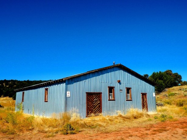
Posts Tagged ‘Southwest’


Atchee, Colorado

Colorado is famous for its Gold Rush era and Silver Boom ghost towns. South of the Arkansas River ghost towns from Colorado’s “coal belt” are plenty. The eastern and northern plains house the remnants of the farming and ranching centers of yesterday. But the far western slope along the Utah border is almost devoid of ghost towns.

atch7

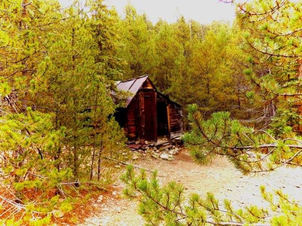
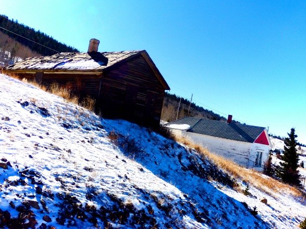
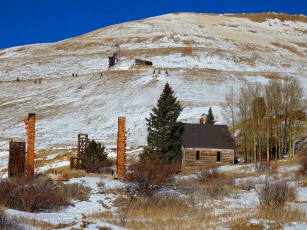
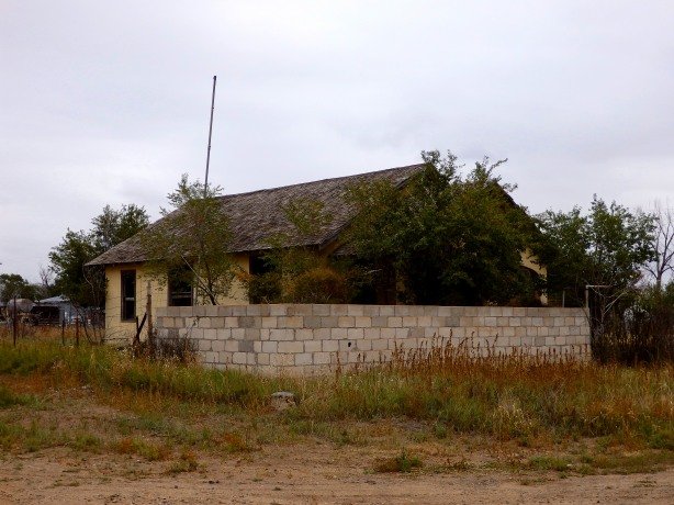
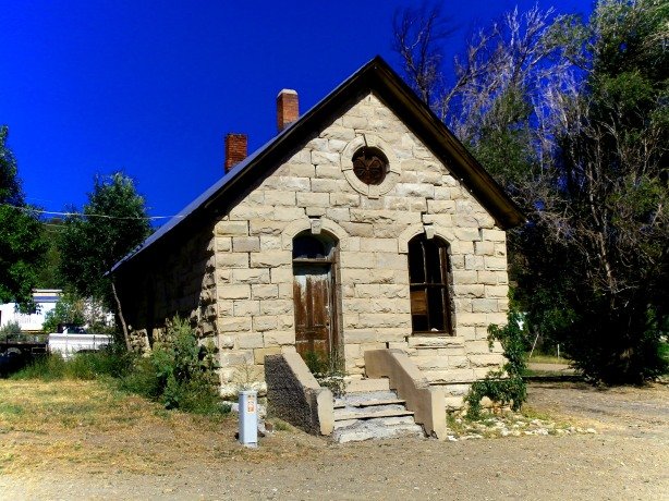
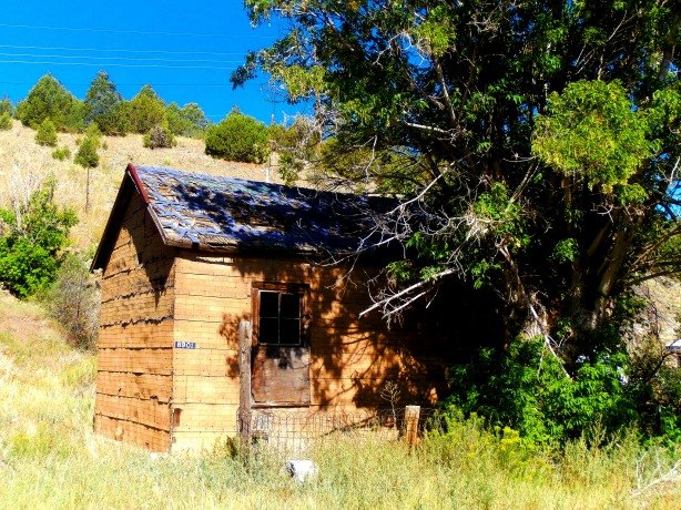
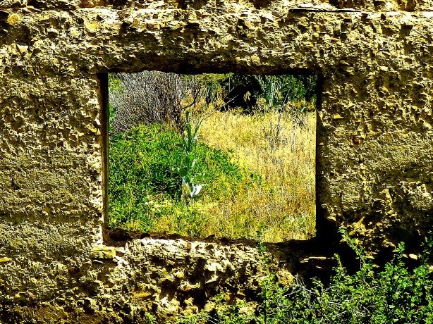
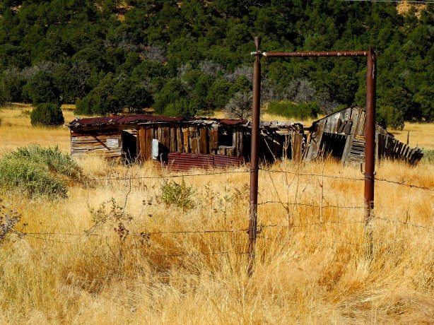
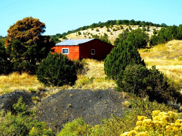
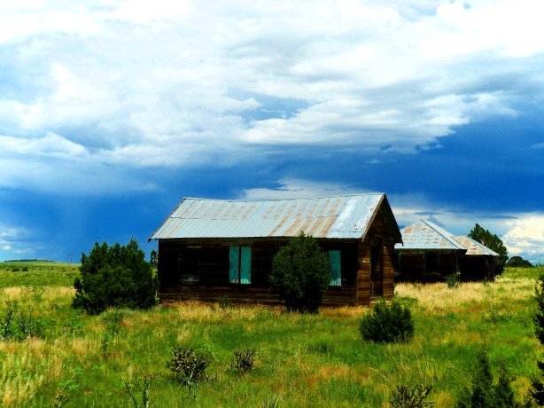
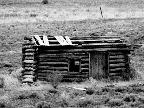
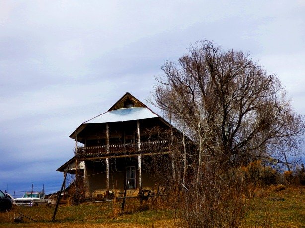
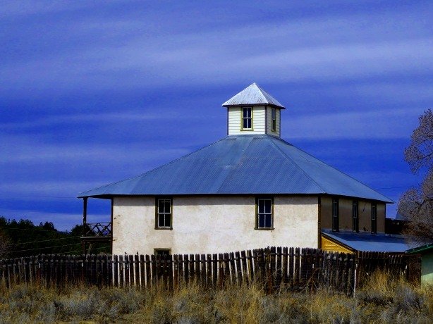
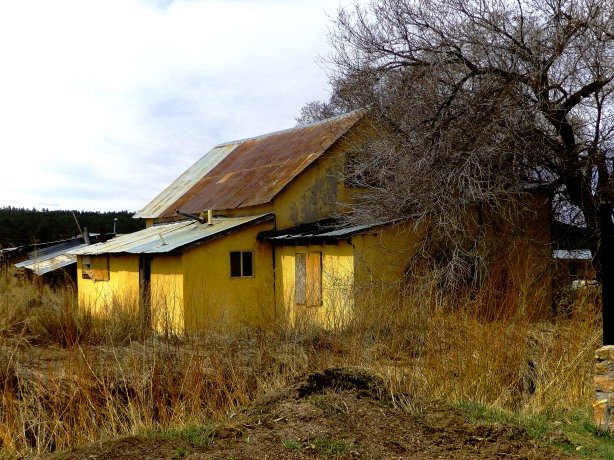
Cabin along the old Uintah Railroad grade near Atchee

Atch5

Another view of the same cabin. The unique tight fit “puzzle” style construction of the cabin is something I have found unique to this isolated corner of Colorado/Utah. Perhaps it was the signature style of a local craftsman, or maybe the hand-select, tight fit, was a regional neccessity to keep the abundant lizards, scorpions, and snakes out- Scorpions, Sun Spiders, Rattlesnakes and Western Coachwhips outnumber humans 100-to-1  in this part of the world!

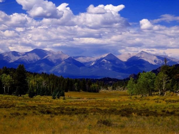
There isn’t much, and wasn’t much in the far western portion of the state, but chalky, sandy cliffs, scrub brush, and cacti, prior to the oil boom. Towns in this part of Colorado can almost all trace their origins to the railroads that once criss-crossed the region and followed the route of the mighty Colorado River as it meandered its way west to its terminus at Mexicali in Baja Mexico.

Atch1

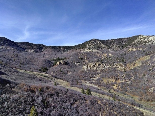
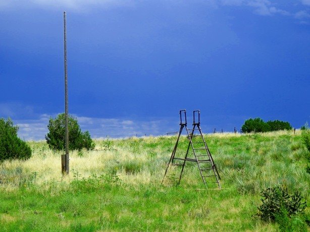
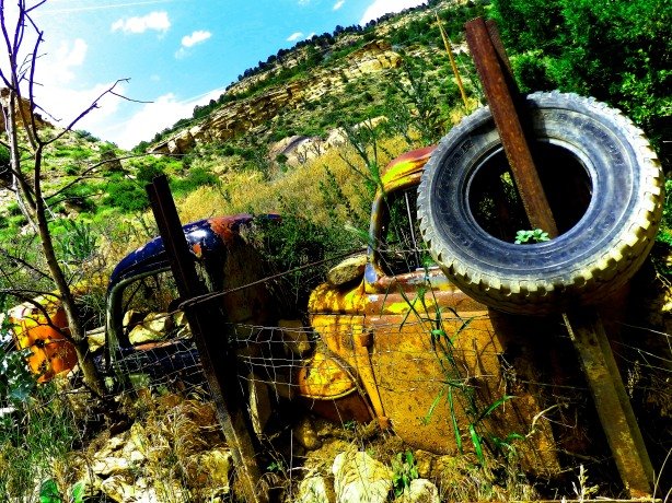
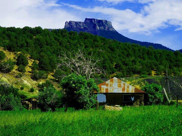
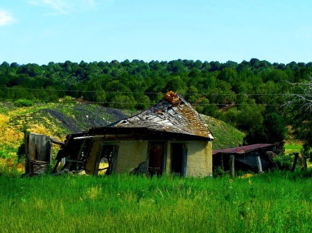
A sense of the desolation and solitude of the area- The County Road today over Baxter Pass into Utah is the old Uintah Railway grade. In the Spring deep, soupy, mud can make it impassable.

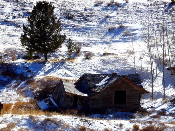
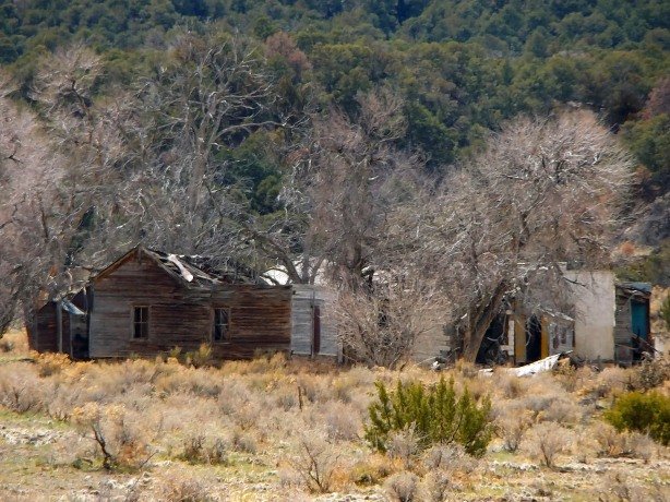
Atchee, north and slightly west of Fruita near Grand Junction, Colorado, is now a 100% ghost town, with only one standing structure and the foundations of others, was founded in the 1880s. Atchee occupies a unique spot in Colorado history as one of the few far-western ghost towns in the state.

Atch2

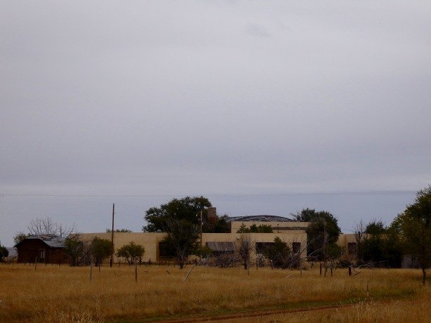
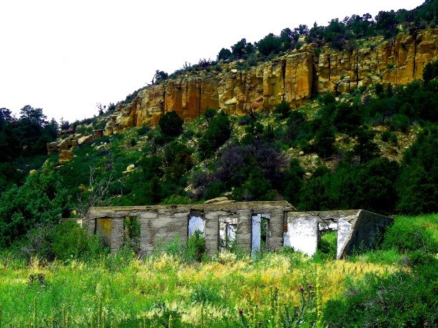
A glimpse of Atchee from the railroad grade above as it ascends Baxter Pass

Atchee came to life in the 1880s as a railroad station along the tiny, narrow-gauge, Uintah Railway which served the Gilsonite (huh? what???) mining camp of Dragon, Utah which lay on the western side of Baxter Pass. The entire length of the Uintah Railway was only 62.8 miles in total length, running from Mack,Colorado to Watson, Utah, which was nothing more than a named place with a water tank, coal shed, and wye where the train turned around.

at1

Atchee, Colorado 1880s

At3

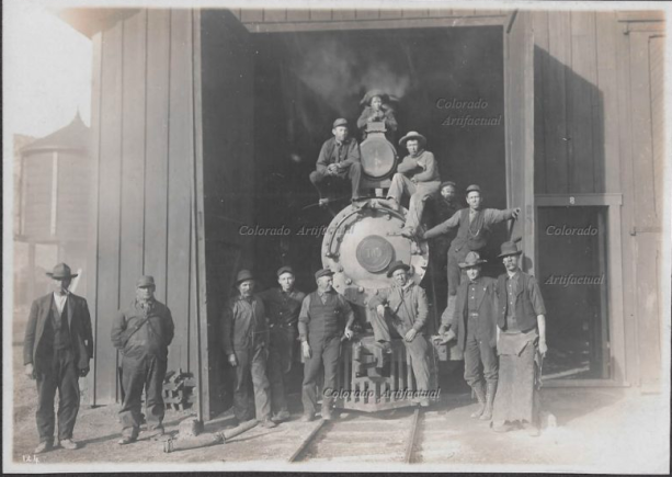
A Uintah Railway engine at Atchee around 1900

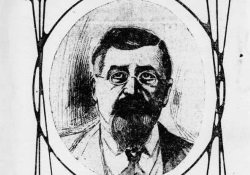
Atchee lay at just under the halfway point of the Uintah line- 28 miles to be exact. Atchee featured a wye, coal shed, water tank, machine/repair shop, and a couple rows of simple houses for railroad employees and their families. Atchee was situated in a arid, but beautiful basin,dotted with sage brush, scrub, and short pines on the slopes surrounding the town. Water was scarce and both summer and winters at Atchee were harsh. Atchee was named in honor of Ute Chief Atchee- A man of which little is known, but must have made a positive impression on his contemporaries.

atchee

Chief Atchee, of whom the town was named

Gilsonite, the mineral mined at Dragon and Rainbow in Utah, where the Uintah Railway passed, was first discovered in the 1860s by Sam Gilson, a prospector.  Gilson discovered rich veins of black, shiny, oily substance in the sandy hills of the Uintah Basin. The substance looked like coal, was flammable, but was hard to keep burning. His discovery was also flexible and sticky. Gilson knew it had to be worth something to someone, but a use for the substance did not exist…yet.
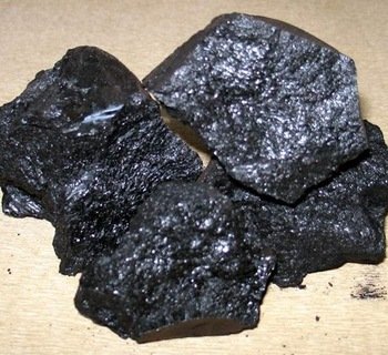
gilsonite

Gilsonite


Gilson tried to refine his strange mineral into a fuel source like coal, but it never could maintain an even slow burn. He discovered it could be used in varnishes and paints with moderate success- But the only color would be jet black, and it never really dried properly, always remaining tacky to the touch, and more troubling, flammable.

10-Samuel-H-Gilson-Small

Sam Gilson


Around the turn of the 20th Century Gilson, and his mineral, now called “Gilsonite” found their place in the world- Mixing Gilsonite with gravel created a smooth, durable, long-lasting surface for the city-dwellers and their velocipedes and new-fangled horseless carriages to ride on. Gilsonite, a naturally occurring, semi-solid, soluble, hydrocarbon-  The strange, sticky, black muck of the Uintah Basin would become a key ingredient in what we know as “asphalt” or “bitumen” today.

at2

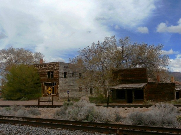
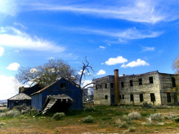
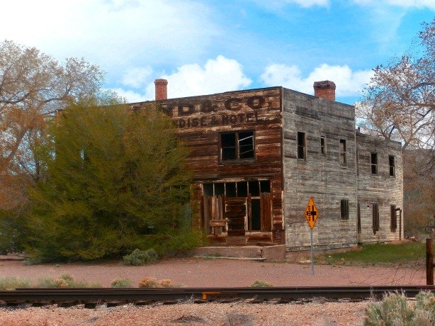
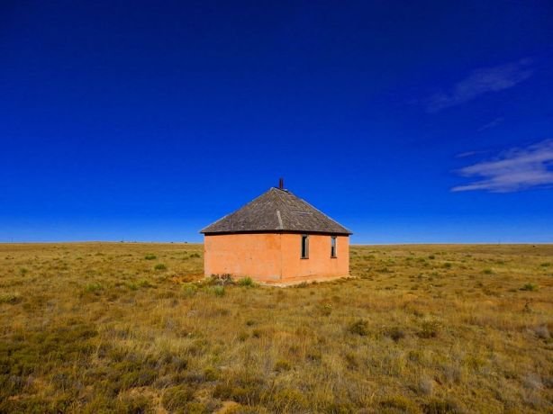
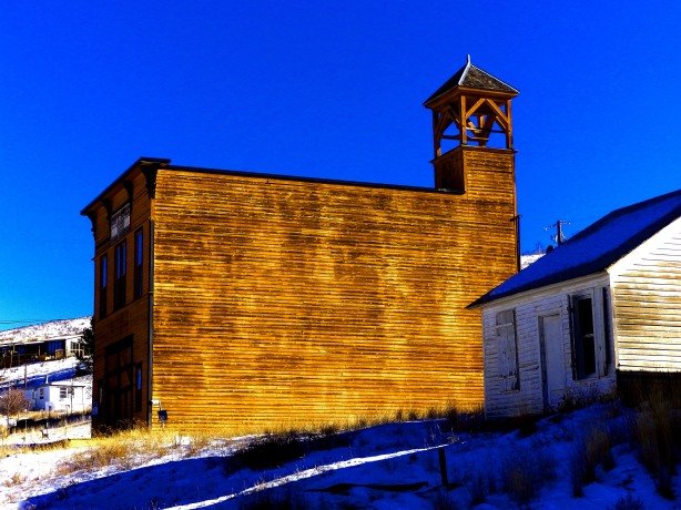
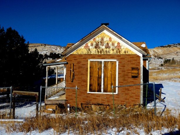
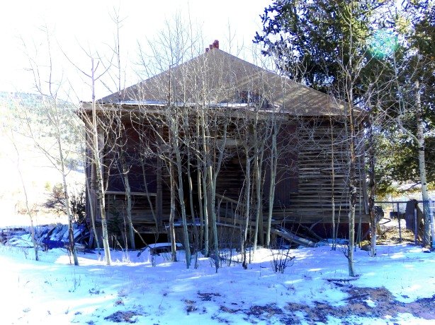
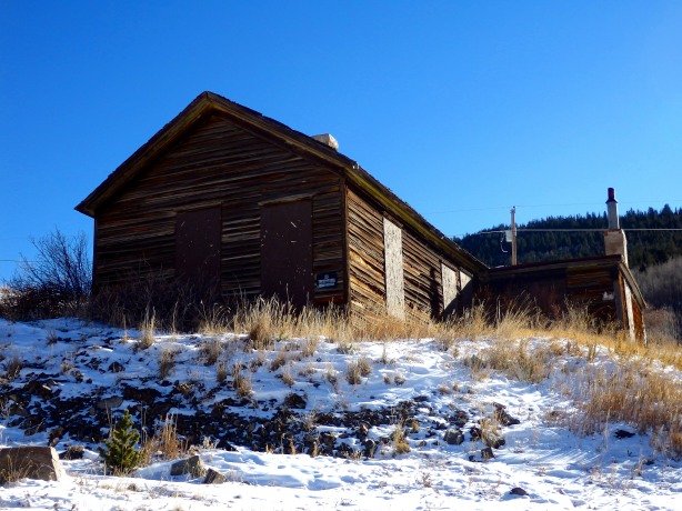
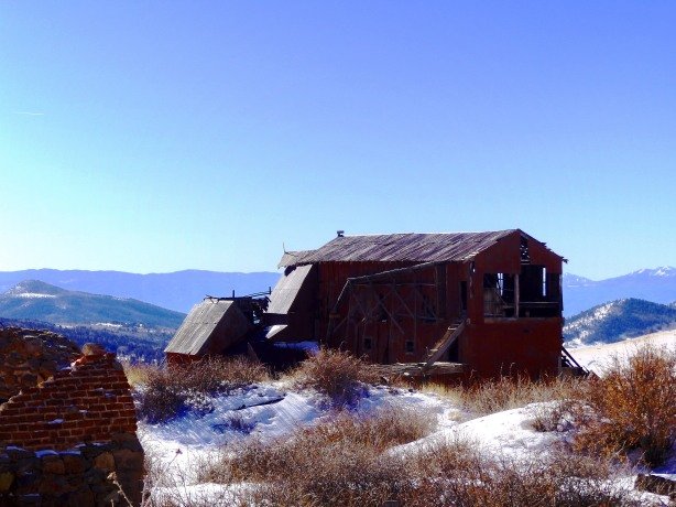
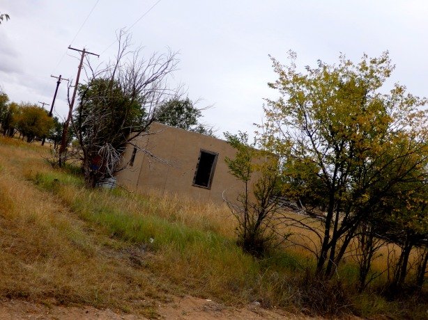
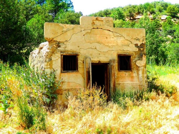
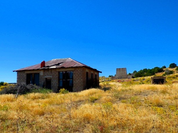
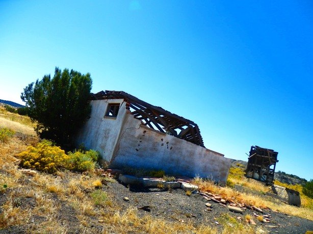
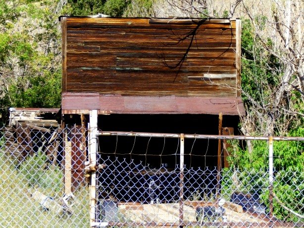
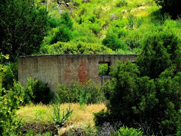
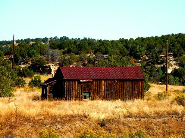
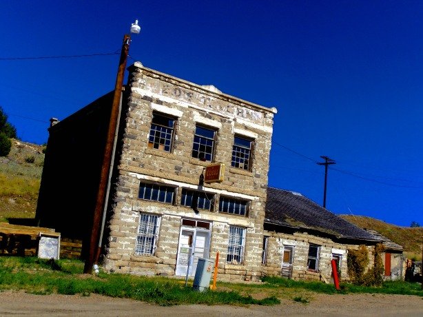
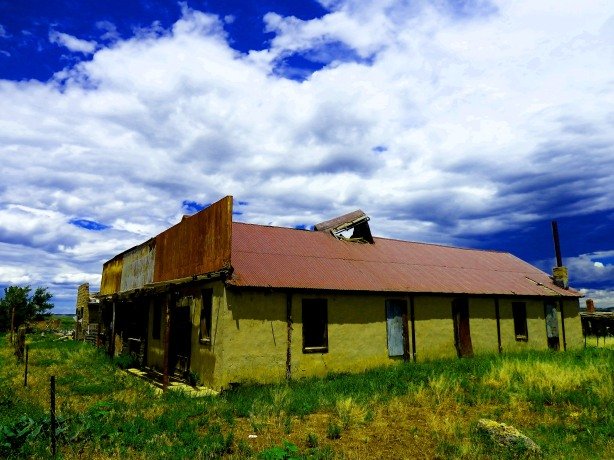
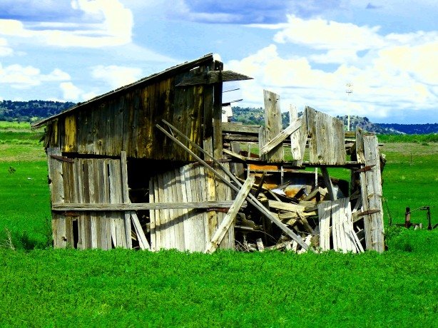
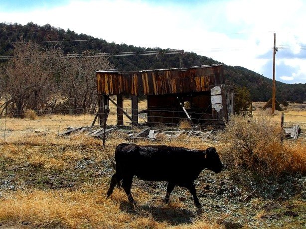
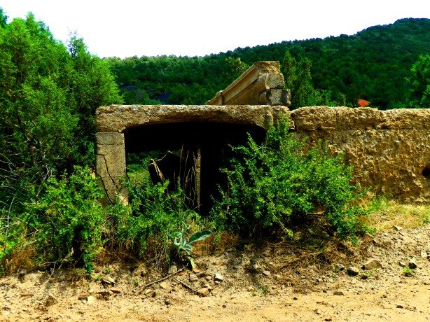
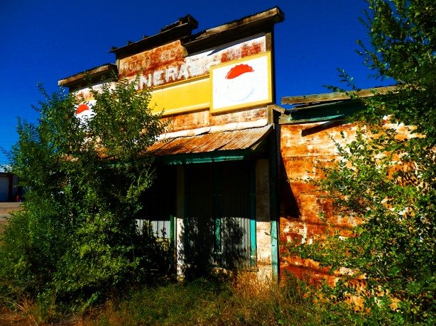
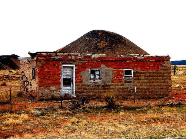
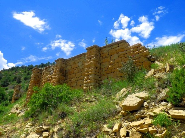
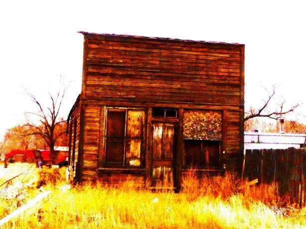
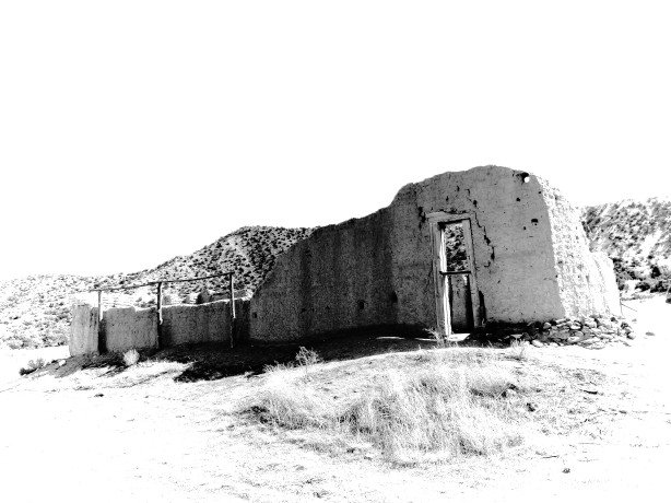
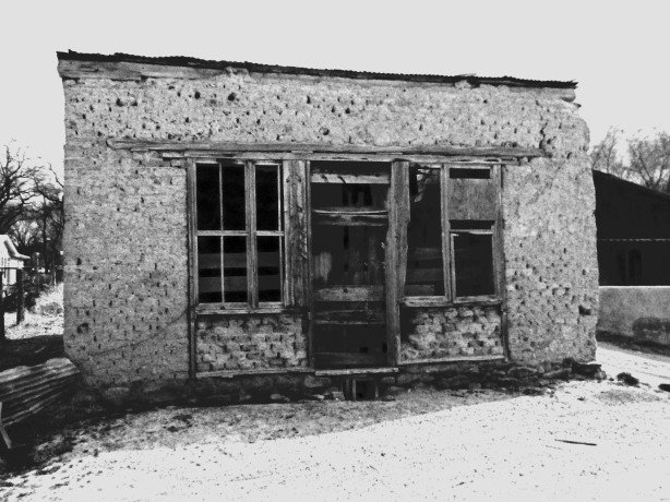
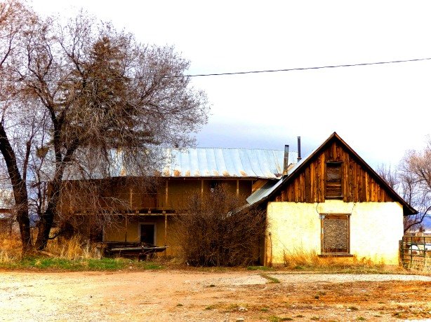
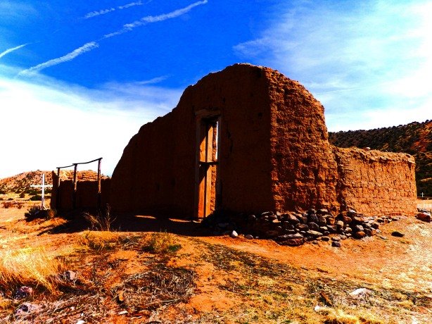
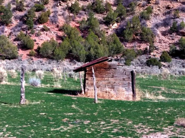
Atchee at its peak around 1900. The “peaked” building at the far righ of the photo is all that remains today- The machine shop/repair shop for the Uintah Railway train engines.

Atch3

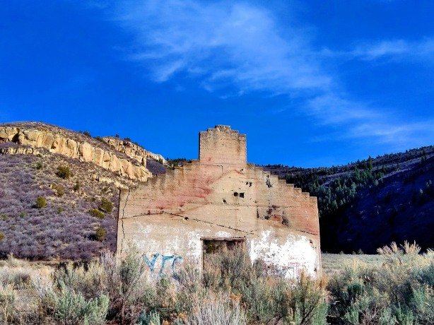
The machine shop today.

Atchee is all but gone now- One structure, or more appropriately, the walls of one structure remain- The old machine and repair shop for the steam engines that once passed through the town.  Numerous foundations can be seen in the scrub surrounding the machine shop. All the remnants are on clearly posted private property, but this has not stopped idiots from spray painting their names on the last remnants of the town. The rest of us who respect our Nation’s history can safely and legally take photos from just a few feet away alonmg the county road which passes through the site. The county road is the old railroad grade which crosses Baxter Pass into Utah.  When my brother and I visited winter snows were still melting and had turned the track into a swampy morass that became impassable shortly before we reached the summit of Baxter.


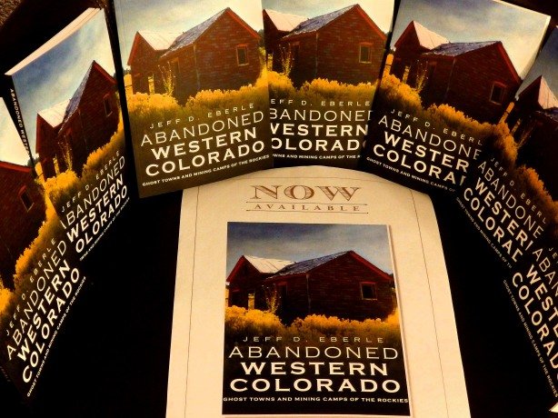
Check Out My Photo Book- Abandoned Western Colorado-Order Here!

MyBook

Coming August 24th!- Pre-Order Now- Abandoned Northern Colorado

NoColoGHPcover

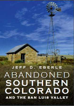
Coming September 28th!- Pre-Order Now!- Southern Colorad and the San Luis Valley

slvCOVER

Colorado Ghost Town Guide- The Foothills “Gold Belt” Region- Order Here!

mybook2

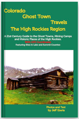
Colorado Ghost Town Guide- The High Rockies- Order Here!

MyBook3

Thanks For Visiting My Ghost Town Blog!  Give Us A “Share” On Your Social Media!

Day # 26 features Modena, Utah

Modena9

Modena was a railroad town born in December of 1899 when tracks from the Utah and Nevada Railroad reached the area. Located west of the iron mines at Iron City, Utah, Modena  grew into an important shipping and supply center, as well as a water stop for the steam engines of the railroad.


Modena3

It is said the town was named after the Chinese cook on the railroad crew who laid the tracks to the site- He would call from his stoves “Mo dinna! Mo dinna!” (More dinner! More dinner!) each evening. Another tale claims the town was named after Modena, Italy. There was also famous mountain man in the Rockies at one time named Manuel Modena. Exactly how Modena was named seems to be lost to time.

Modena6


Modena2

Brigham Lund established a freighting business serving the region, based in Modena, and successful mercantile/hotel in the town.  In 1903 a U.S. government Weather Station was established in the town. By 1905 the Los Angeles and Salt Lake City Railroad routed its line through Modena and brought more commerce to the town.

Modena4

Water tank and pump house for the Utah and Nevada Railroad at Modena


Modena1

Today Modena is largely abandoned or vacant, a few residents remain in the residential section of town, but the old business district is vacant.  The train still passes through Modena, but no longer stops. Brigham Lund’s Merchandise & Hotel building dominates the town site. A false-fronted shop next door to Lund’s Hotel along the dirt main street looks could be a still shot from any “Wild West” movie of the 1950s. Modena sits just a few feet off the railroad tracks, and it must have been quite an experience to be a guest in the hotel when the steam engine came rolling into town, blaring its whistle more than a Century ago.

Modena7

Lund’s Merchandise and Hotel


Modena8


Modena10


Check Out My Book- Order Here!

MyBook

Haswell, Colorado was founded in the early 1900s, some accounts say 1905, others say 1908. Haswell sprang up along the line of Missouri Pacific railroad and once had a population of around 200 in its peak days.

Haswell9

Buildings along the main street in Haswell.

Haswell5

A vacant home along Highway 96 in the center of Haswell

Today Haswell, like most of the other small towns in Kiowa County struggles to hang on. Today only around 60 residents remain in and around Haswell. The highlights of Haswell are the old Texaco gas station which you can’t miss along Highway 96, and the tiny jail, which the residents boast is the smallest in the United States. Unfortunately when I visited town, the view of the jail was obscured by vehicles so I couldn’t get a photo.

Haswell1

The Old Texaco gas station- A new tin roof will ensure it is around for a few more years.

Haswell6

One of the many empty houses in the residential section of Haswell

Haswell is a combination of abandoned or empty storefronts, grain elevators, service stations and residential dwellings. When I passed through around half of the buildings in town were vacant.  Someone was barbequing and the smell drifted through the tiny town. At a small part on the western edge of the community two boys played baseball and stopped to wave as I passed by.

Haswell2

This old building with its aerial tower out back had the looks of an old radio station.

haswell10

A row of forlorn shops on the west end of Haswell.

Haswell7

Another vacant house in town

Thanks for visiting!

If you enjoyed this photo blog please share on your social media pages and be sure to visit my other photo blogs!

Buy a copy of my book at the link below, only $23.99!

Abandoned Western Colorado- Ghost Towns and Mining Camps of the Rockies


MyBook

My 20 best photos of 2018- A little bit of everything, and in no particular order-

b1621

Abandoned Church, Las Mesitas, Colorado

b16

Twooch aka “Busy Feets”  my polydactyl or “Hemingway” Siamese, she has 25 toes!

b161

Century House, Golden Gate Canyon, Colorado

b162

Somewhere in Colorado

b163

Columbines, near Red Feather Lakes, Colorado

OLYMPUS DIGITAL CAMERA

Masonic Lodge, Victor, Colorado

b165

Hawk, Derry Ranch Placer, Colorado

b166

View of the Collegiate Peaks near Turret, Colorado

b167

Grouse, somewhere in Colorado

b168

Mr. Campbell’s cabin, Campbell Town, Colorado

b169

Wild Turkey, somewhere in Colorado

b1612

Hot Rod Hill Climb, Central City, Colorado

b1613

Miner’s Shack, Freeland, Colorado

b1614

Near Rabbit Ears Mountain, New Mexico

b1615

Mills, New Mexico

b1616

La Liendre, New Mexico

b1617

Sandhill Crane, Pecos River, New Mexico

b1618

Along the Pecos River, New Mexico

b1619

Holman, New Mexico

b1620

Moon over the Sangre de Cristos, near Taos, New Mexico

At first glance it is hard to believe Goldfield, Colorado once boasted a population of over 3,500 residents when the nearby Portland Mine provided ample employment opportunities around 1900.

port

The Portland Mine at Goldfield in its prime around 1900

The ebb and flow of mining is a brutal life of boom and bust, in Goldfield, as in nearly every mining town and camp in the West, the ore played out that coupled with the Federal Government abandoning the gold standard, the town withered and faded away. Today, Goldfield still struggles to hang on, a handful of residents, some retired, some weekenders, some descendants of earlier miners, and a smattering of coyotes, deer, and foxes still occupy a number of homes in this boom and bust town.


Newmont Gold is reworking the tailings piles from yesteryear nearby, as well as carrying out new large-scale mining operations which has also brought a few folks back to town, but for the most part, Goldfield is fragile, wind-blown remnant of a forgotten era. The splintered wood and cracked cornices, peeled paint, and shifting foundations stand today as silent witnesses of grander times in Goldfield. The highlight of the town in the City Hall and fire station, built in 1899, which stands guard over the town, its weathered and flaking yellow paint an ode the gold that once brought life to this great Colorado ghost town.

OLYMPUS DIGITAL CAMERA

Preserved in a state of “arrested decay” in recent City Hall, built in 1899, looms over Goldfield

OLYMPUS DIGITAL CAMERA

Another view of the combination City Hall and Fire Station

OLYMPUS DIGITAL CAMERA

Goldfield’s residential streets are a combo of abandoned and occupied dwellings

OLYMPUS DIGITAL CAMERA

A 100-year-old miner’s shack with the Newmont property in the distance, providing work for modern-day miners who rework the tailings piles of yesterday’s mines for microscopic gold which could not be harvested with the primitive  techniques of the 19th Century. Newmont employs hundreds at decent wages, reworking the “waste rock” of 100 years ago.

OLYMPUS DIGITAL CAMERA

A little elbow grease and we’d have a winner!

OLYMPUS DIGITAL CAMERA

A seasonal home in Goldfield, boarded up for the winter

OLYMPUS DIGITAL CAMERA

This beautiful old Ford and the house behind still have lots of promise!

OLYMPUS DIGITAL CAMERA

Many years since a fire warmed the hearth of this Goldfield house

2019 Ghosts of Colorado Calendar by Jeff Eberle $14.99 CLICK HERE!

cal19

OLYMPUS DIGITAL CAMERA

If walls could talk

OLYMPUS DIGITAL CAMERA

On the south end of Goldfield is the short-lived suburb of “Hollywood” which was swallowed by Goldfield’s expansion. Hollywood was actually a suburb of nearby Victor, about a mile away in the boom days. Hollywood was soon swallowed by Goldfield when the Portland Mine boomed.

OLYMPUS DIGITAL CAMERA

One of Hollywood’s nicer homes

OLYMPUS DIGITAL CAMERA

On the north end of Goldfield sits this impressive two-story, occupied until recent years as evinced by the satellite dish. This home is where the “suburbs” or “satellite camp” of Goldfield known both as “Indpendence” and “Hull City” was located. Just south lies the Vindicator Mine.

Ghost Town Guide Books and Photography by Jeff Eberle- CLICK HERE!


OLYMPUS DIGITAL CAMERA

The Vindicator, a truly impressive structure, photos do it no justice. It is an enormous building.

OLYMPUS DIGITAL CAMERA

A “fancy” house at the old Indpendence/Hull City site

OLYMPUS DIGITAL CAMERA

Close-up of the fancy house

OLYMPUS DIGITAL CAMERA

Home of the mine boss and his family, occupied until the early-1950s

OLYMPUS DIGITAL CAMERA

Another “satellite” camp of Goldfield was Bull Hill where the hardscrabble miners lived in retired railroad cars on the windswept side of the hill.

I came across Farley, NM by accident. I was enjoying my last night at the historic Eklund Hotel in Clayton, NM and looking for abandoned places on my map to stop the next day as I took wound my way to Las Vegas, NM on back roads. I saw a speck that said “Farley” which was on the route I’d be taking the next morning, so I grabbed my yellow highlighter and circled the dot on the map. I’m glad I did it is worth the visit. Although I didn’t see anyone in the 20 minutes or so I explored the town, it appeared that a few folks still live there. A host of abandoned trucks of 40s, 50s and 60s vintage were scattered among the forlorn and vacant storefronts of  what used to be Main Street. Numerous abandoned buildings, barns, and homes lined the side streets. A sprawling abandoned schoolhouse of 1930s style laid down a dirt road on the edge of town- I wanted to investigate closer, but couldn’t tell if the road to the school was public or private, so I opted to stay away. Farley was an unexpected gem of a ghost town on the high plains of northeastern New Mexico. Farley sits just north of Highway 412 about 50 miles west of Clayton smack dab in the middle of nowhere. If, for some reason you find yourself in this vast expanse of northeastern New Mexico, take a minute and enjoy Farley!


OLYMPUS DIGITAL CAMERA

OLYMPUS DIGITAL CAMERA


OLYMPUS DIGITAL CAMERA

OLYMPUS DIGITAL CAMERA


OLYMPUS DIGITAL CAMERA


OLYMPUS DIGITAL CAMERA


OLYMPUS DIGITAL CAMERA


OLYMPUS DIGITAL CAMERA

2019 Ghosts of Colorado Calendar Only $14.99! Click Here!

cal19

BerwindJail

Jail at the abandoned coal town of Berwind, Colorado

Colorado mining history is usually thought of in terms of gold and silver, but coal mining in the state also dates back to the earliest days of the state’s existence. Coal was found in large seams along the foothills shortly after John Gregory, the Russell brothers, and George Jackson made their more famous gold strikes in 1859.

Coal isn’t glamorous, or precious- It’s dirty, it smells, and those who toiled underground to extract it were faced with the grim aspect of underground fires and explosions and pockets of poison gas which could extinguish life in the blink of an eye. The future wasn’t much brighter for those who were lucky enough to avoid disasters, as inhaling the powder fine dust of the mines resulted in “black lung” and various cancers which cut many a life short.

But coal was vital to the industrialization of America and the westward expansion- Coal was used to fire the furnaces that smelted the gold, silver, and copper ore mined in the mountains. Coal fueled the giant boilers of the steam railroad engines that connected the United States, transporting people, goods, animals, and armies across the continent. And, for many miners who failed to find riches in the gold mines, there was always plenty of demand for coal miners.

Traveling south along Interstate 25 in Colorado, just as you cross the Arkansas River and leave the city limits of Pueblo you enter the heart of Colorado’s coal country. A quick side trip down nearly any of the many exits along this southern stretch of I-25 will lead you to sandstone and concrete ruins- The final reminders of the many small coal towns which once dotted the foothills in the late-1800s through through the 1950s- Places like Lester, Rugby, Tioga, Tobasco, Ludlow, Pryor, Valdez and Berwind.

Here is a collection of random images of these fading faces of Colorado’s coal industry:

(Click on image to make larger)

calumet

Berwindraton3pryor2

ber20

starkville2ludlow3ludlow9gordonleg20berwindbk3starkville3

segundo1t2

Engleville1

starkville4ber17

valdez1

LudlowSaloonRugbyStoreber15ber11

vigil1ber5

lester1ber10starkville1

rugbybk2

starkville5

eng14

ber2LudlowCoStoreber19t1

ludlow16valdez4

ludlow12

rugby1ludlow6vigil2

ber7pryor3eng8valdez3LudlowSchool2

ber12leg19 - Copyrugby3vigil3TobascoTiogaludlow4eng7

eng11

berwindbk1lester4lester3pryor1

eng3

ludlow9

IF YOU ENJOYED THESE PHOTOS PLEASE SHARE THIS LINK, Thanks!

FOR MORE ABANDONED COLORADO PHOTO BLOGS CHECK OUT THE LINKS BELOW

Thank You for Visiting!


25 Abandoned Buildings In Colorado You Must See Before They Are Gone

25 (More) Abandoned Buildings in Colorado You Must See Before They Are Gone

25 Forgotten Cemeteries and Burial Plots of Colorado

Autumn Colors in Colorado’s Ghost Towns

Abandoned Faces of Colorado’s San Luis Valley and Northern New Mexico.

“The Gray Ghosts of Colorado- Book I: The Copperheads” The True, Suppressed History of Colorado’s Secessionist Movement of 1860-1861, and the Coloradans Who Fought for the Confederacy During the Civil War $19.99


I just returned from a short but satisfying trip through the San Luis Valley of Colorado and a small chunk of northern New Mexico between Taos and Chama. I was out to snap a few photos of the past- The faces of the forgotten and forlorn buildings of the region- A region still very much alive, but where the past coexists side-by-side with the present.

slvx5

Tierra Amarilla, New Mexico

slv2

Garcia, Colorado

There is a unique energy in this part of the world. I can not describe it, but things just look and feel “different” in some way as you travel down the lonely stretches of blacktop that run the length of the San Luis Valley and North-Central New Mexico. There is something about this area and it’s vast openness and sweeping views, the surreal aspect of the Great Sand Dunes butting up against the jagged snow-capped peaks of the Sangre de Cristo mountains, the Taos plateau and the great defile of the Rio Grande Gorge that rips through the middle of it- This is an area of intense natural beauty and quiet, peaceful, solitude. Some even say this is an area of supernatural or otherworldly energy- Cattle mutilations, UFO sightings, and the “Taos Hum” which reportedly only about 10% of people can hear, are evidence of this theory.

slvx8

Tierra Amarilla, New Mexico

tpx3

Tierra Amarilla, New Mexico

slvx16

Hooper, Colorado

tp10

Along a back road in northern New Mexico

slv1

Mosca, Colorado

slv3

Moffatt, Colorado

tpx2

Tierra Amarilla, New Mexico

book1

Colorado Ghost Travels- The Gold Belt Region Guide Book by Jeff Eberle Only $20!

abq3

Penitente Morada, Abiquiu, New Mexico

slvx1

Tres Piedras, New Mexico

garcia3

Garcia, Colorado

slvx15

Moffatt, Colorado

slvx3

18th Century Spanish Colonial Church, New Mexico

tpx1

Tierra Amarilla, New Mexico

slvx13

Moffatt, Colorado

2016 Ghosts of Colorado Calendar by Jeff Eberle only $14.99!

garcia2

Garcia, Colorado

tpx4

Tierra Amarilla, New Mexico

slvx9

Ranchos de Taos, New Mexico

slvx12

Hooper, Colorado

slvx11

Costilla, New Mexico

slvx15

Moffatt, Colorado

slvx4

Abandoned Church, New Mexico

tpx5

Tierra Amarilla, New Mexico

abq2

New Mexico

slvx10

Costilla, New Mexico

slvx6

Tierra Amarilla, New Mexico

slvx7

Tierra Amarilla, New Mexico