Archive for the ‘Ghost Towns’ Category

It has been far too many months since I was able to get out and do some exploring- The high cost of being dumb enough to buy a Jeep, having mistakenly interpreted the term “off-road vehicle” to mean “4×4” when, in relation to Jeeps, “off-road” actually means “broken down and in the garage all the time, thus off-road.” Anyhow, with a loud bang followed by a shower of hot oil across my windshield and cloud of black smoke, my hapless and maddening three year learning experience with Jeep products came to a not-soon-enough end as the innards of my engine splattered out onto Interstate 70. I’d never been so happy in my life knowing the Jeep was finally dead, and soon I’d have another vehicle capable of taking me to the back country for adventures. My first journey in my new, brighter, post-Jeep apocalypse world would be to a little-known ghost town in Gunnison County Colorado named Vulcan.

A bird’s eye view of Vulcan in the late-1890s

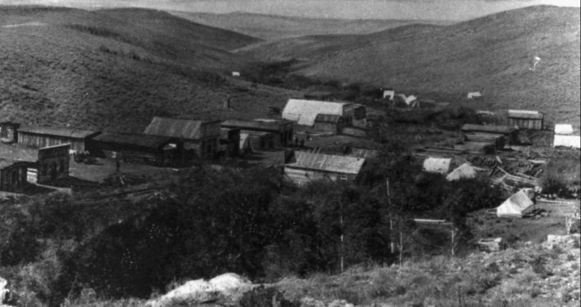
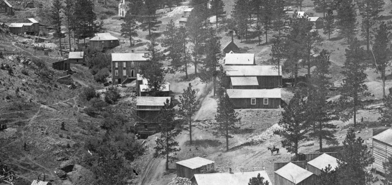
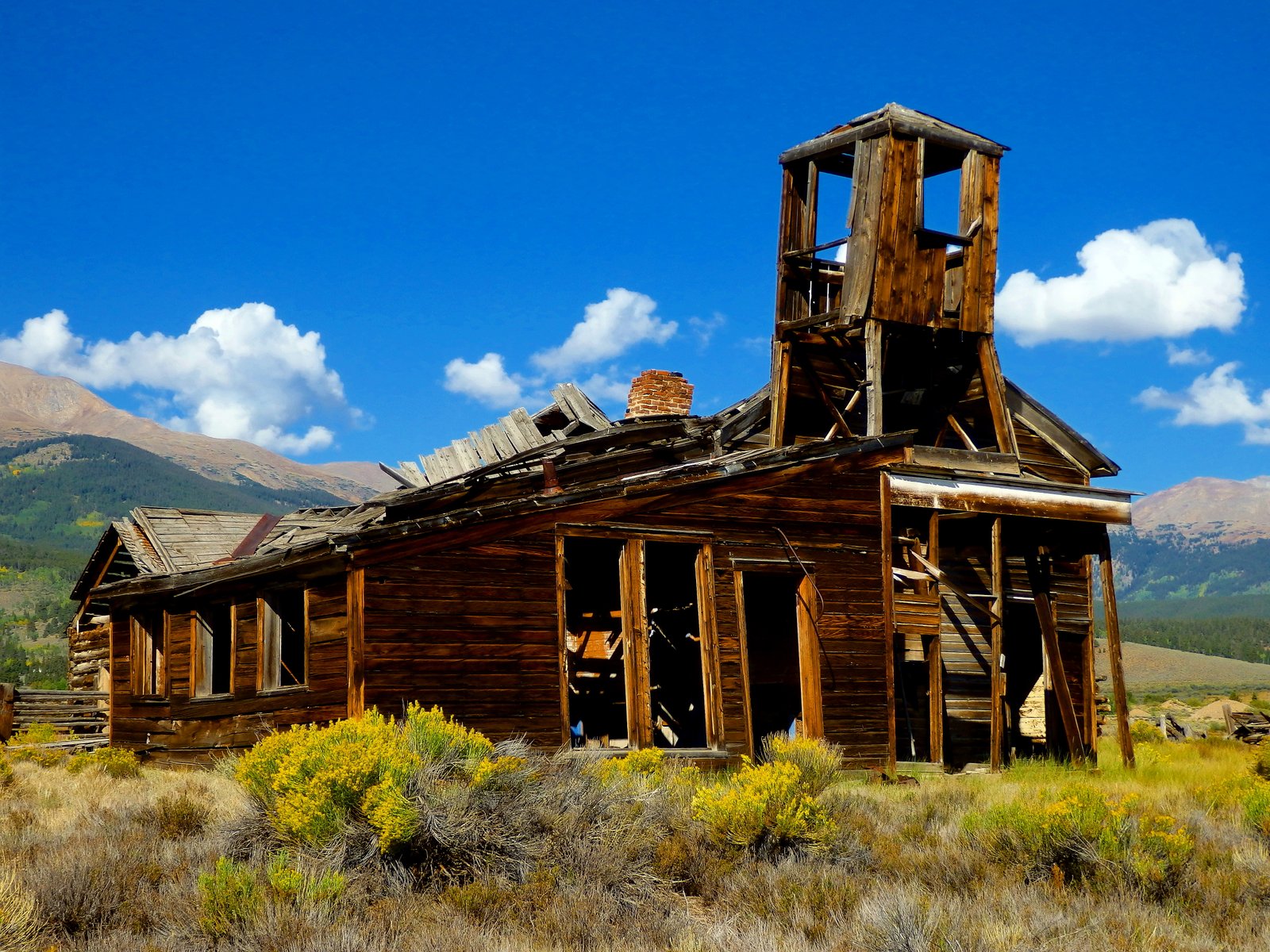
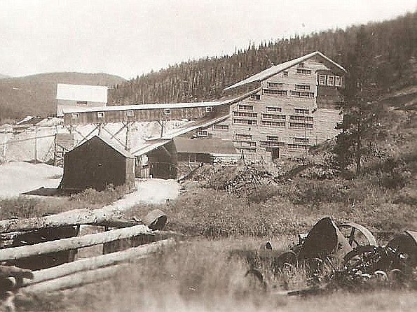
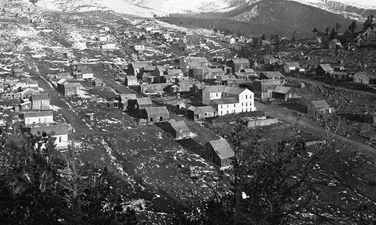
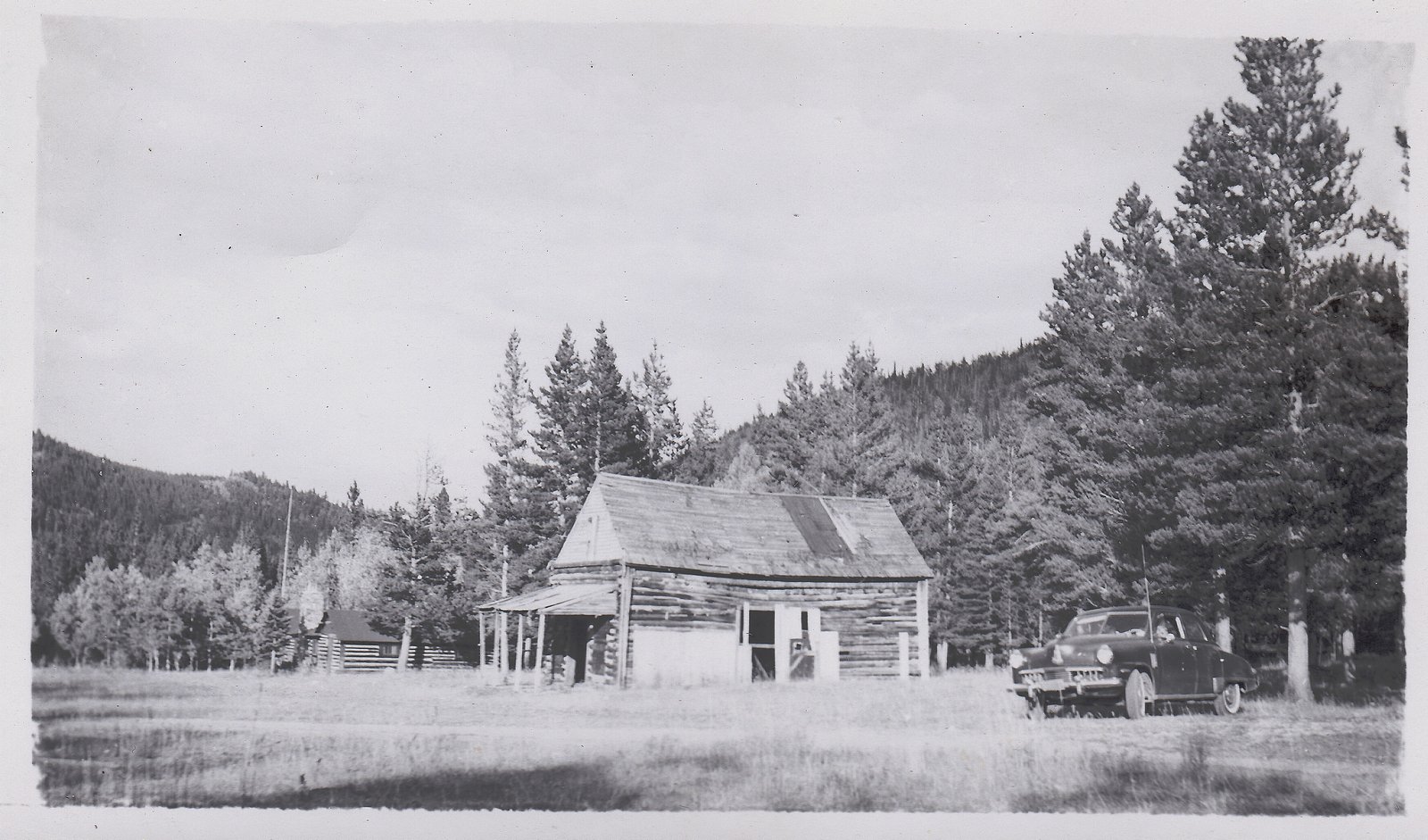
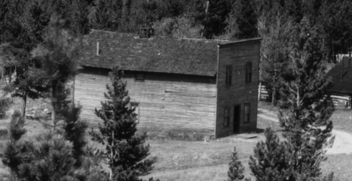
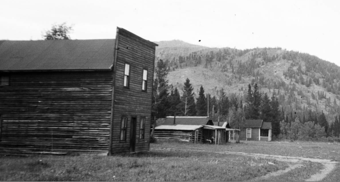
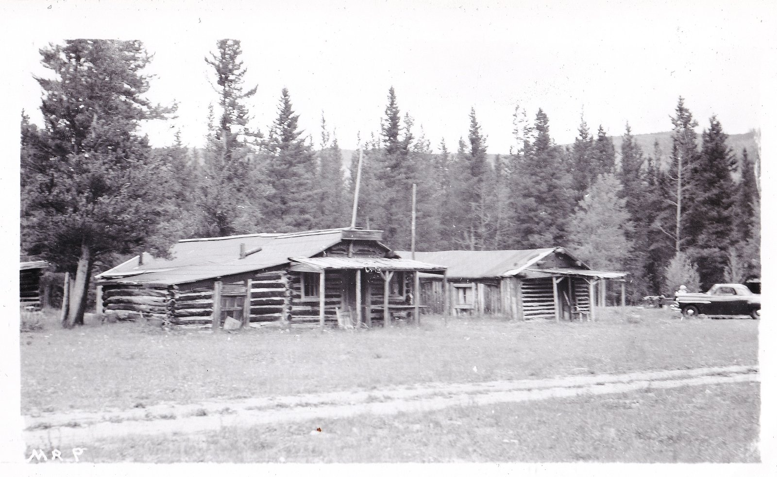
Vulcan had long been on my list of Colorado ghost towns to visit. There is one old photo of Vulcan (see above) that appears on numerous other sites across the internet that shows the town during it’s boom days in the late-1890s. Vulcan sprang up on the site of an dormant geyser, the walls of the cavern where the geyser once emerged from the ground were lined with rich, gold-bearing ore. Soon the extinct geyser site became a mine, and Vulcan became the richest gold producer in Gunnison County. Around 1930 the last of the gold ore was finally extracted, and Vulcan was abandoned, joining the growing list of Colorado ghost towns.

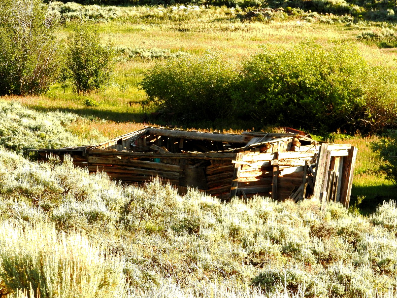
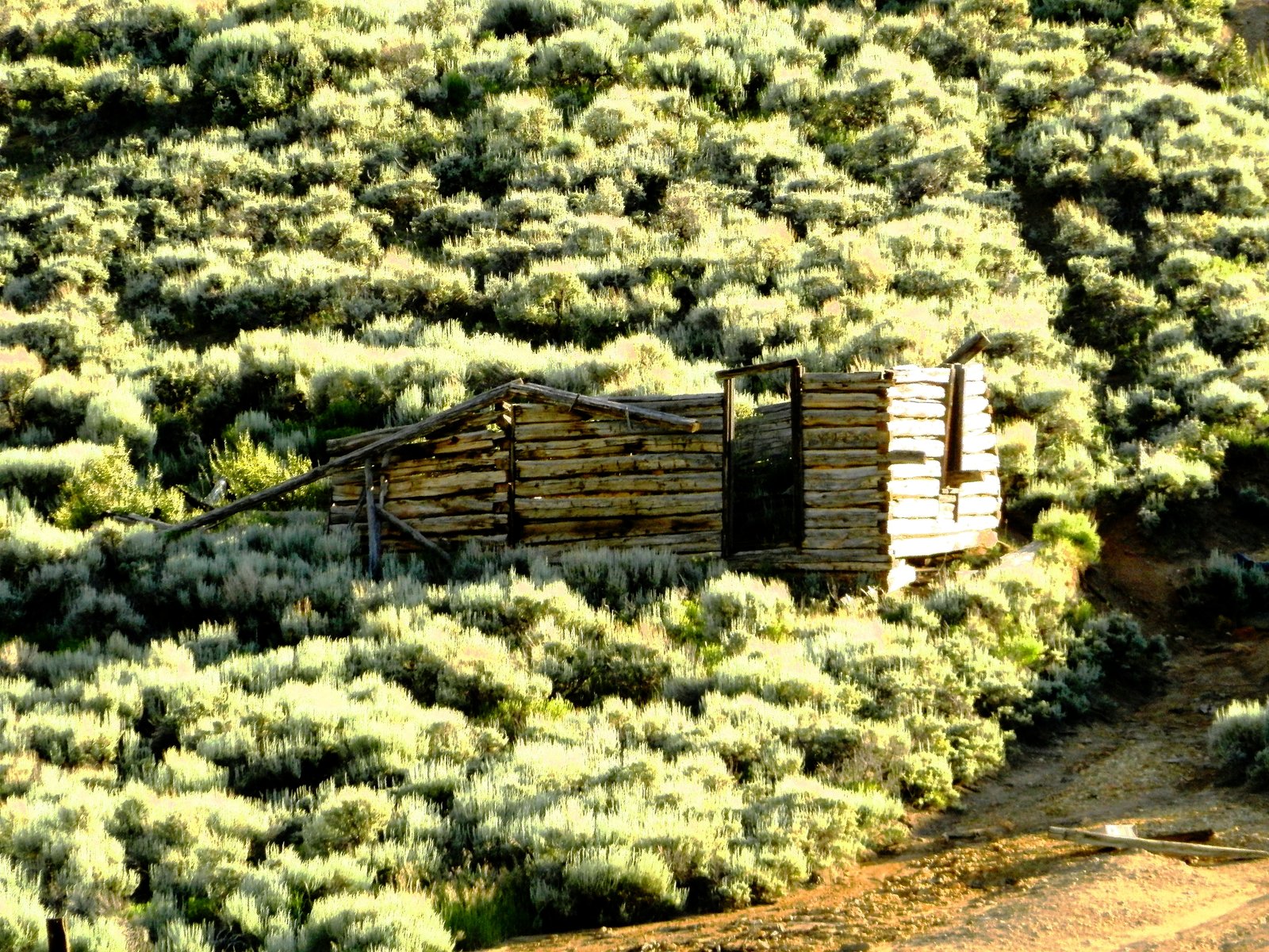
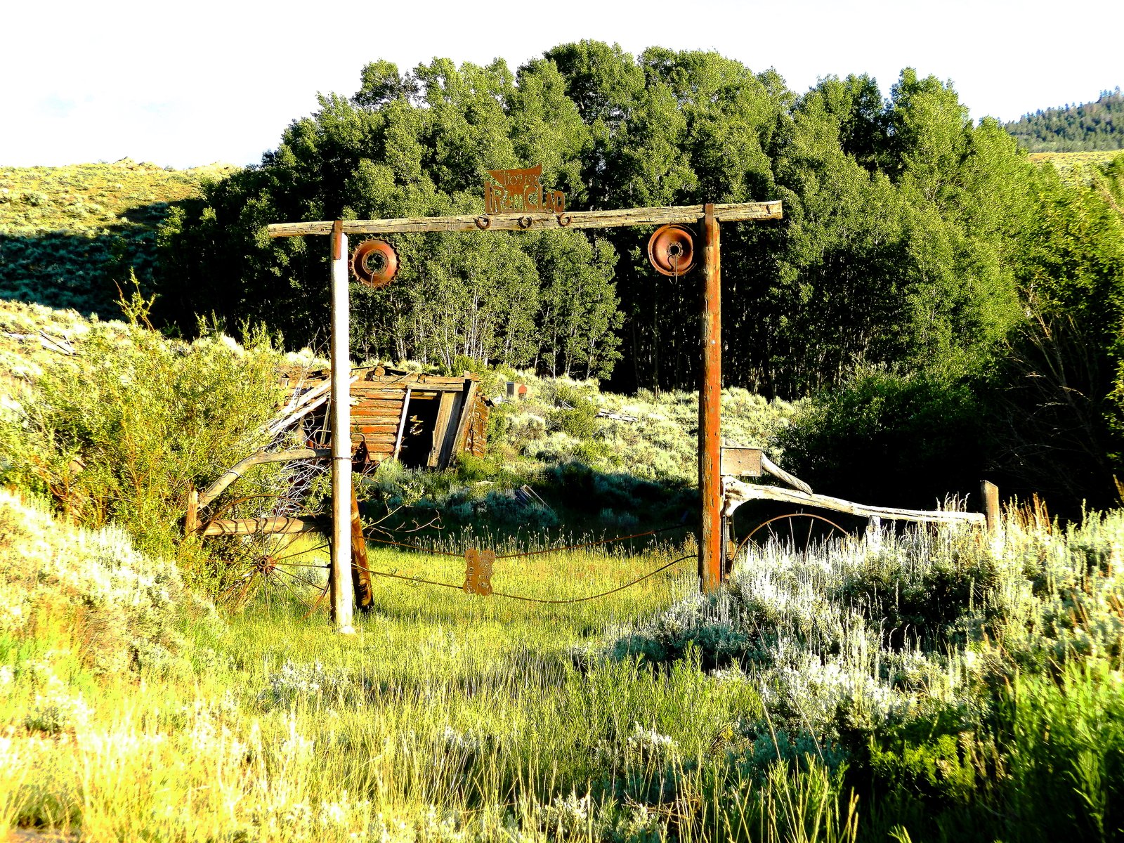
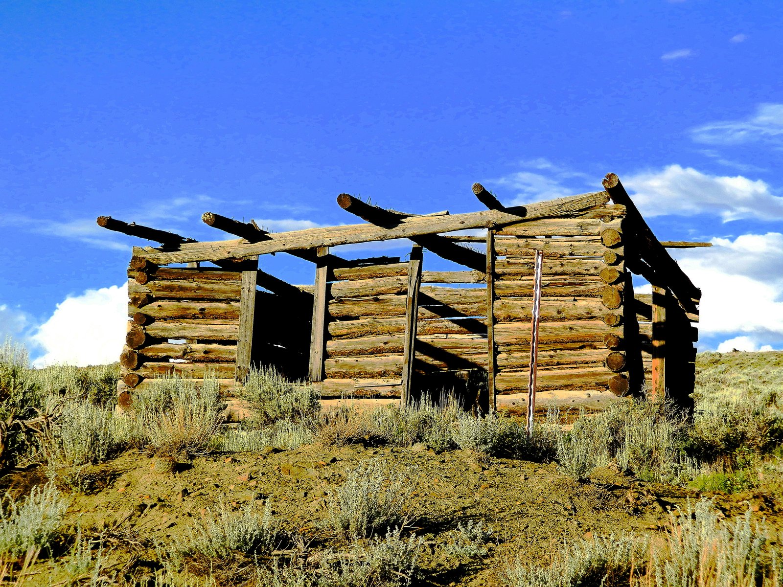
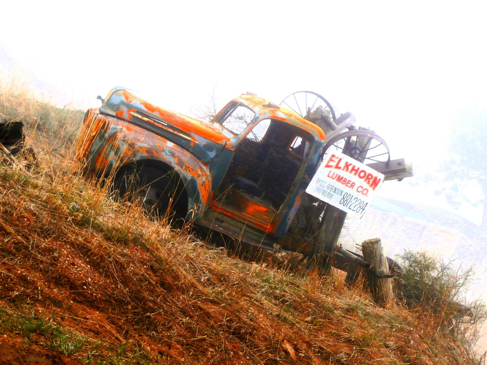
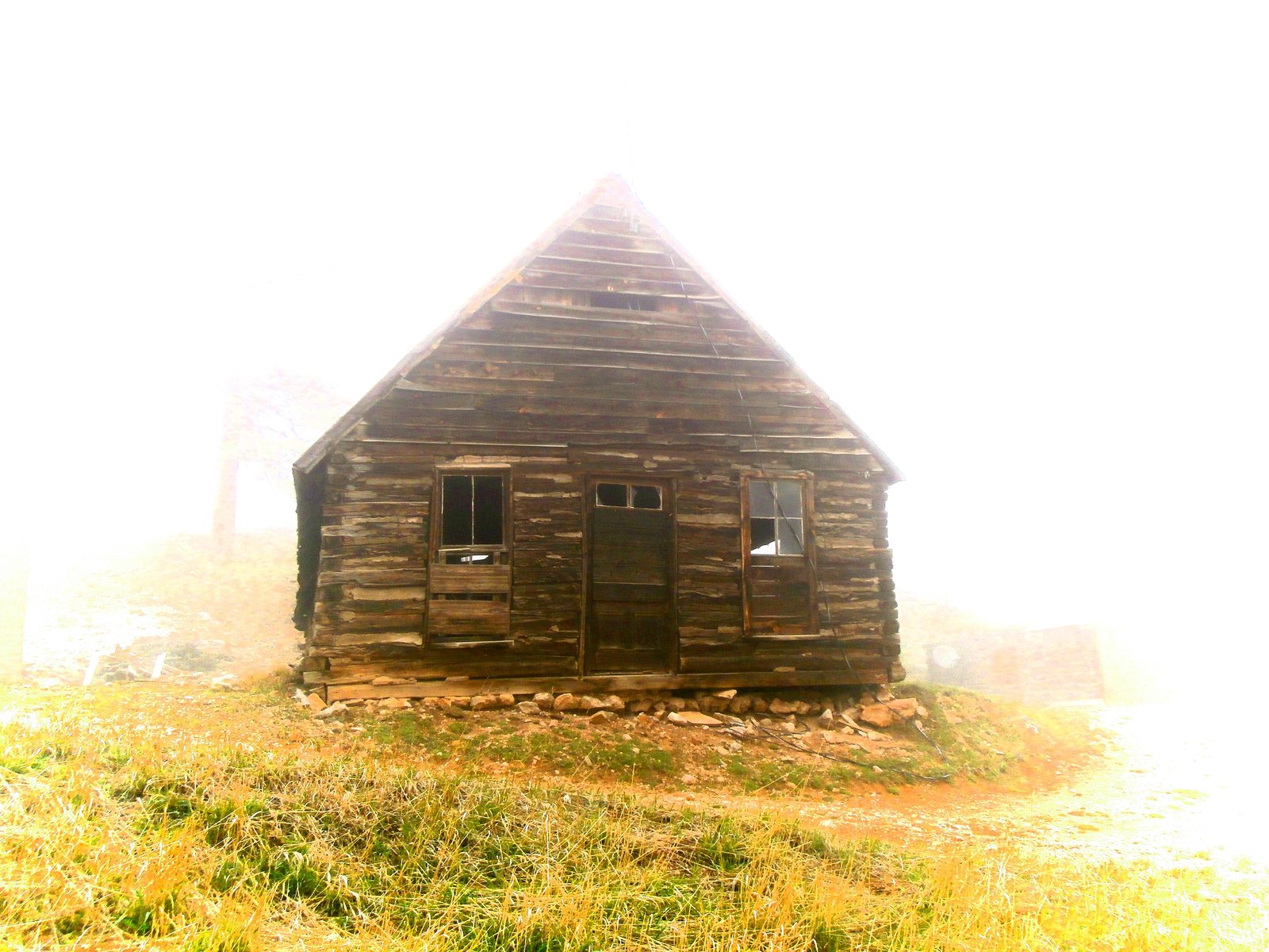
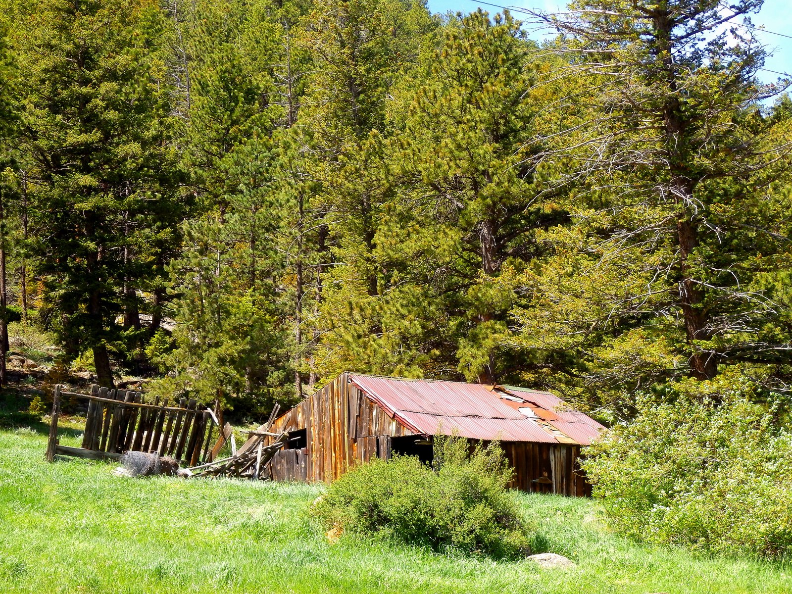
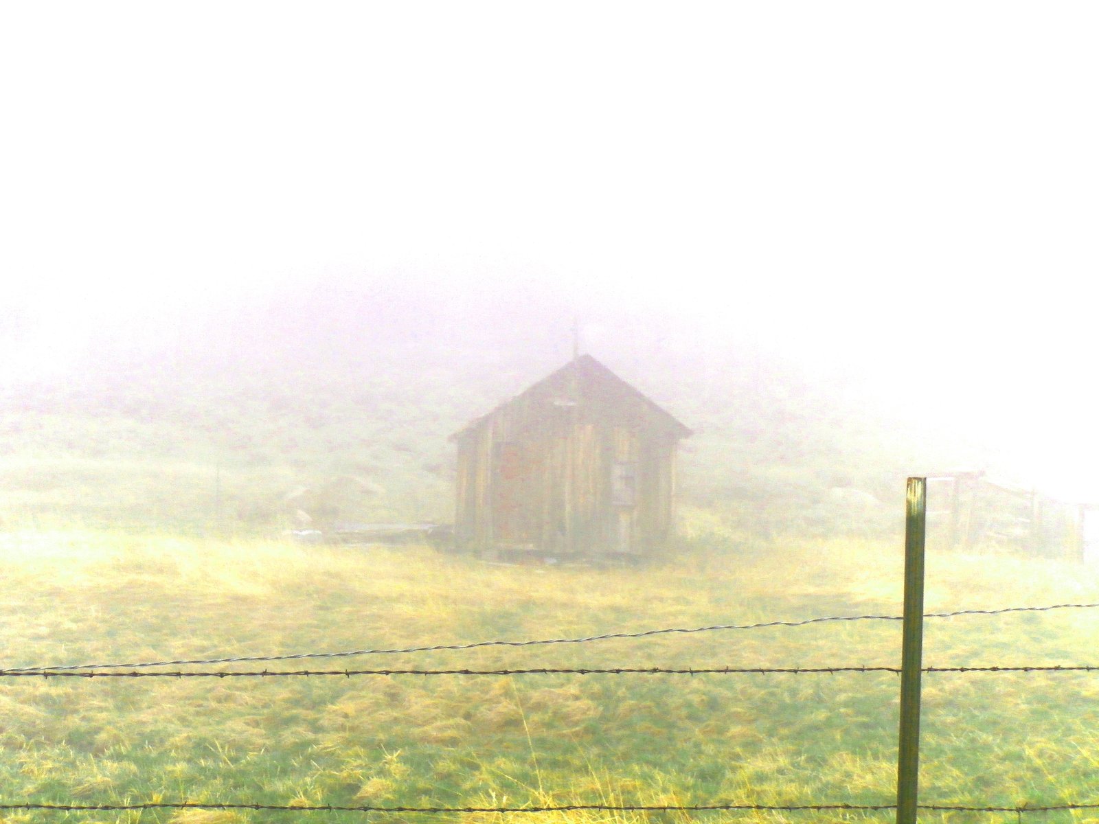
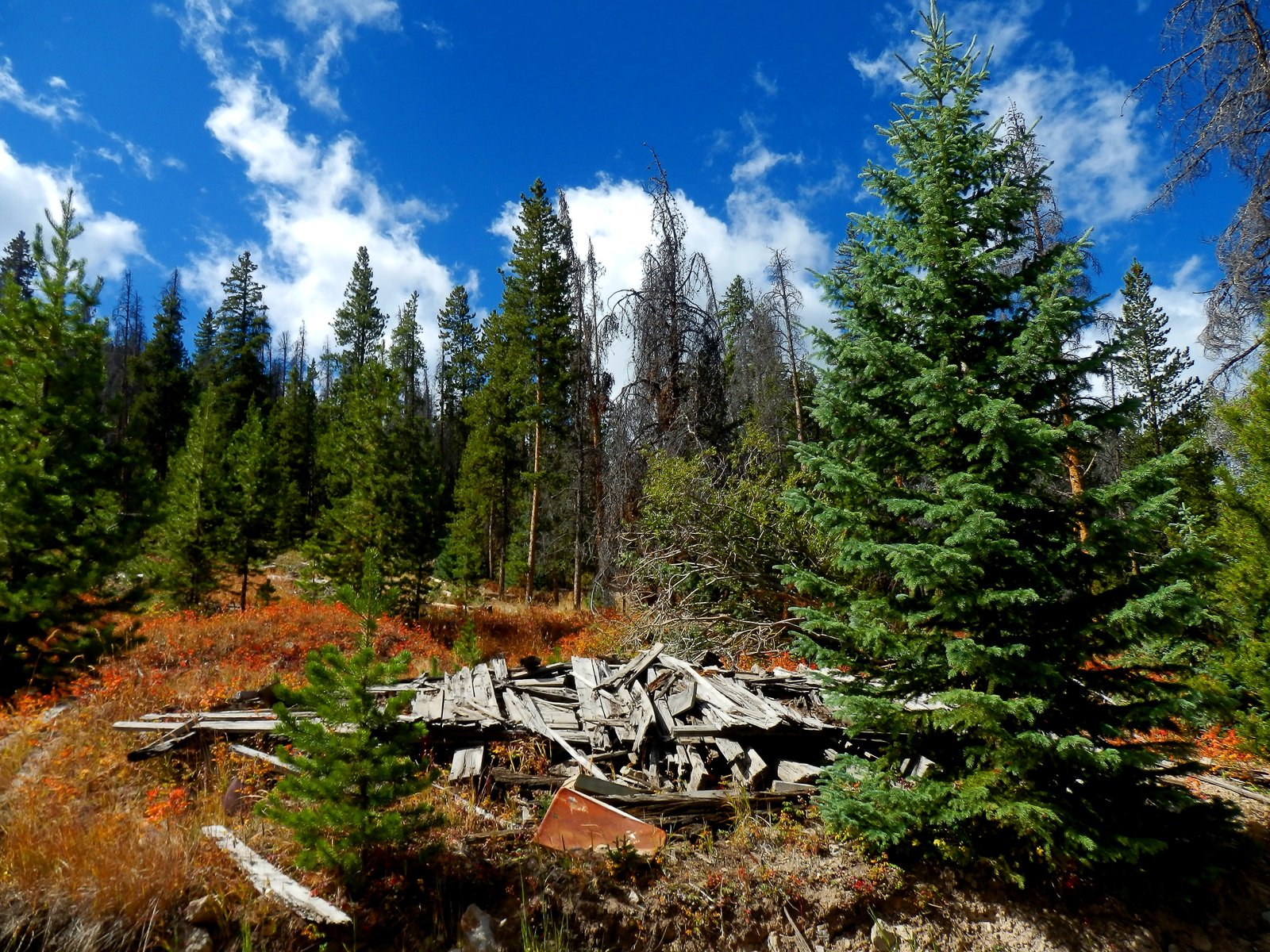
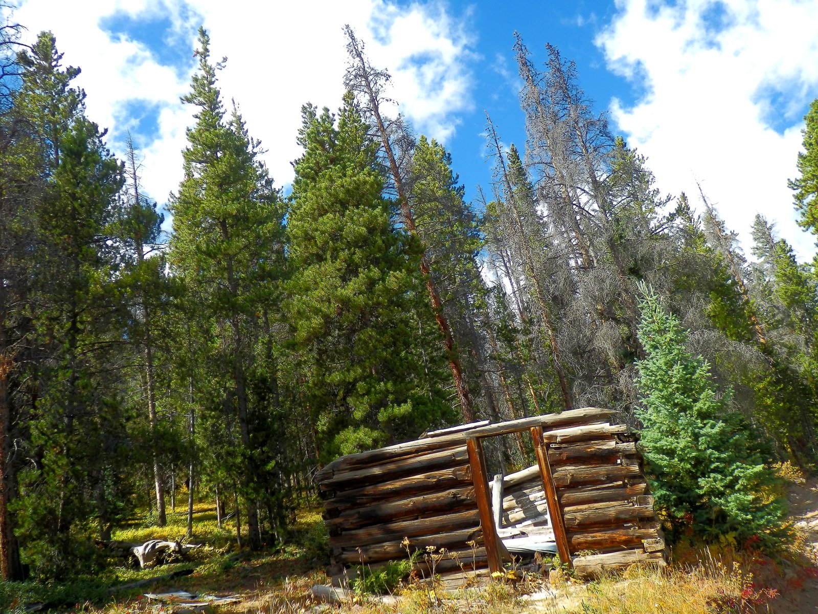
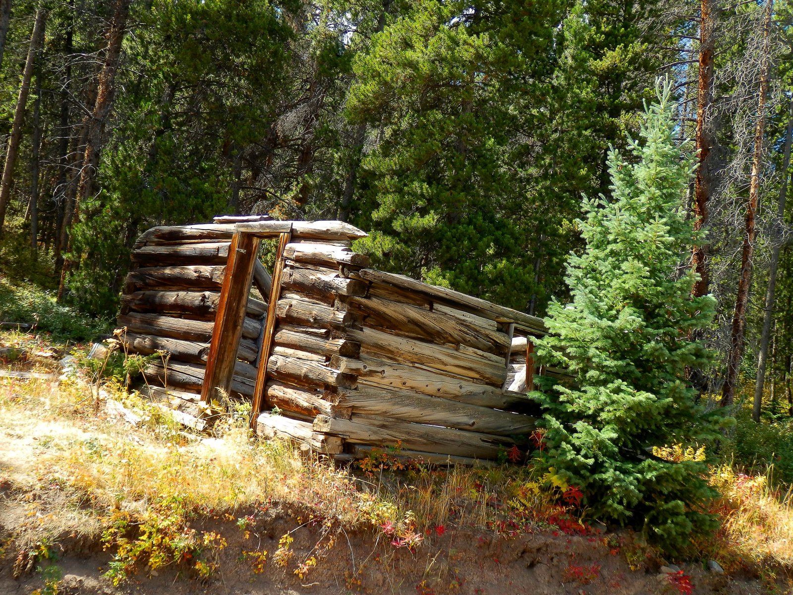
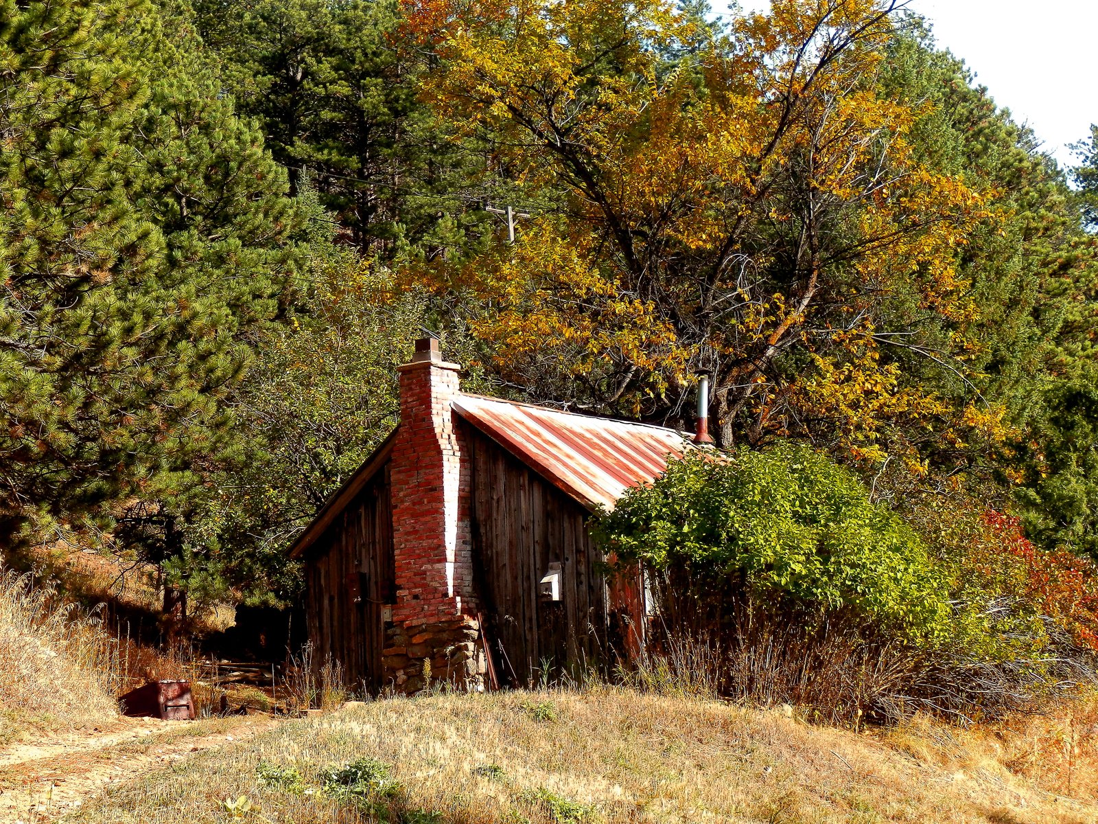
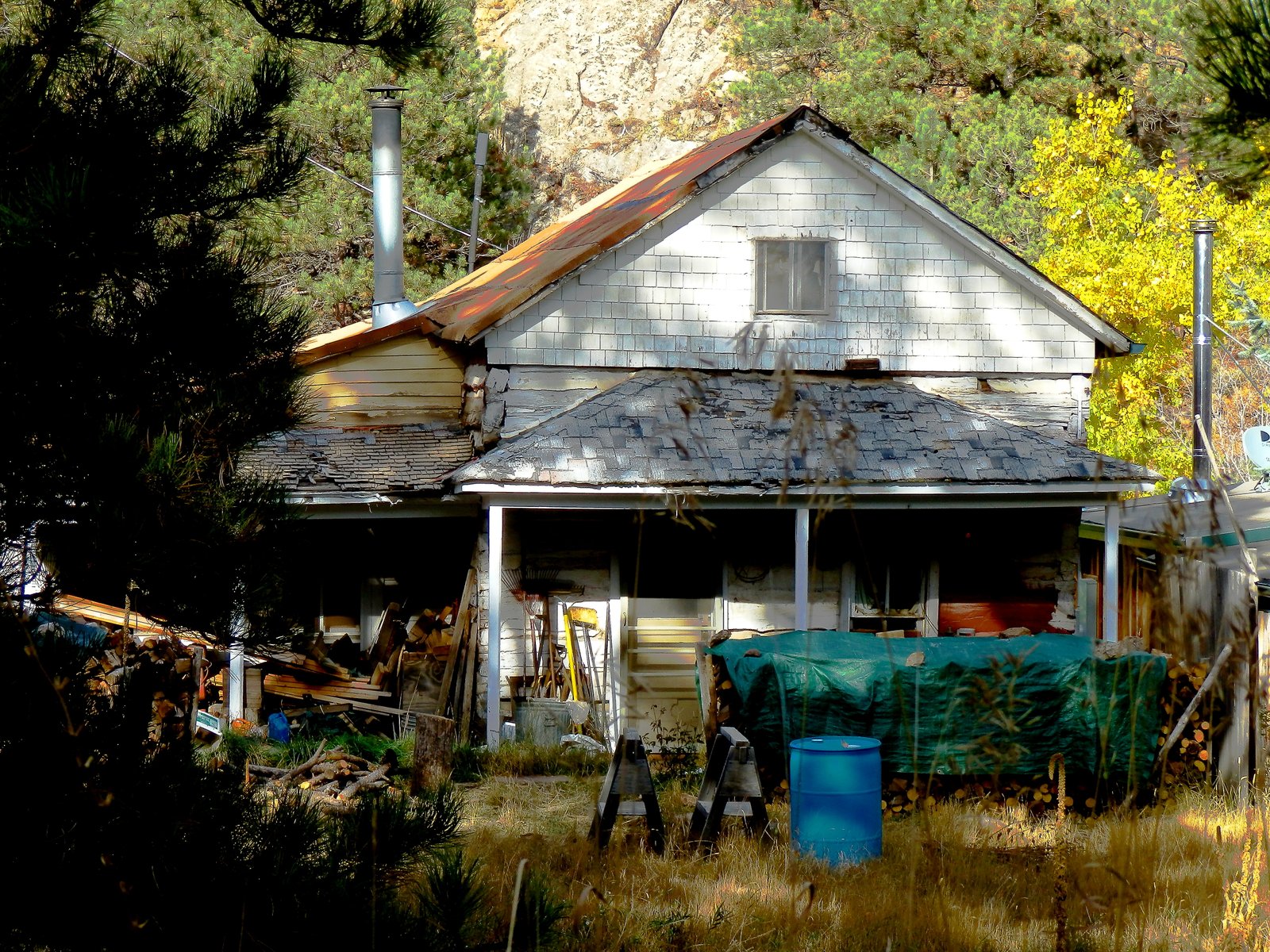
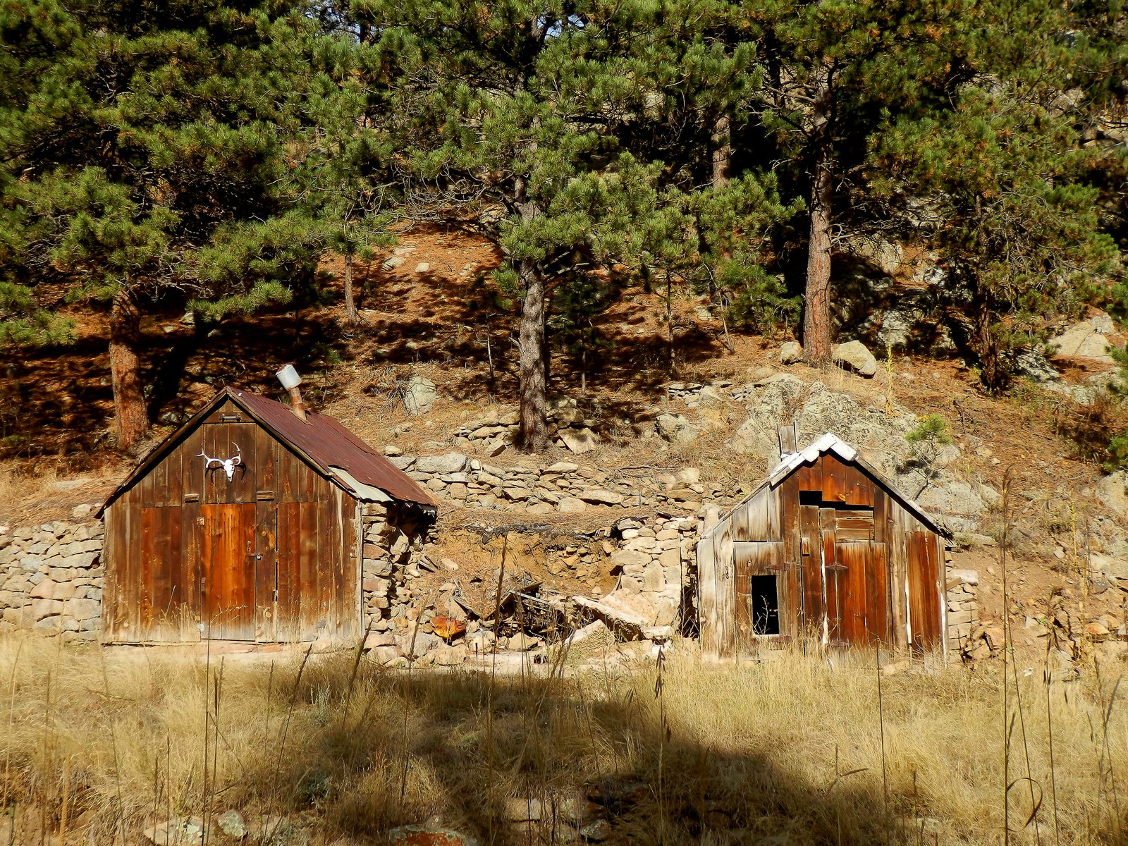
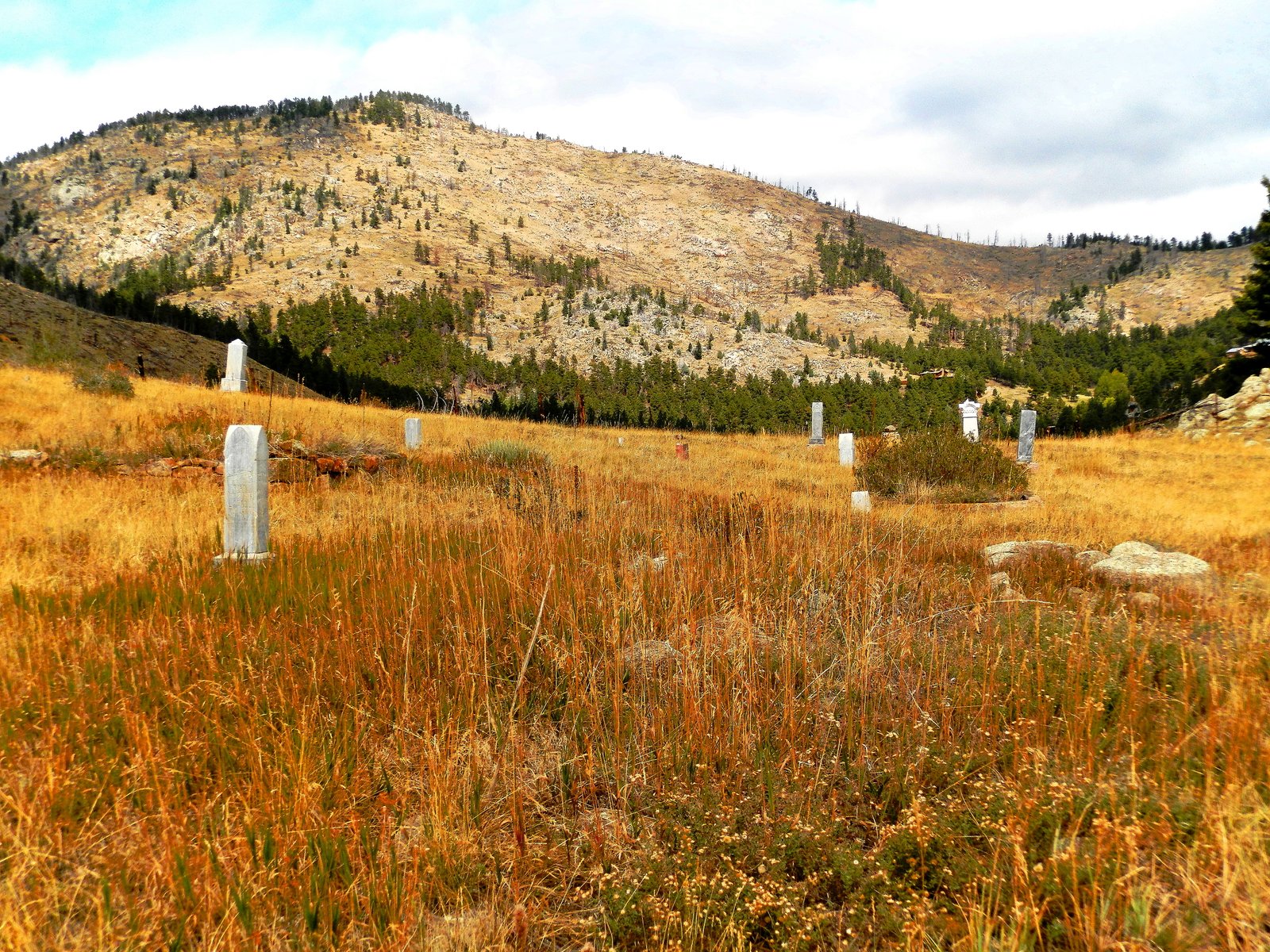
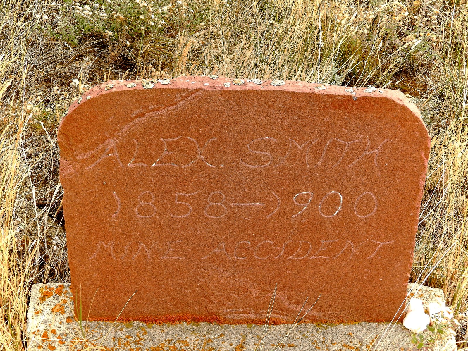
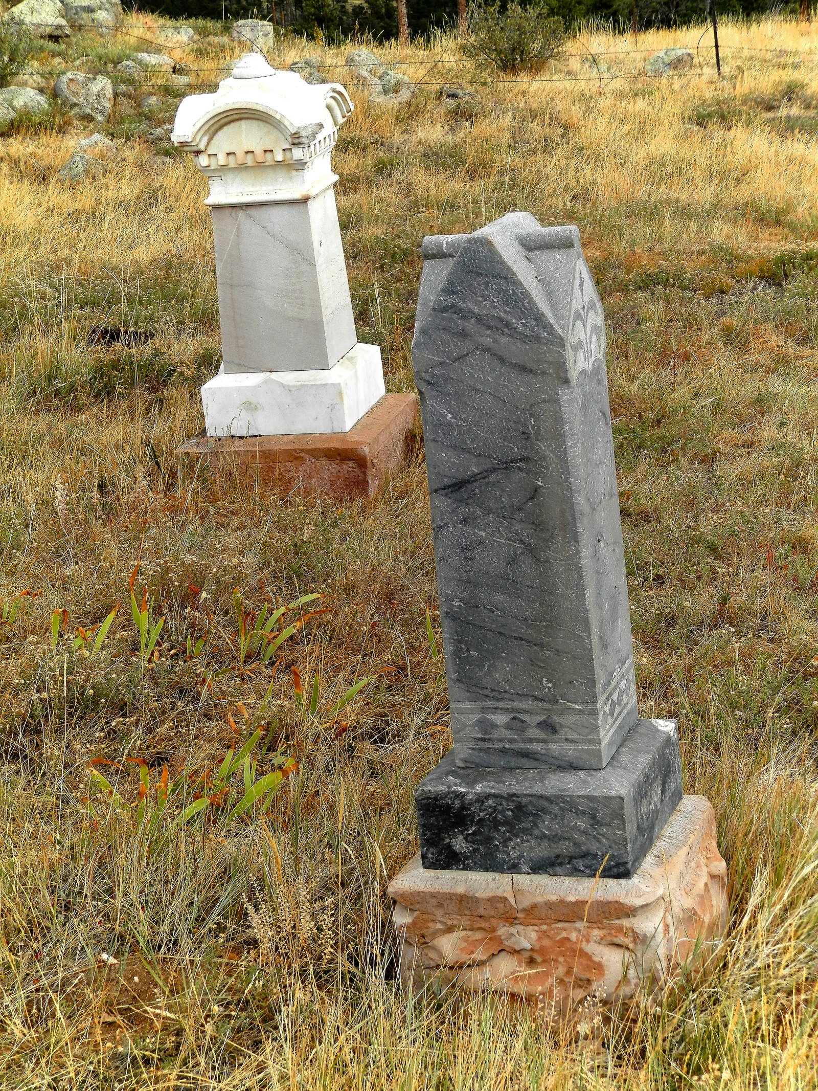
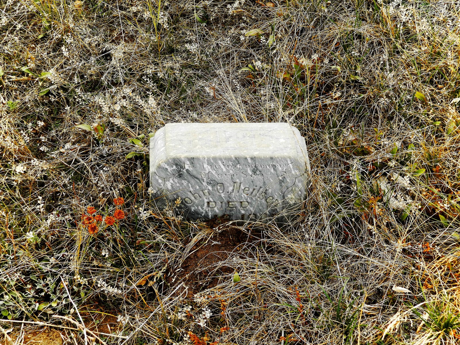
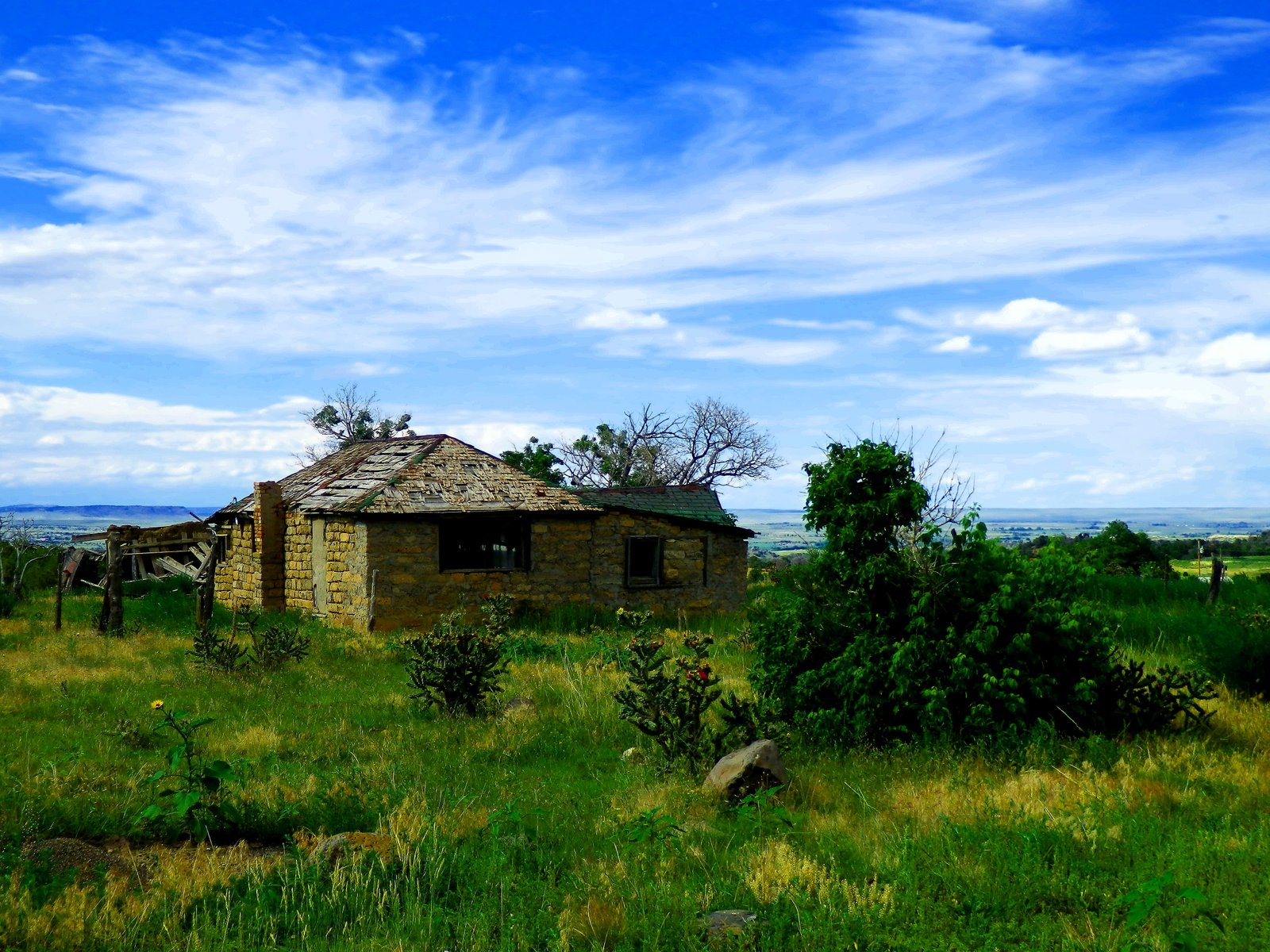
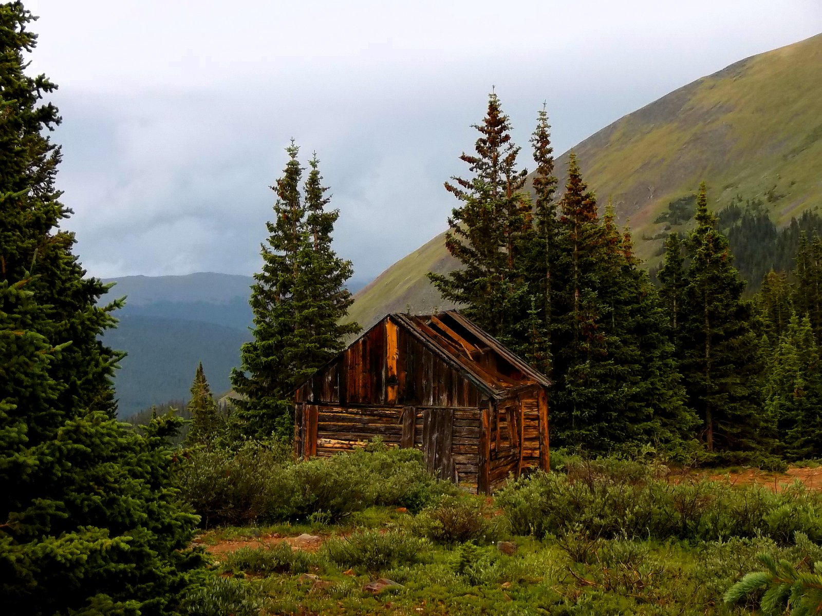
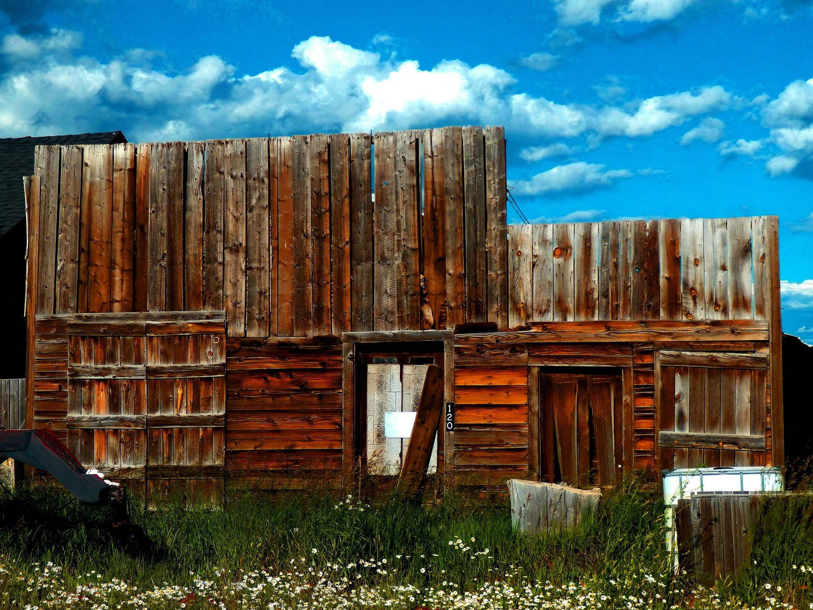
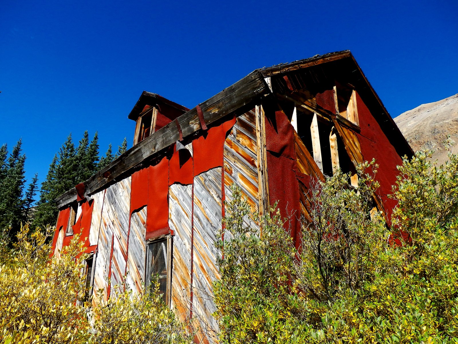
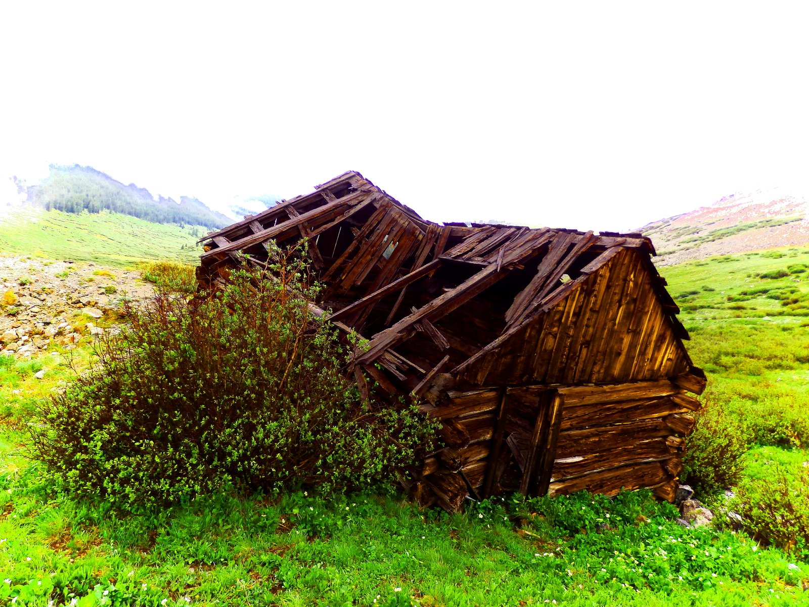
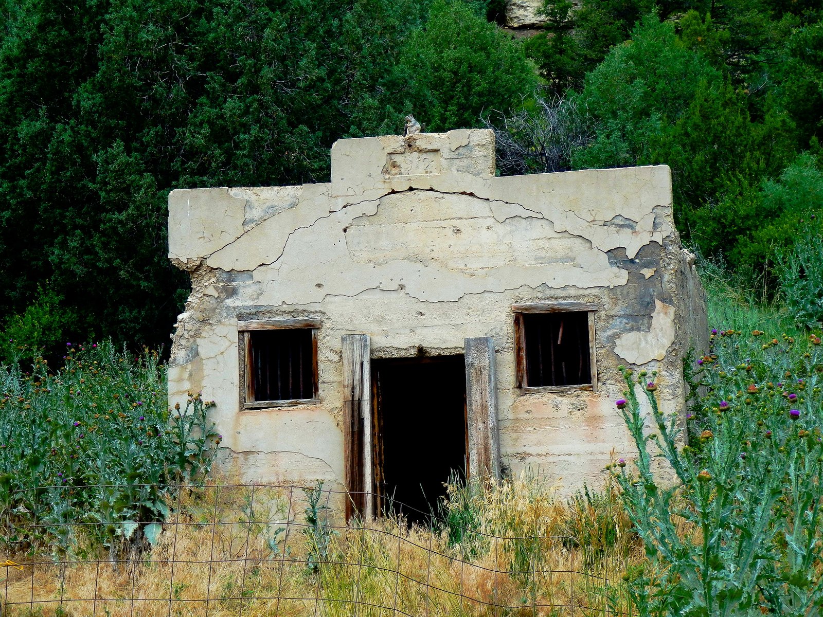
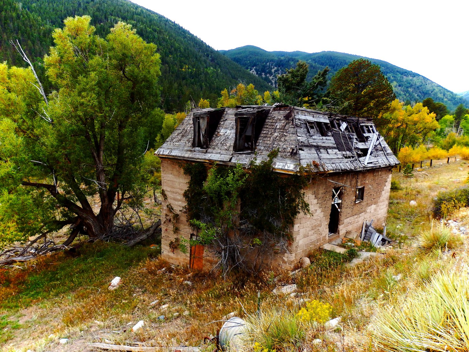
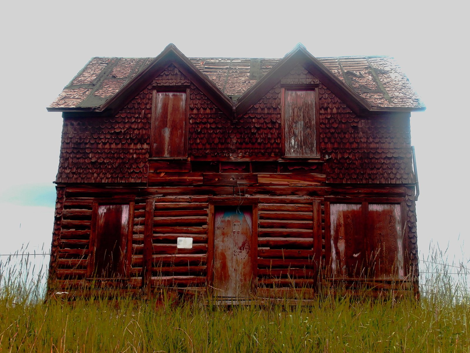
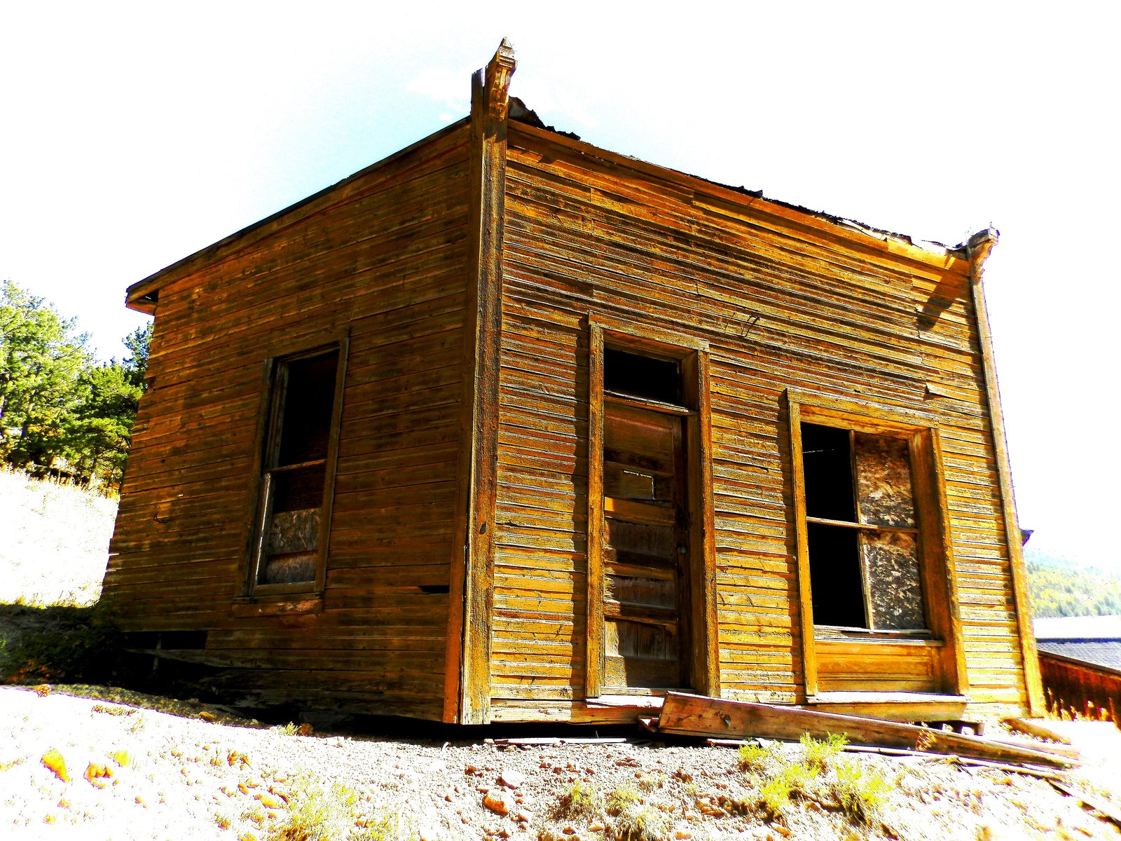
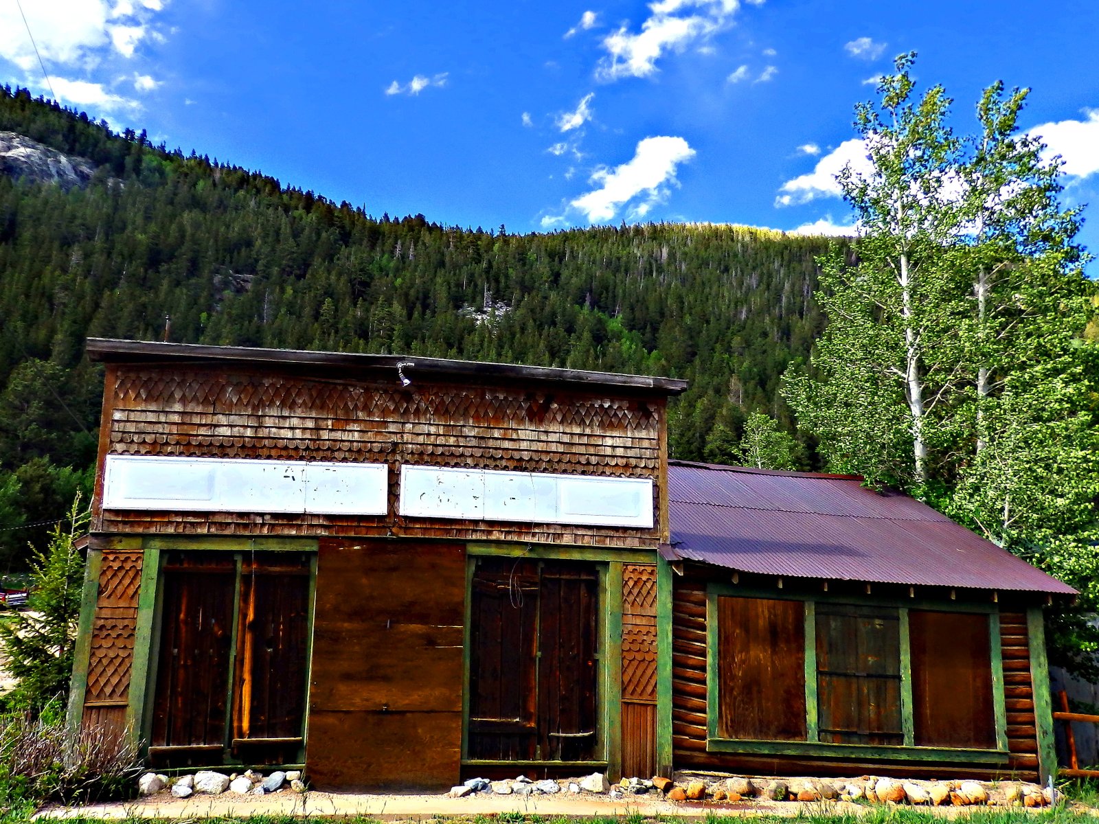
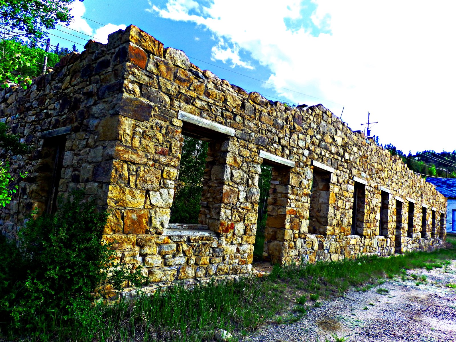
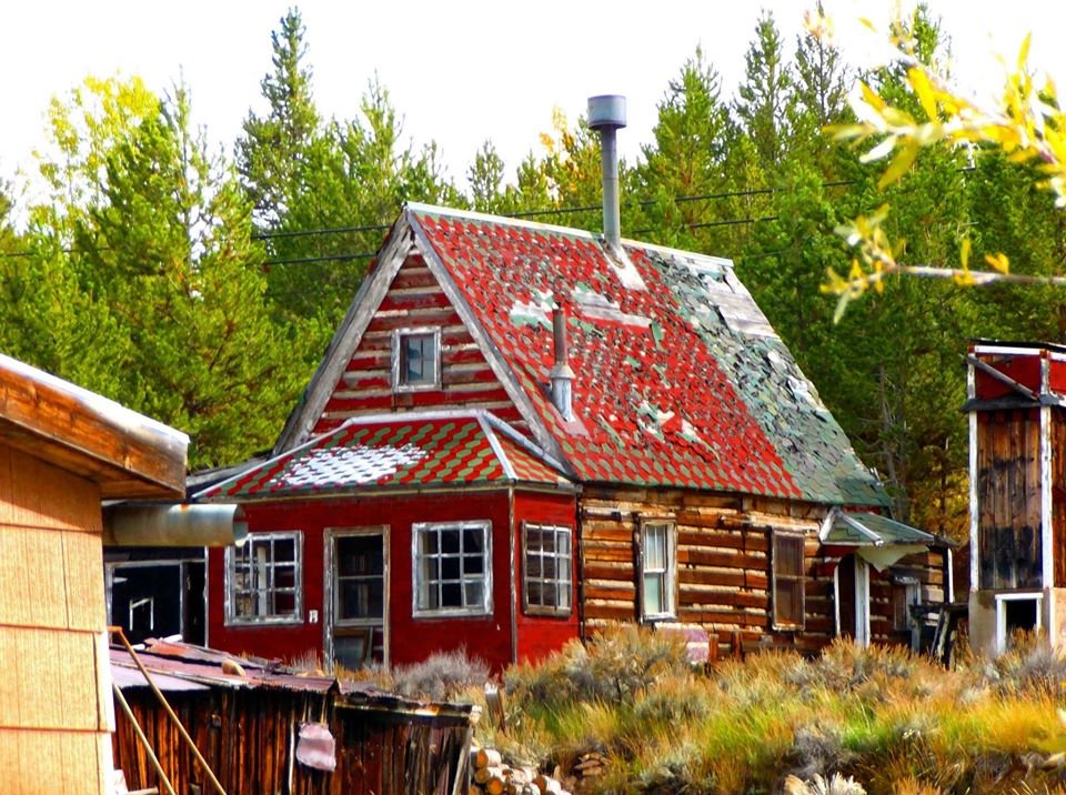
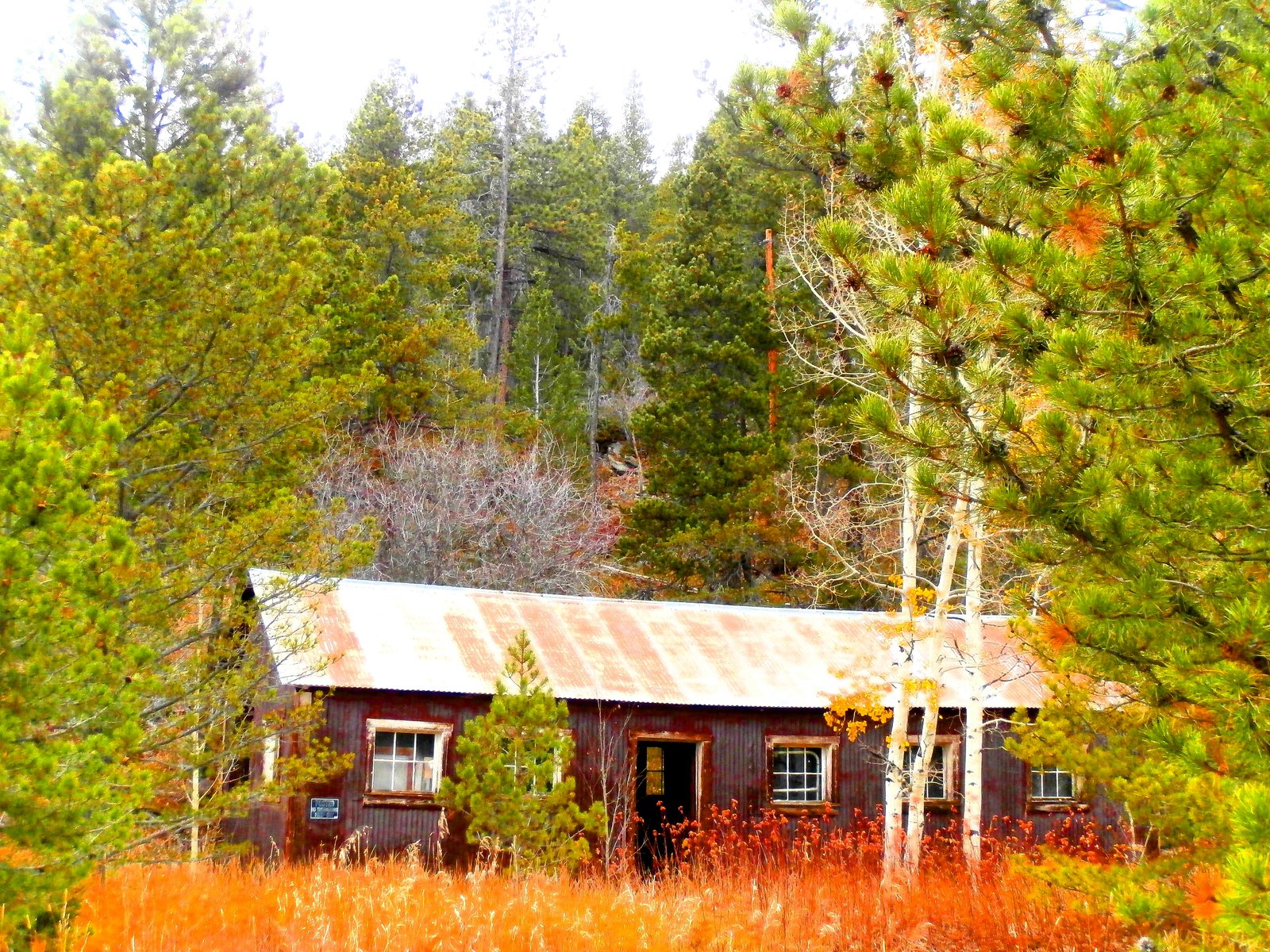
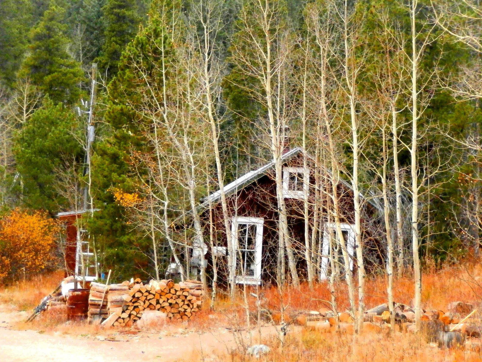
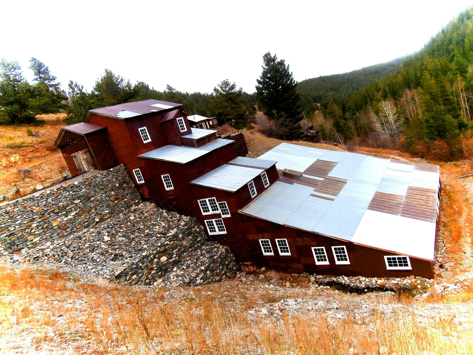
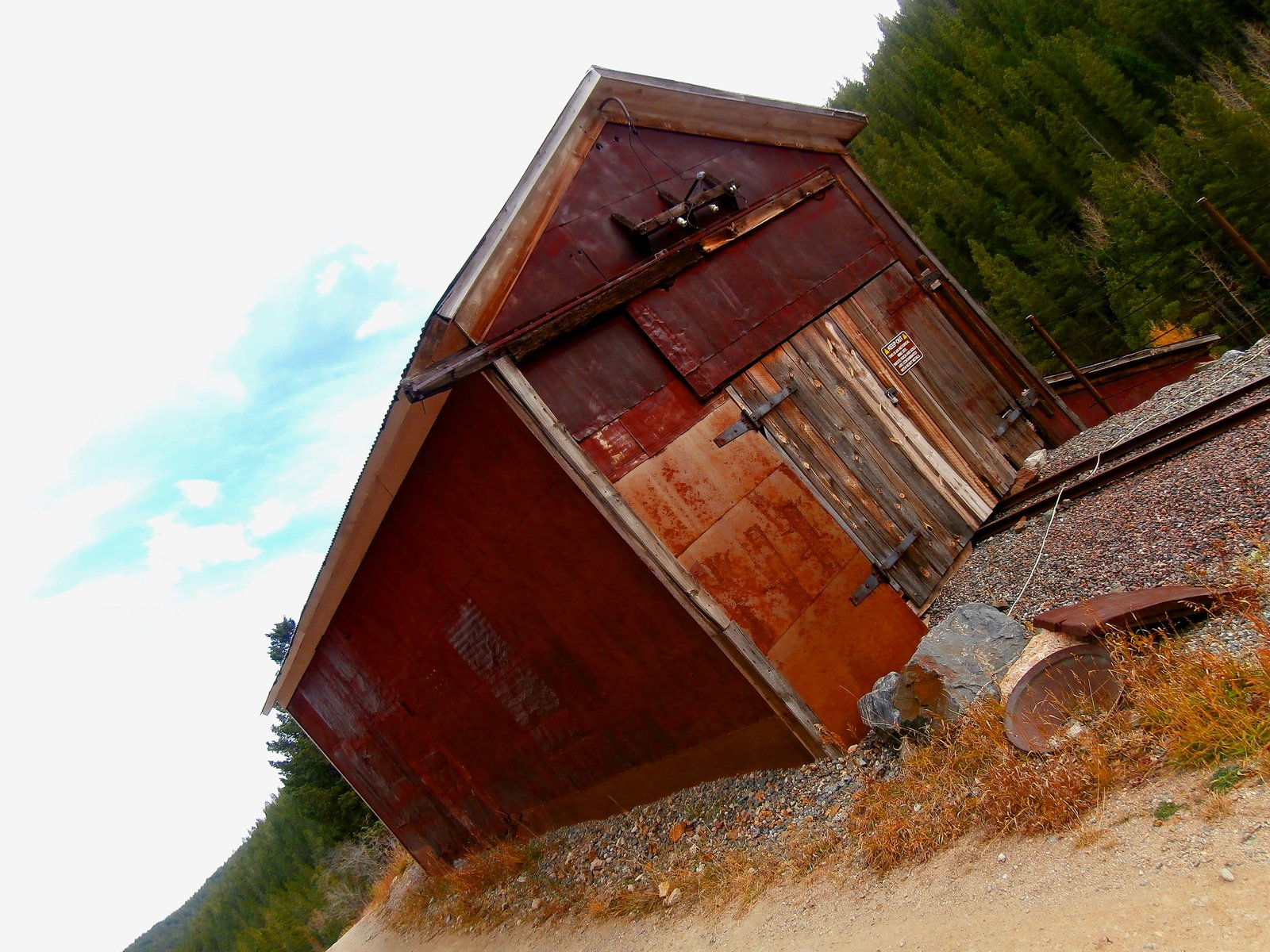
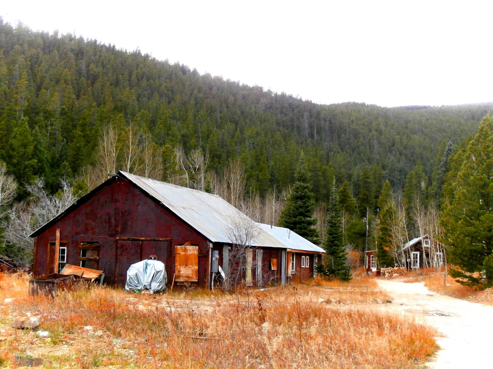
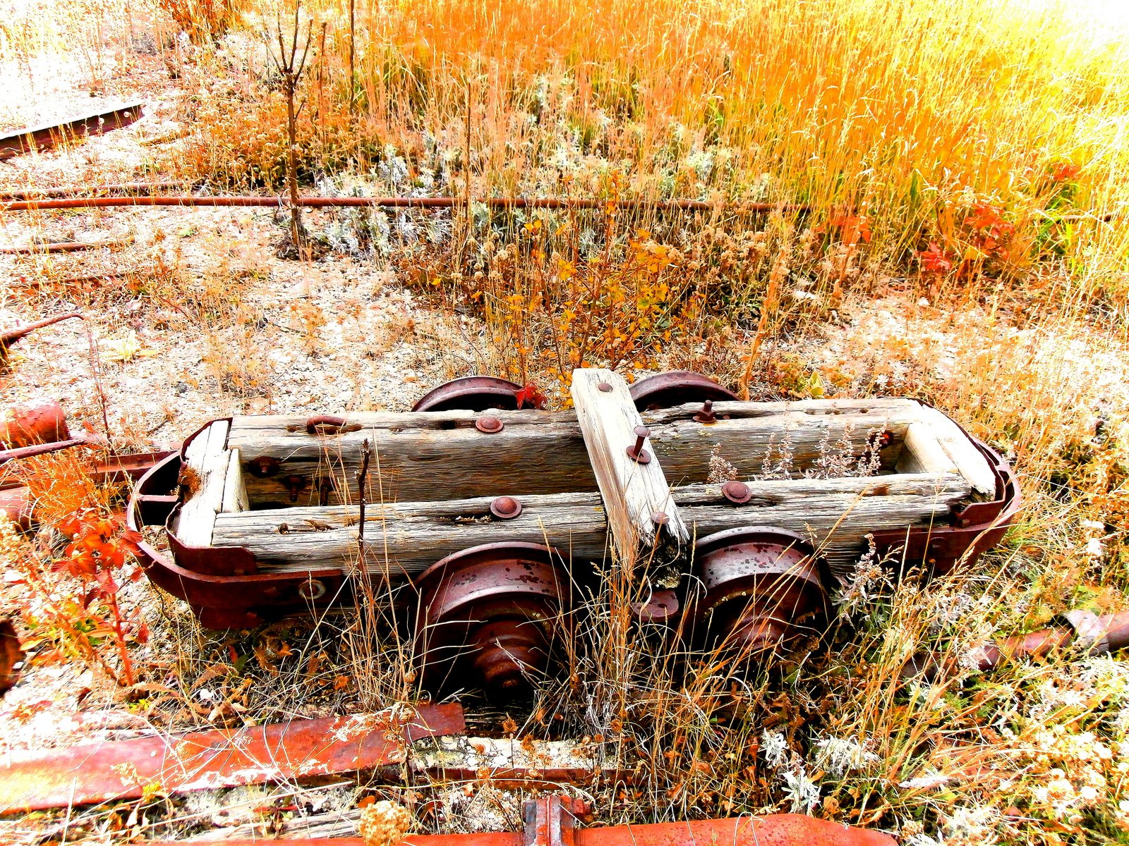
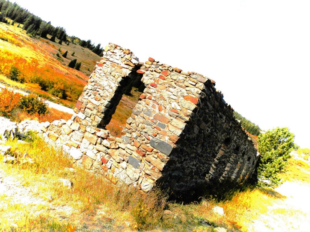
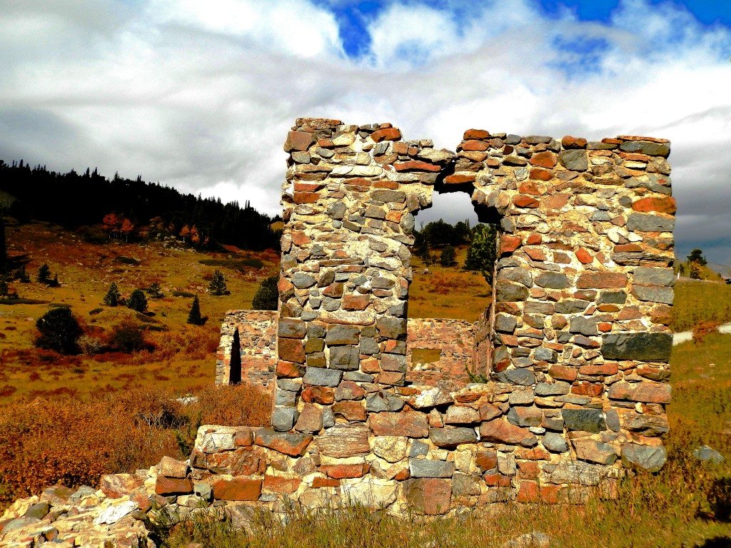
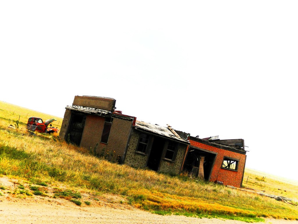
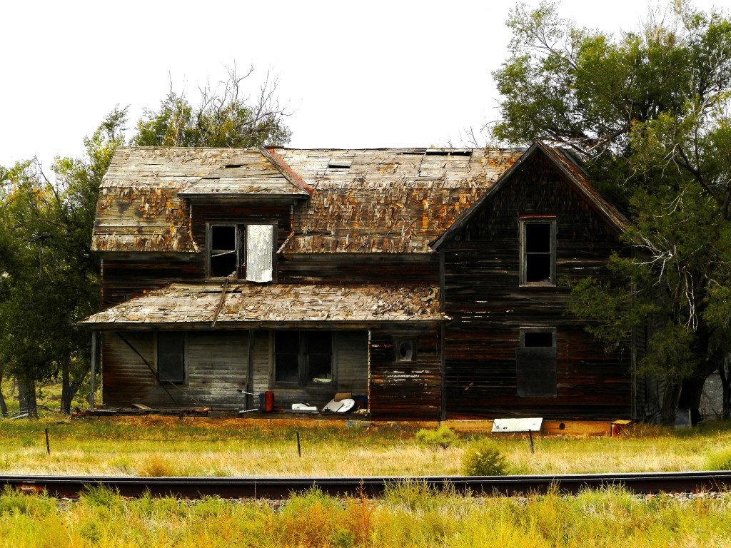
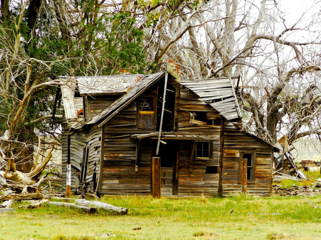
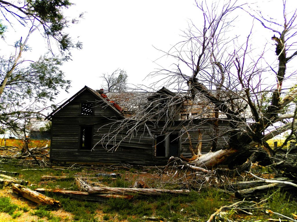
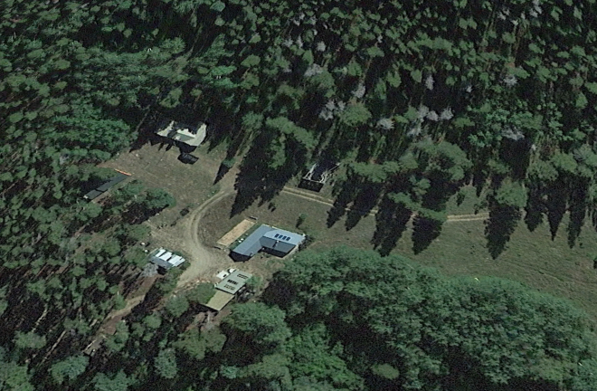
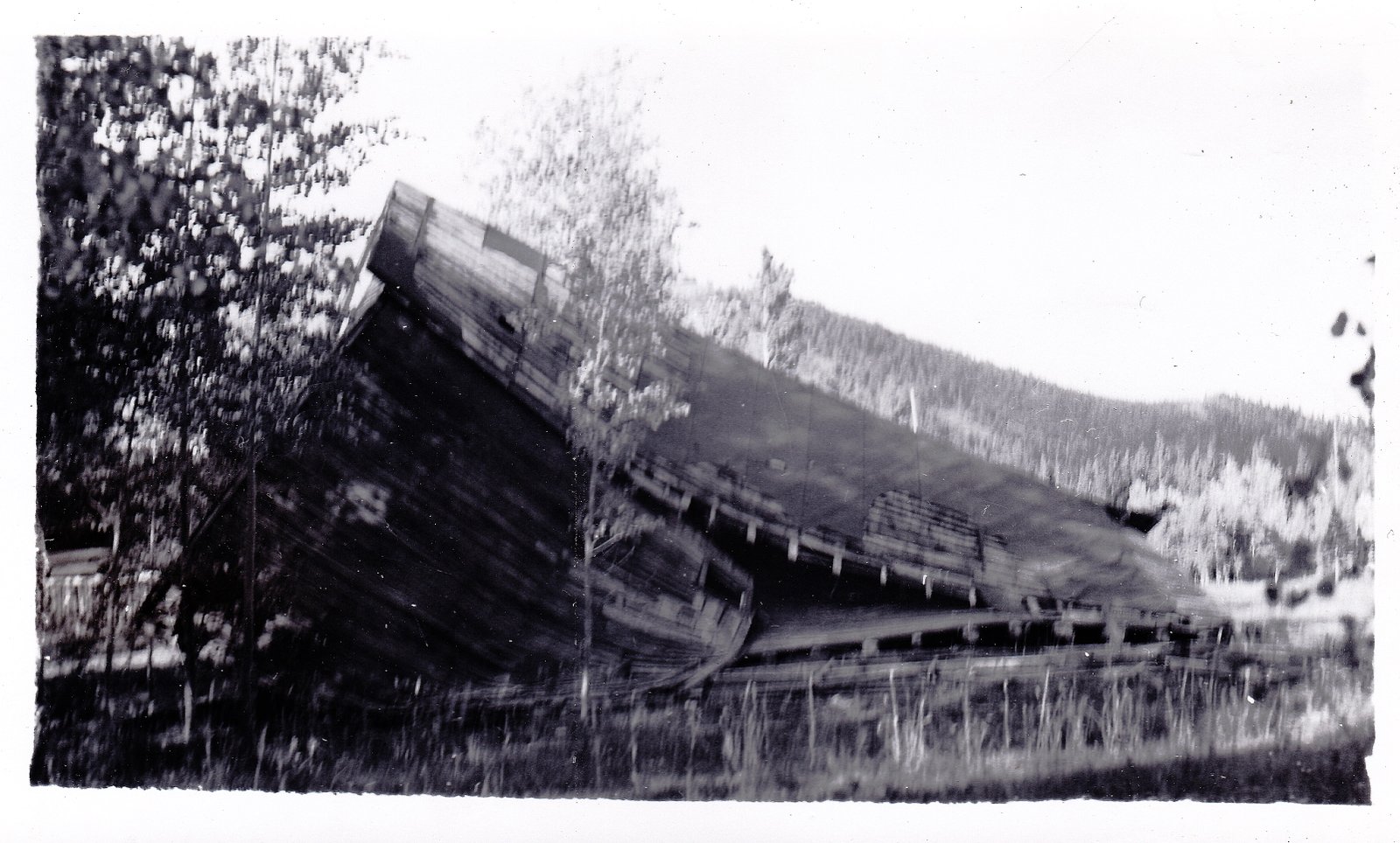
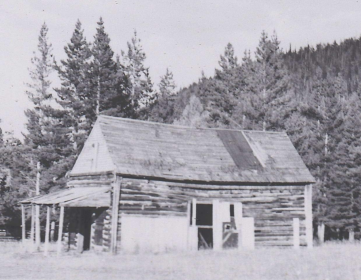
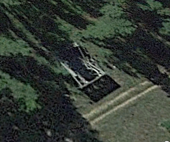
Vulcan today is a mere shadow of it’s former glory- Just a few scattered log cabins along the sagebrush dotted rise that leads to the mound of yellow tailings where the mine once was.  The road in to Vulcan is dirt, and can easily be navigated in dry weather if you take it slow- But be warned, it looks like it could become a quagmire oin a rainy day. Another challenge in finding Vulcan is that none of the marked roads in the area correspond to the markings on popular maps and atlases which leads to some confusion- Although the roads all looked right, and followed the correct path, the numbers did not coincide, and it led to me warrying that I had taken a wrong turn somewhere, but I hadn’t.  Please note: All of the buildings at Vulcan are located on PRIVATE PROPERTY which is clearly marked, please stay on the main road and respect other’s land.

Elkhorn, dating to the 1880s, in the hills of northern Larimer County was nearly lost in the recent Cameron Peak Fire, the largest forest fire in Colorado history. Heroic efforts by fire fighters, and a little help from Mother Nature slowed the fire just before it consumed this old mining camp and supply depot along Elkhorn Creek, although it does appear that some structures were lost to the flames.

Historic Photo of Elkhorn, Colorado

Very little gold was ever discovered in Larimer County, Colorado- A few deposits in paying quantities were located along Manhattan and Elkhorn Creeks in the Poudre River drainage about 40 miles northwest of Ft. Collins. Two small camps by the same names appeared- Manhattan and Elkhorn. Manhattan, the larger and more important of the two, became the namesake for the Manhattan Mining District which boomed and busted between 1890 and 1905.


Miner’s shacks at Elkhorn in 2018
Current Map of the Cameron Peak Forest Fire- Red Area is burnt area- This indicates the two small shacks pictured in previous photo may have been lost to the fire.

So little gold was found along Elkhorn Creek that the town of Elkhorn never grew to be much more than a few miner’s shacks, a general store, Post Office, and school. Gold fever, which never truly panned in Elkhorn, soon gave way to ranching and logging operations. Elkhorn eked out an existence as a small supply depot for the area. Logging continues in the area to this day…or did prior to the devastating Cameron Peak fire.


One of the old stores at Elkhorn, used as a storage barn today

Elkhorn today is a wide spot in the road along County Road 68. An impressive log store dating to Elkhorn’s boom days can’t be missed as you pass through- Today it serves as a storage barn. A few other miner’s shacks and old log buildings can be seen scattered along the meadow and the hillsides around the old store. All of the area is private property, fenced, and marked. Photos can be taken from the County Road of what remains, although that is unclear following the forest fire.


Elkhorn Store on a sunny day
Elkhorn Store in the fog
Another old shop at Elkhorn- This building and those in the background may have been lost in the Cameron Peak fire according to Forest Service maps showing the fire’s preimeter in the area of Elkhorn.
Elkhorn in the fog
Another shot of Elkhorn on a foggy day

THANKS FOR VISITING!

GIVE US A “SHARE” ON YOUR SOCIAL MEDIA PAGES!

CHECK OUT MY BOOKS- CLICK LINK BELOW

Abandoned Colorado Book Series by Jeff Eberle- CLICK HERE!

VISIT MY OTHER GHOST TOWN PHOTO BLOGS-

Photo Blog- 25 Picturesque Abandoned Buildings in Colorado

Photo Blog- Ghost Town of Balfour, Colorado- Vanished as Fast as it Appeared!

Photo Blog: Ghost Town of Brandon, Colorado

Ghost Town Photo Blog- Caribou, Colorado

Photo Blog- Galatea, Colorado Plains Ghost Town

25 (More) Abandoned Buildings in Colorado You Must See Before They Are Gone

25 (More) Abandoned Buildings in Colorado You Must See Before They Are Gone

Very few visitors who spend a weekend in the booming tourist town of Breckenridge, Colorado are aware that there is a ghost town within walking distance to explore- Preston. Preston is a tiny mining town located at the head of Gold Run Gulch in the pine tree covered slopes right next to the Breckenridge Municipal Golf Course. Preston can be reached by a short hike, mountain bike, or 4×4 using Gold Run Road/Forest Road 300 near the Jessie Mill.

Preston dates to around 1874 when the Jumbo Mine began to pay big dividends, and a couple hundred miners and their families brought the camp to life. There was general store, lumber mill, bunk house for bachelor miners, and an on-and-off Post Office at Preston which operated intermittently between 1874 and 1890. Preston was stopping point for supply trains and miners heading in between the mining towns of the Swan River valley, and the camps located in French Gulch.

A few old cabins nestled at the base of towering stands of pine trees remain at Preston today. The tumbledown walls and boards of other once-important buildings are scattered around the town site as well as the customary rusted bits and pieces of yesterday. A sign at the edge of the site gives a brief history of Preston and its mines. If you find yourself with an afternoon to kill the next time you visit Breckenridge, take the short and scenic journey to nearby Preston.

CHECK OUT MY BOOKS!


CLICK HERE TO VIEW AND ORDER MY BOOKS ON AMAZON!

Photo Blog- Sunshine, Colorado a Forgotten Gold Camp

Photo Blog- 25 Picturesque Abandoned Buildings in Colorado

Ghost Town Photo Blog- Caribou, Colorado

Photo Blog- Ghost Town of Balfour, Colorado- Vanished as Fast as it Appeared!

25 Abandoned Buildings In Colorado You Must See Before They Are Gone

25 (More) Abandoned Buildings in Colorado You Must See Before They Are Gone

Sunshine, Colorado, located just west of Boulder in Sunshine Canyon, sprang to life between 1870 and 1873, after George A, Jackson (who first found gold at the spot which is now Idaho Springs back in 1859) discovered rich gold deposits in the sandy terrain of Sunshine Canyon. George A. Jackson was a lucky man in many ways- He had made the first big gold strike in 1859 at what became Idaho Springs, and can be considered one of the “Founding Fathers” of Colorado, alongside William Green Russell and John Gregory- Were it not for the gold strikes of these three men, the Gold Rush of 1859 might not have happened. Jackson fell in with the secessionist crowd in the months prior to the Civil War breaking out in 1861, and he soon found himself arrested and languishing in the Colorado Territorial Prison in Denver for his allegiances to the rebel cause. In February of 1862, Jackson escaped the prison and made his way to Texas, where he joined a Confederate Cavalry unit. During this period, Jackson was a wanted man in Colorado, and had a $100 price tag on his head- A hefty sum in the 1860s. Jackson survived the war in the Red River country of west Texas, in relative anonymity. Jackson returned to Colorado following President Johnson’s general amnesty of 1868, which restored full citizenship status to former members of the Confederate Army, and absolved them of any charges they may have have been facing for wartime activities. This is when Jackson began prospecting again, and had the uncommon fortune of striking it rich a second time in Sunshine Canyon!  


George A. Jackson- Had Luck on His Side

By 1874 Sunshine had a population of over two hundred, and seven mines operating in the surrounding area. Sunshine canyon is narrow and steep, and homes of every configuration sprang up in unusual places at odd angles and on steep inclines. Mine workings intertwined with the residences giving the town a chaotic look. Down towards the bottom of the narrow gulch was the business district with a haphazard row of false-fronted shops and saloons. It is said, at its peak, Sunshine even had seven hotels! In 1900 a beautiful stone school house was built towards the head of Sunshine Canyon which still stands today.


Sunshine at its peak
Old dwelling at Sunshine today

Today not much is left of the “old” Sunshine- Much has been torn down or lost to flooding and forest fires in the past 100 years. Much new construction has gone on in Sunshine Canyon in recent years, and most of the homes and buldings in the area are of more recent times. A keen set of eyes can, however, pick out a few remants of the past scattered in among the new at Sunshine. The school house is a must see.  All of the property and buildings in Sunshine canyon is privately owned, so please respect the locals and their privacy if you plan to visit.


On a small, grassy, knoll above the canyon is the tiny Sunshine Cemetery where many of the early pioneers of the town are buried. There are a handful of recent burials for current residents as well. A small parking lot is open to visitors, and a simple gate allows access to the graveyard.


THANKS FOR VISITING!

GIVE US A “SHARE” ON YOUR SOCIAL MEDIA PAGES!

CHECK OUT MY OTHER GHOST TOWN BLOGS!

Photo Blog- 25 Picturesque Abandoned Buildings in Colorado

Photo Blog: Ghost Town of Wild Horse, Colorado

Photo Blog: Guffey, Colorado- Unique Doesn’t Even Begin to Describe it!

Photo Blog- Fondis, Colorado- In the Pine Hills of Elbert County

25 Abandoned Buildings In Colorado You Must See Before They Are Gone

25 (More) Abandoned Buildings in Colorado You Must See Before They Are Gone

Since forest fires have most of the National Forest closed down in Colorado and we can’t get out and explore much, here is a completely random collection of 25 picturesque abandoned buildings from across the Centennial State. Enjoy!

1. Crosson’s Store- Yampa, Colorado
2. Coal miner’s home- Engleville,Colorado
3. General Store- Andrix, Colorado
4. Farm house- San Acacio,Colorado
5. The Soda Shop- Pritchett, Colorado
6. Home- Ironton, Colorado
7. General Store- Rugby, Colorado
8. Miner’s cabin- Geneva City, Colorado
9. General Store- Garo, Colorado
10. School/General Store/Post Office- Elkhorn, Colorado
11. Trading Post- Gardner, Colorado
12. Store Fronts- Como, Colorado
13. Farm House- Baca County, Colorado
14. Bunkhouse- Buckskin Gulch, Colorado
15. Miner’s Cabin- Boston, Colorado
16. Ranch House- Park County, Colorado
17. Jail- Berwind Canyon, Colorado
18. Home- Arbourville, Colorado
19. Fancy House- Cripple Creek, Colorado
20. Miner’s Shack- Cameltown, Colorado
21. Assayer’s Office- Rollisnville, Colorado
22. Mine Office- Derry Ranch Placer, Colorado
23. General Store- Eldora, Colorado
24. Masonic Lodge- Central City, Colorado
25. Home- Stringtown, Colorado

THANKS FOR VISITING!

GIVE US A “SHARE” ON YOUR SOCIAL MEDIA PAGES!

CHECK OUT MY OTHER GHOST TOWN PHOTO BLOGS-

Ghost Town Photo Blog- New Cardinal, Colorado

Ghost Town Photo Blog- Caribou, Colorado

Photo Blog- Fondis, Colorado- In the Pine Hills of Elbert County

Colorado’s Lost Highway- A Photo Voyage Down Highway 350 From La Junta to Trinidad


25 Abandoned Buildings In Colorado You Must See Before They Are Gone

25 (More) Abandoned Buildings in Colorado You Must See Before They Are Gone

25 Forgotten Cemeteries and Burial Plots of Colorado


25 Abandoned Colorado Homes/Homesteads/Cabins To See Before They Are Gone

Powderhorn, Colorado- Ghost Town In the Gunnison Country

Cardinal is a realtively unknown ghost town by Colorado standards. Located in Boulder County just west of Nederland on the road to Caribou. (Check out my blog on the Caribou Ghost Town)


Cardinal could tachnically be called “New Cardinal” because there was once another Cardinal,or “Old Cardinal” a mile or two up the road from the present town site. Old Cardinal was the weekend recreation camp for miner from Caribou- Caribou residents had voted to make Caribou a dry town with no saloons or brothels, so enterprising bar keepers and sporting ladies set up shop down the hill from Caribou in a small meadow along the railroad tracks. Miners from Caribou could catch the ore train down the hill to Old Cardinal for a wild weekend, then ride the ore train back up to righteous Caribou.


In the late 1800s, an ore vein was discovered a couple of miles below Old Cardinal, and a new mining camp sprang up which did not harbor the same puritanical values of Caribou. It only made sense for the working girls and booze peddlers of Old Cardinal to move on down the hill to the new camp.  As they abandoned Old Cardinal, they even moved their buildings down the hill to the new camp, which soon took on the monicker of “New Cardinal.”


A freighter hauling mining equipment into the New Cardinal town site

New Cardinal boomed for a few short years around the turn of the last Century. An enormous stamp mill was constructed, an Assayer’s Office overlooked the mine workings, and bunk houses and private homes sprang up, and of course there were the saloons and the brothel.

Assayer’s Office
Mill building around 1920

New Cardinal, as all mining towns do, eventually faded away and was abandoned. The old buildings at the sight fell into decay, and some wetre occupied in the 1960s. In recent years the better homes at the site have been renovated and once again occupied. For a short time, someone was even renting the old Assayer’s Office as a weekend getaway.  


In the early 2000s Boulder County Open Space invested substantial time, labor, and money into the restoration/preservation of the mill building at Cardinal in hopes of opening it up as historic park/museum.  Unfortunately, all the restored mill building attracted was unscrupulous rock climbers who scaled the outer faces of the freshly restored building, and Boulder County closed the site to the public, and it has remained closed.


The mill at Cardinal after restoration efforts
Boiler at Cardinal

I have only visited Cardinal once, using an old guide book that said the site was open to exploration. When I reached the spot, I was unaware that the site had been closed by Boulder County. All of the land and buildings at Cardinal are now privately owned, and at least two houses are occupied. I was met by one of the residents who was friendly and allowed me to look around the old town site as long as I stayed on the dirt road, and took photos from a distance. I appreciated their hospitality, but it was clear that Cardinal is private and the owners would like to keep it that way- I can respect that.


THANKS FOR VISITING!

CHECK OUT MY OTHER GHOST TOWN PHOTO BLOGS-

Photo Blog- Historic Gold Hill, Colorado

Ghost Town Photo Blog- Boyero, Colorado

A Rare Glimpse of Baltimore- Colorado’s Lost Ghost Town Taken in 1957

Atchee- Photo Blog Colorado’s Least Known Ghost Town- Thank You Gilsonite!

Powderhorn, Colorado- Ghost Town In the Gunnison Country

Took a trip up to Caribou, Colorado last weekend. First time I have visited in about five years. Not much has changed since my last visit other than more graffitti spray painted on the inside walls of the ruins- A sad phenomenon that has become more and more common across Colorado in the last decade.

Ruins at Caribou, Colorado

There isn’t much left at Caribou (which about 10 miles northwest of Nederland, Colorado in Boulder County) just the concrete and stone walls of two buildings on the far eastern edge of the old town site, and one forlorn log cabin, scarcely detectable among the tall grasses and shrubs of the northern slope of the site. It won’t be long until the log cabin is reclaimed by nature.

Caribou at its peak in the late 1800s, today hardly a trace remains

Caribou began life in around 1860 as Conger’s Camp, named after the prospector who first discovered silver and gold at the site. A mine called “The Caribou” was opened, and the camp soon took that name for its own.

The two stone buildings that remain today

Caribou boomed as a top silver producer in the 1870s and 1880s. The town boasted the typical furnishings of any mining camp of the era- A hotel, boarding houses for the miners, a small row of general merchandise stores, and a schoolhouse which only held class in the summer months because the high winds of the other three seasons were too severe- It is said that only particularly windy or snowy days, teachers would string out a rope which the children would cling to as they made their way to class.  Lightning also plagued Caribou residents, many decades after the town had been abandoned it was discovered that the town had been built on right on top a huge, natural, iron dike.

Caribou once had a cemetery, but in the 1960s and 1970s all of the headstones were stolen. Which leads to the question who and why? A short hike over a small rise on the southeast edge of the town site leads to the approximate location of the cemetery, but I have never been able to find any trace of it personally.

Ten years ago, Caribou was relatively unknown except for locals. Today it has become a popular hiking and mountain biking destination, which can be overrun with people, dogs, and cars by 7:00am on a weekend. It is best to visit early in the morning on a weekday of you want to experience any solitude.

THANKS FOR VISITING!

BE SURE TO VISIT MY OTHER GHOST TOWN PHOTO BLOGS!

GIVE US A SHARE ON YOUR SOCIAL MEDIA PAGES!

CHECK OUT MY BOOKS-

Abandoned Southern Colorado and the San Luis Valley

Abandoned Western Colorado- Ghost Towns and Mining Camps of the Rockies

Abandoned Northern Colorado- Ghosts of the Great High Plains

Colorado Ghost Town Guide- The Gold Belt Region Near Denver

Colorado Ghost Town Guide- The High Rockies Region

Finally had a chance to get back out on the road and do some ghost towning. This time around I headed to Boyero, a small ghost town in Lincoln County about two hours east of Denver on the eastern plains.

Boyero started life as ranching and supply stop along the Kansas-Pacific Railroad in the latter half of the 1800s, as well as a stop along the Texas- Montana cattle trail. Situated along a wooded bend of Sand Creek, Boyero must have been a welcome sight for cowboys who had just crossed the scorching, featureless frying pan to the east. 

A once impressive two-story home at Boyero, the old tracks of the Kansas-Pacific Railroad can be seen in the foreground

Boyero was granted a Post Office in 1902,which served locals until the early-1970s when the office, and mail was transferred to nearby Wild Horse, which itself is nearly a ghost town today.

(CLICK HERE TO VISIT MY BLOG ON WILD HORSE)

What appears to be the remains of an old garage or service station at Boyero

Boyero still appears on maps today, but the old town site sits on private property, straddling both sides of County Road 39 about twenty minutes southeast of Hugo, just off of Highway 287. 

Buildings at Boyero

All of buildings at Boyero are private property, but can be seen from County Road 39. There are occupied dwellings and modern structures mixed in among the old remnants of the town, and it is comon to see the family who owns the property out working. Please respect their privacy and their property and stay on the main road. 

A friendly local passing by in a pickup stopped to make sure I wasn’t broke down when I visited last.  I assured him I was fine, and just taking photos of the old town. With a nod and smile he wished me a good day and drove on down the desolate road in a cloud of dust.

It is almost surreal to stand in the silence of Boyero, where the only sound is the wind or a random bird, with the knowledge that the frenzied chaos, angst, and in-your-face noise of the Denver metro area is only two hours away- Boyero is proof that there really is two separate, and entirely unique Colorados.

An added bonus awaits just down the road if you know where to look- This awesome old farm house right off of Highway 287 and County Road 2G.

Click Here to Order My Photo Book- Abandoned Northern Colorado

Click Here to Order My Photo Book- Abandoned Western Colorado

Click Here to Order My Photo Book- Abandoned Southern Colorado

THANKS FOR VISITING!

PLEASE SHARE THIS ON YOUR SOCIAL MEDIA PAGES!

NoColoGHPcover

Abandoned Northern Colorado: Ghosts of the Great High Plains is a collection of photographs taking you on a tour of Colorado’s Northern High Plains region. Author and photographer Jeff Eberle spent much of the last decade traveling the back roads and 4 x 4 trails of Colorado in an effort to capture a few final images of the state’s rapidly vanishing past. Covered in this book are the areas of Colorado north of the Arkansas River and east of the Rocky Mountains. Inside you will find images of the ghost towns, dormant grain elevators, forgotten cemeteries, and abandoned homesteads of Colorado’s prairie. The author hopes to help raise awareness and public interest in the preservation and protection of Colorado’s historic sites and structures. What one might see as merely an old, rusty eyesore, another sees as an aged beauty who stood silent witness to the hard work and struggle that gave birth to the Colorado we know and love today.


Available through the following links (click to order)-

Arcadia Publishing

Amazon

Barnes & Noble

Goodreads


Ever since I first began “ghost towning” around a decade ago, there has been a place that has captured my imagination, and stoked my frustration- Baltimore, Colorado- A ghost town just beyond my reach!

balt1

Baltimore still appears on maps and in many Colorado ghost town guide books. It sits just a quarter-mile or so off of Tolland Road, in a quaint meadow surrounded by dense pine and aspen trees, in between Rollinsville and East Portal. You can zoom in on Baltimore using satellite images, and you can see a cluster of newer buildings.

baltx3

Satellite view of Baltimore today- Note only newer construction and one old relic survivor

That is as close as you will get though- The little road leading to Baltimore is chained off qnd posted “NO TRESPASSING”- Sometime, around 1990, maybe earlier, the town site was bought up by private interests, and public access to the spot ended. Today, all you will find is the chained off road, with Baltimore just out of eye’s reach.  I hopelessly drive by year after year, hoping to catch one of the property owners just so I can ask if I can take a quick peek, just to check Baltimore off my bucket list, but I have never been that lucky!

A few days ago, to my surprise, I received an e-mail from a follower of my Facebook page saying her family had a few photos taken in the 1950s during a visit to Baltimore, that they would like to share with me if I was interested. This offer brought a smile to my face, as very few images of Baltimore exist, and only a few written accounts can be found. Most of the photos accompanying this blog are thanks to that kind gesture from the Hawkins Family.

balt4

Baltimore in 1957, photo courtesy of the Hawkins Family

balt5

Baltimore Saloon and cabin 1957, photo courtesy of the Hawkins Family

Baltimore was one of Gilpin County’s gold camps. Very little is known about the town, but from what little does exist, it sounds like it was fine place- Baltimore came to life around 1880, had a newspaper for a short time, a saloon, school, church, and surprisingly, an elabirately decorated opera house!

balt7

The collapsed Baltimore Opera House in 1957, photo courtesy of the Hawkins Family

Locals would pay opera singers from nearby Central City to come and perform in Baltimore. When famous artist and ghost town historian Muriel Sibell Wolle visited Baltimore in the 1930s, many decades after it had been largely abandoned, she noted the opera house still contained a piano and fine furnishings.

Balt

Baltimore Opera House in the 1930s prior to collapsing, photo found on the internet

baltx1

Another view Baltimore in the 1930s or 1940s, all is gone now. Photo found on the internet.

Baltimore faded around 1900, and most of the town was abandoned. It appears that a few of the residential cabins were used as summertime resort up until the 1930s, and some were possibly still in use into the 1950s.

balt2

Baltimore cabins in 1957, photo courtesy of the Hawkins Family 

balt3

Detailed crop of the above photo, courtesy of the Hawkins Family

The once-fine opera house began to sag in the 1940s, and collapsed under its own weight in the 1950s. When developers bought the spot in later years, the tumbledown remnants of the residential cabins were demolished, or perhaps radically remodeled- Modern satellite images show what appears to be only newer construction homes at the site and only one remaining old structure- The remains of the saloon.  Some of the modern structures might hide remnants of old structures within their walls, but it is hard to say without having access to the site. In ghost town afficianado Kenneth Jessen’s books, he features an image of the sole survivor of Baltimore, taken in recent years,  before public access was blocked, but that is the only color photo I have ever found of the site.

balt6

Baltimore Saloon 1957 (Hawkins Family photo)

baltx7

Baltimore Saloon today (Google Earth)

I would like to extend a huge THANK YOU to the Hawkins Family for sharing their photos of Baltimore, Colorado circa 1957!


Check Out My Book- Abandoned Western Colorado

MyBook

Coming August 24, 2020! Pre-Order Now! Abandoned Northern Colorado

NoColoGHPcover

Coming September 28! Pre-Order! Abandoned Southern Colorado & San Luis Valley!

slvCOVER